As you know, I always tried to maintain a daily blog when we were on the road. I decided not to have a daily blog since most of the days will be spent on long drives from point A to B with little to talk about except for one day when we had some excitement. Complicating our ability to maintain a daily blog was the poor quality of Internet service in some of the hotels and the high cost of Internet service onboard the cruise ship.
Susie and I spent six weeks in Sarasota, ending on August 3rd when we started out to Seattle to meet our family. As you will see, we are not taking the easy or most direct route.
Why another cruise to Alaska?
We celebrated our 50th anniversary on April 28th and wanted to go on a trip with our children and grandchildren to commemorate the event. Ben, our oldest grandson, asked that we take a trip to Alaska, “because Grammy and Poppa always go there.” That request led to our booking a cruise to Alaska starting August 18th. When we were in Chile last November, we mentioned our plan to our cousins. Ilani (actually, Doctor Ilani), the daughter of one of my cousins, asked to come along and we said, “sure.” Before we knew it, Ilani’s parents, aunt and uncle decided to join us.
North to Alaska.
Our route took us from Sarasota to Daphne, AL, located on the eastern shore of Mobile Bay, on the first day. The next day, after a long drive, we stopped in Dallas to visit our friend Bobbie Athey. We had dinner with her before heading to the hotel for the night.
The third day was a long ride to Albuquerque, NM, where we had an exciting finish to the day. We were driving west on I-40, about four miles from our hotel when we saw what looked like a square metal tube on the road. Traffic conditions would not allow me to take evasive action and we hit the object. Fearing the worst, I immediately pulled over to the side of the highway to inspect the damage. The object hit the underside of the car just below the engine and ripped a protective shield that was now scrapping the ground. Not seeing any leaking fluid, we headed to the hotel for the night… nothing was going to get repaired on a Sunday.
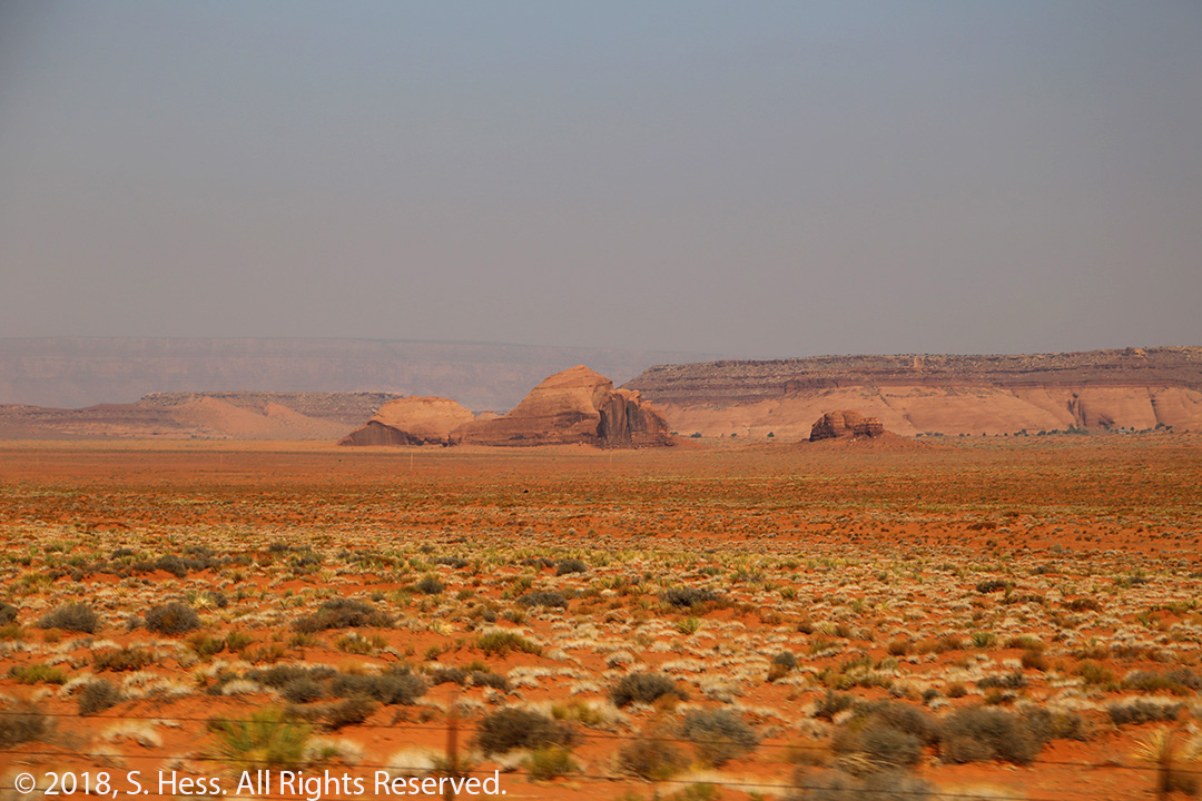
The next morning, we took the car to a nearby Subaru dealer for repairs. Their inspection confirmed that the was no damage other than the shield. Unfortunately, the part had to be ordered so they cut off the hanging portion of the shield and we were ready to continue our trip. We will have the repairs made in New York. Leaving the dealership, we headed out to Monument Valley, UT. The route took us west on I-40 to Gallup, NM where picked up local roads through the Navajo Nation to our destination. As we got closer to Monument Valley, we could see and smell evidence of the many fires that are plaguing the western states.
Monument Valley
We had been to Monument Valley five years ago and took a self-guided tour. This tour is within the Monument Valley Tribal Park and is limited to a loop that took about three hours to complete. To see more of the valley, you must hire a Navajo guide. We wanted to see the backcountry, so we decided to stay at Goulding’s Lodge and take an eight-hour guided tour with one of their Navajo guides. As it turned out, we wound up on a private tour because we were the only people who signed up for that day’s tour.
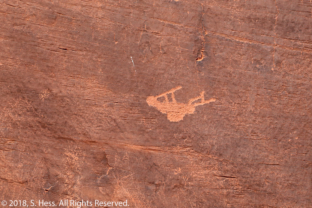
Leland, our guide, was great. He is an exercise physiologist and acts as a guide on a part-time basis. After a quick introduction, we were off to Mystery Valley, south of Monument Valley. As you turn off the highway, you see a sign warning that this is private property and not open to the public. Goulding’s Lodge must pay for every tour that goes outside of the tribal park. We spent about four hours in Mystery Valley exploring Ancestral Puebloan dwellings tucked under rock overheads and up in the cliffs. All around the backcountry, we could see petroglyphs that date back to the earlier inhabitants.
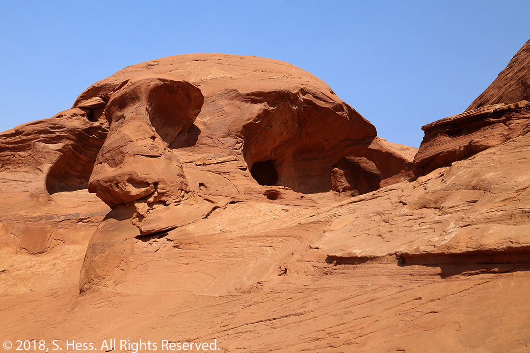

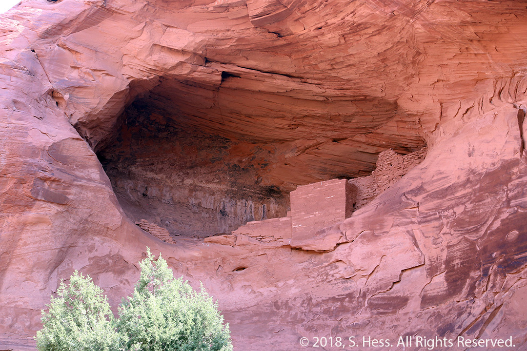
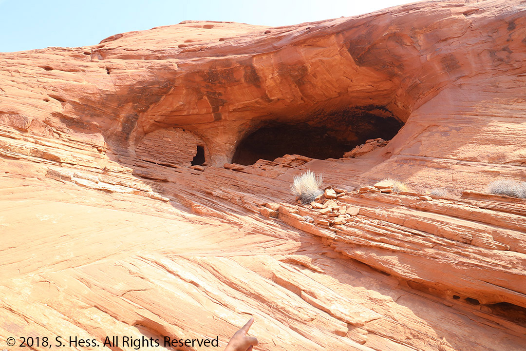
There are also a lot of interesting rock formations and arches. Leland guided me up two of these formations showing me step by step where to place my feet. The trip down retraced the path up, except that I did a little sliding down on my backside. One of these climbs brought us up to the top of an arch which I estimate to be 70 to 100 feet above the ground below. Looking down I could see Susie who looked very small. After climbing the arch, Leland brought us into a cool (a relative term considering the temperature was above 100˚F) grove of trees that contained a grill and picnic table where he made hamburgers for the three of us. After lunch, Leland drove us into the Navajo Tribal Park section of Monument Valley. We stayed on the route that is used by visitors who are not traveling with a Navajo guide for a short distance and entered an area requiring escorts. Here we encountered more rock formations, dwellings, and petroglyphs.
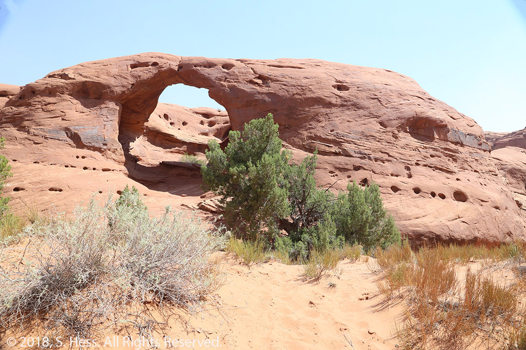


It was a long hot day, but we enjoyed every minute of it. The only down part of the whole trip was the smoke from forest fires that covered the valley and obscured some of the most spectacular scenery in the United States. If you are planning a trip to this area, I recommend using a Navajo guide rather than a self-guided trip.
On to Olympic National Park
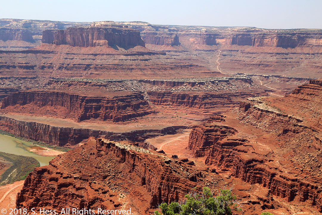
The next few days were spent driving to Washington’s Olympic National Park. The first day out of Monument Valley was a short run to Green River, UT. On the way to Green River, we stopped in Dead Horse Point State Park. Dead horse Point overlooks the Colorado River and Shafer Canyon, a portion of Canyonlands National Park. In 2006 we traveled through the Southwestern United States. One of the stops was in Moab, UT, from which we explored Canyonlands and Arches National Park. On exiting Canyonlands, I asked a park ranger if there was a four-wheel drive road/trail that would take us back to Moab. The ranger recommended using the Shafer Canyon Trail (check out the YouTube Video on this website). This trail had a lot of switchbacks and some significant drops that would have totally ruined our day. We made it, but Susie warned me not to think about doing another trail like this one. Now I wanted to see Shafer Canyon from a different perspective, thus our side trip to Dead Horse Point.


Our next stop was Boise, ID. To get there we traveled off the Interstate System from Green River to Provo. On this route, we saw at least one active fire being worked in extremely steep terrain. The firefighters working in the Western United States are doing a difficult job in extreme circumstances with minimal rest. Once on the Interstate Highway system travel was a little better but the smoke conditions and reduced visibility continued. We stopped in Boise for two nights because we wanted to visit with one of Susie’s colleagues who moved to Boise after retiring. We also wanted to spend some time with one of Susie’s cousins who is working on her master’s degree at Boise State.
From Boise, we headed to Port Angeles, WA, and the Olympic National Park. It was scheduled to be one of the longest drives we had on this trip. The closing of the Northbound section of I-5 in Seattle caused a traffic nightmare that resulted in our spending an additional hour and a half on the road.
Olympic National Park
Olympic National Park was one of the places on my “bucket list.” Twice before we had plans to visit Washington’s Olympic Peninsula and had to change our plans because of serious issues encountered with our trailer. When we hit the pipe on the Interstate in Albuquerque, I thought that the “Olympic Curse” hit us again… it didn’t!
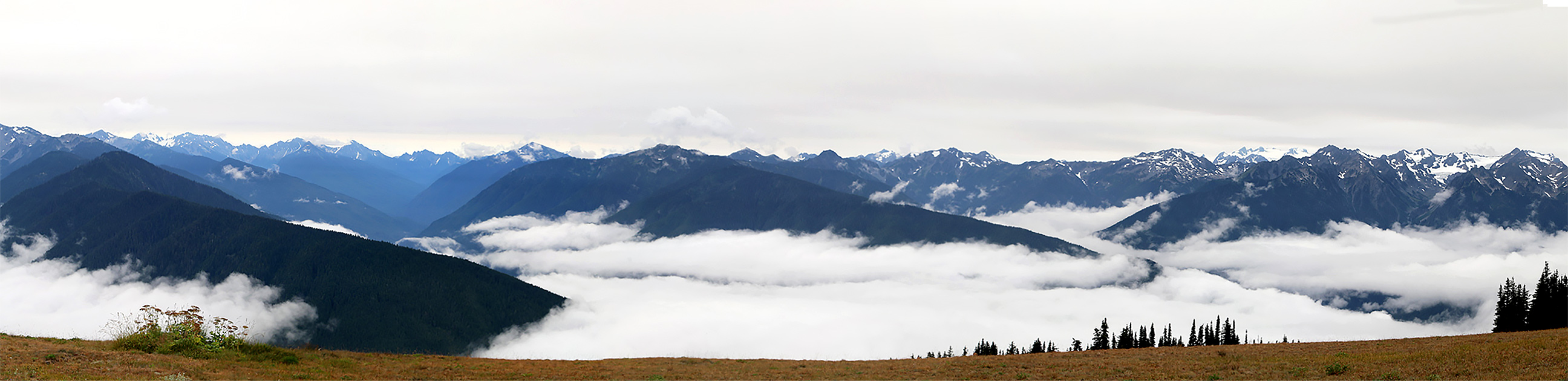
The Olympic Peninsula is in the southern part of a temperate rainforest that reaches through British Columbia to Southeastern Alaska. We spent three days visiting different parts of the Olympic National Park. On our first day, we visited Hurricane Ridge, which rises to over 5,200 feet in elevation. When we woke up that morning, we saw fog in addition to the persistent smoke and thought that we were not able to see anything from the ridge. The road from the Hurricane Ridge Visitors Center is 17 miles long with many curves. At times, as we had to slow down to a crawl because visibility was extremely limited. Shortly before we reached the top of the road, the fog cleared up and we found ourselves with a view of the Olympic Mountains above the clouds. The clouds limited our view of the terrain below. Port Angeles and the surrounding area would be visible on a clear day and so would Victoria, British Columbia, across the Strait of Juan de Fuca. On the way down off the ridge, we again encountered some more thick fog. At least we got a good view of the mountain tops.

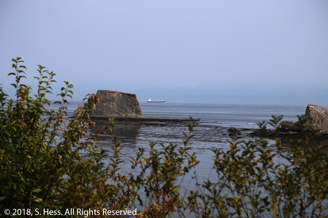
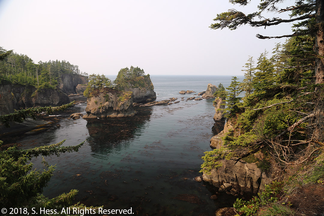
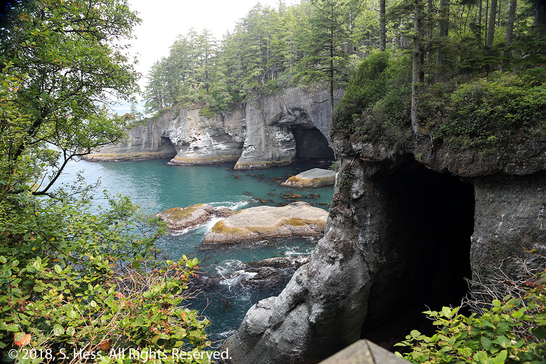
On our second day, we drove to Cape Flattery, the northwesternmost point in the contiguous United States. It was a long ride that basically followed the northern coast of the Olympic Peninsula. The smoky haze that we have lived with since New Mexico now obscured the southern coast of Vancouver Island. Once we arrived at the parking area we had to walk about half a mile to the tip of Cape Flattery. The trail is moderately steep at first with “stairs” built in (I found it easier at times to walk off the stairs… less impact on my knees). It then flattens out somewhat on boardwalks and stairs on soggy ground. The last part of the trail is a combination of boardwalks and steps leading to several different lookouts. Susie opted not to go all the way to the tip of the cape and stopped at the first lookout which offered a good view of the action of the waves on the land. I continued to the end of the trail where I stood and had a good view of several “holes in the wall” and one arch. From the last lookout, I could see the Cape Flattery lighthouse which is located on a small rocky island. The walk back was partially uphill, and we were both happy to see the car at the head of the trail.


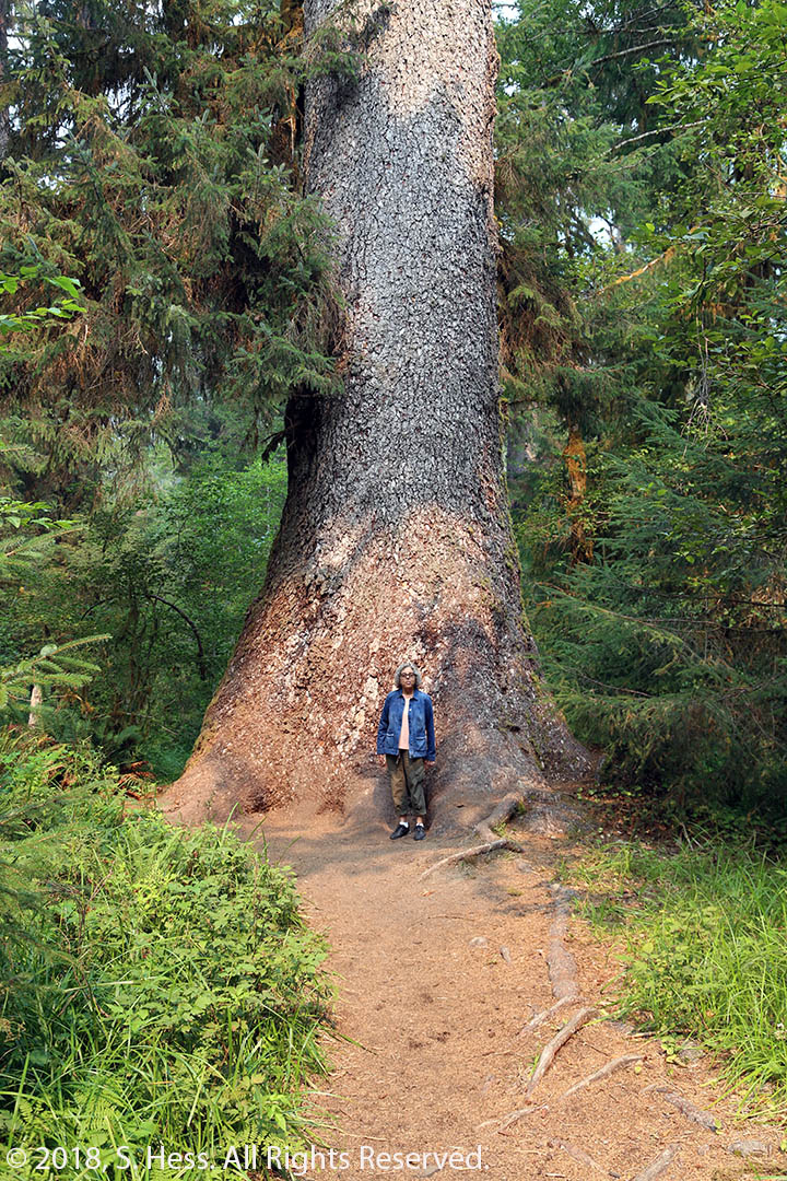
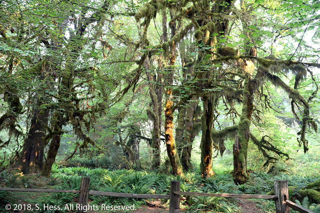
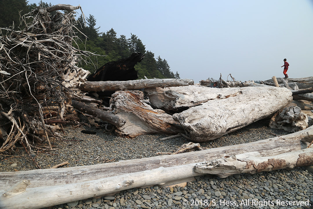
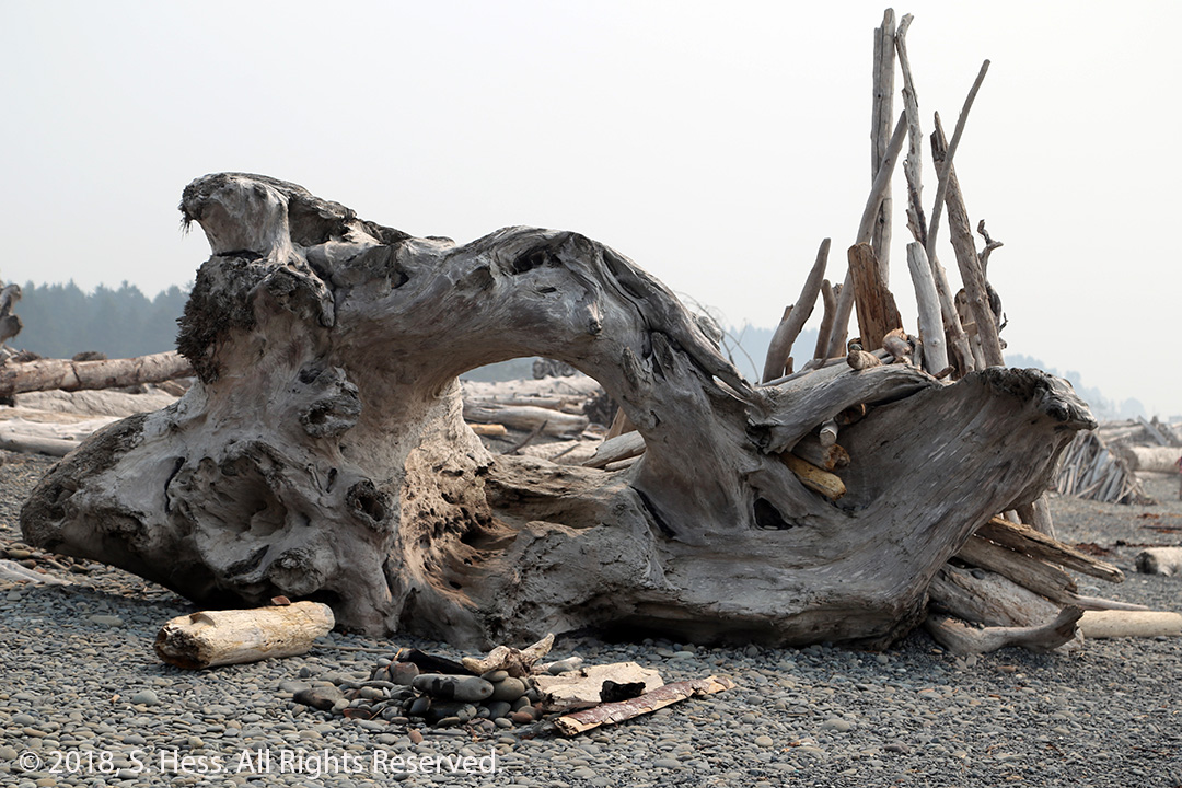
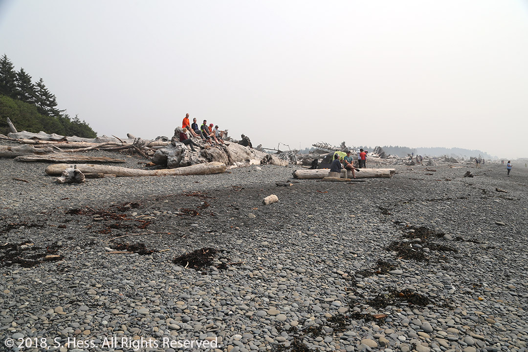
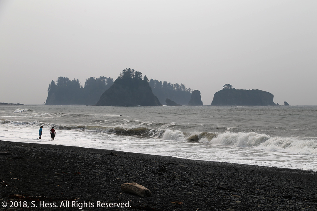
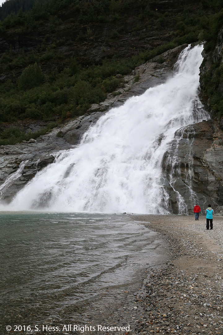
On the third day, we headed to the Hoh Rainforest, another trip down the winding US 101. There has been less than normal (whatever counts as normal these days) rainfall so the forest was not as wet as I expected. Nonetheless, it is a lush environment with moss-draped trees, clear spring-fed streams and silty glacial rivers running through it. There are several trails in the forest and, at the recommendation of a park ranger we chose a 0.8-mile loop that would give us a good view of the rainforest. There are a variety of trees in the forest ranging from huge Douglass Firs to Sitka Spruce and maples. The elevation changes on the trail were moderate. After leaving the rainforest, we headed for several beaches that line the western shore of the Olympic Peninsula. We visited two beaches, Rialto Beach and First Beach located on either side of the mouth of the Quileute River near the Quileute Indian Reservation and the town of La Push. The beaches are not very wide and don’t go far above the high tide mark. Above the beaches piles of driftwood ranging from large sections of trees complete with roots to smaller pieces with very interesting shapes. Offshore are sea stacks, rocky outcroppings of various sizes. We have seen these sea stacks along the Pacific coast from Northern California to Washington.


Seattle
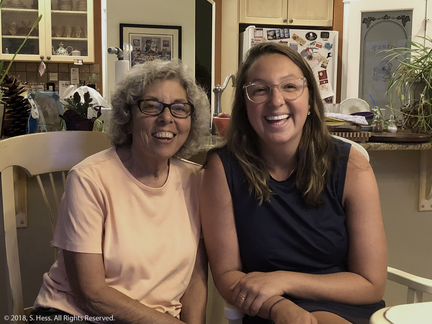
With the Olympic Peninsula now off our bucket list, we went to Seattle to meet our family in advance of our Alaska cruise. Because this is a relatively short trip, we left our Port Angeles lodgings later than normal for us. Rather than drive around Puget Sound, we headed for Bainbridge Island to get on the ferry to Seattle. While this doesn’t significantly affect travel time, it does save miles. We arrived at the terminal approximately two hours after we left Port Angeles and were on the line for the ferry with a half hour wait. The crossing is about half an hour and we were on the streets of Seattle within a few minutes of docking. The trip to the hotel should have taken 15 minutes but took more than 20… for some reason the car’s GPS did not have a lock on its location and led me astray. The same thing happened with Google Maps on the iPhone on the next day. Carrie, Josh and the grandkids arrived on Thursday and Rick arrived on Friday. Saturday afternoon, we were on the Ruby Princess ready for our Alaska cruise.
Cruising Alaska
This is our fifth time in these waters. Susie and I cruised to Alaska from Vancouver in 1999 and in 2001 (following a Hess family reunion). We also traveled on the Alaska Ferry System in 2015 from Bellingham, WA and 2016 from Prince Rupert, BC. That trip took us some places that the big cruise ships cannot enter. Click for the route map.
Day 1 and 2 – At Sea
The Ruby Princess pulled out of Elliott Bay and turned North on Puget Sound. It then to the Strait of Juan de Fuca west before turning north along the west coast of Vancouver Island. The ship continued on the open sea west of Haida Gwaii (formerly known as the Queen Charlotte Islands) before entering the Inside Passage. This was new to us since our previous cruises from Vancouver followed the channel between Vancouver Island and the British Columbia mainland and up the inside passage.
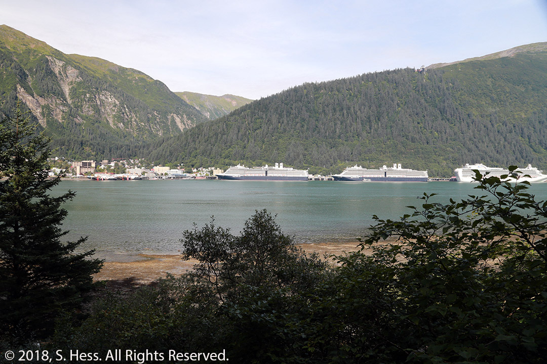
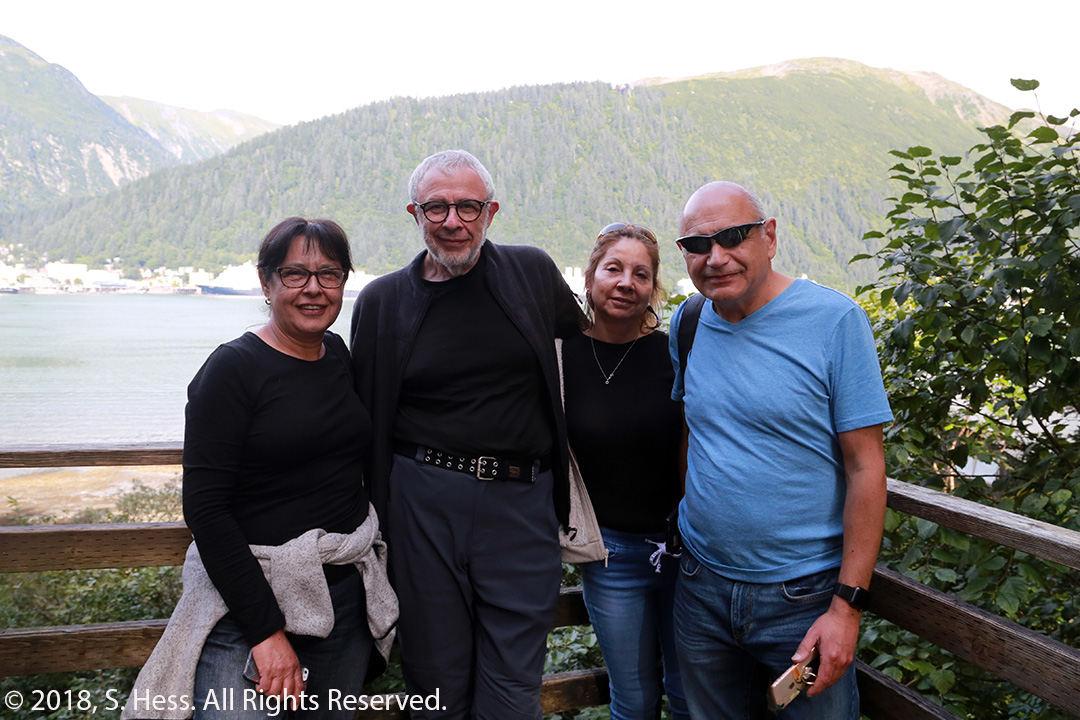
Day 3 – Juneau, AK
We arrived in Juneau around 11:00 am. My Chilean cousins, Susie and I had not paid for any shore excursions, so we were freewheeling it. Josh, Ben, Henry and cousin Ilani took an excursion to a dog sledding demonstration. The rest of us had lunch and then decided to go on the Mount Roberts Tramway to get a view of Juneau from above. While on one of the trails on the mountain we encountered Josh and company who had decided to go on the tram after their excursion.


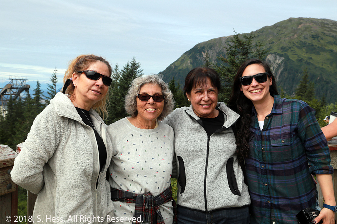
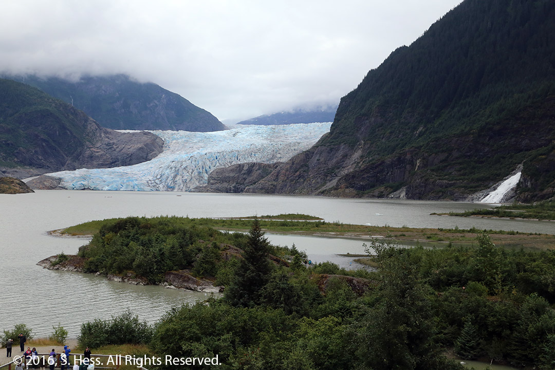
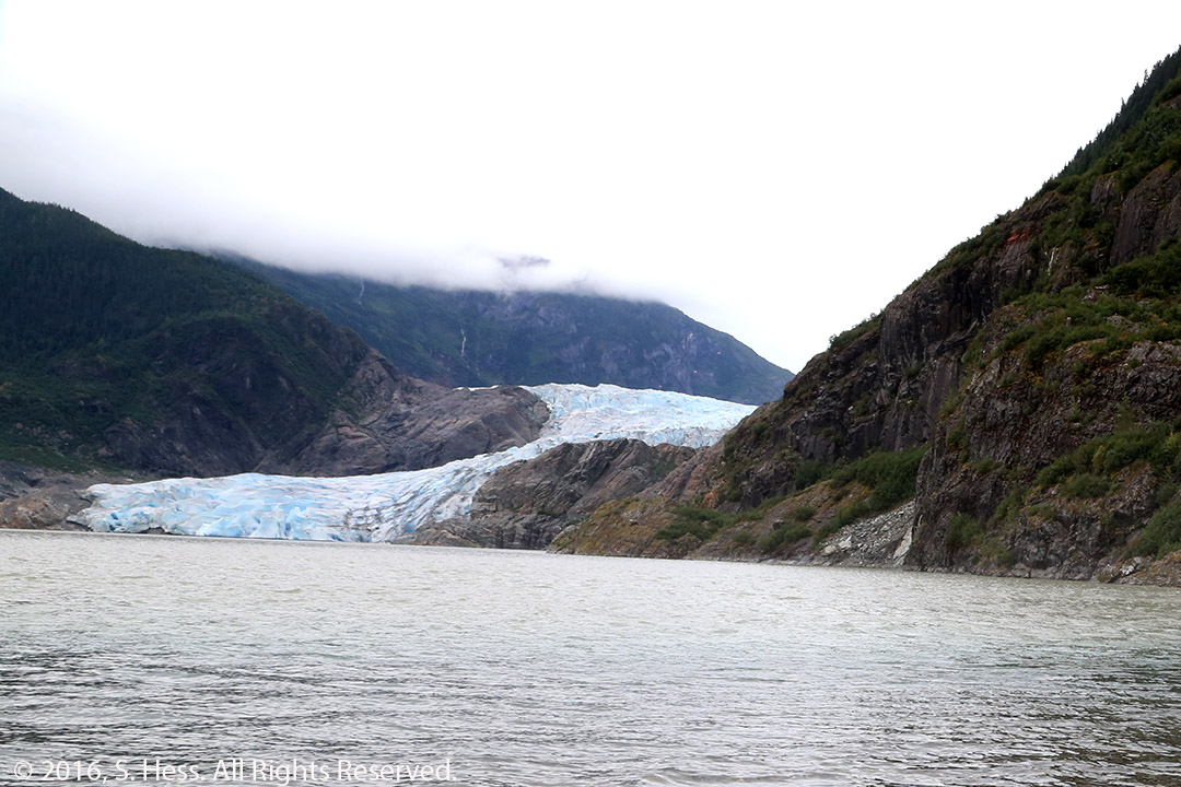
After we came down from Mount Roberts, the Chilean cousins, Susie and I took a shuttle (which also gave us a city tour) to the Mendenhall Glacier. Unfortunately, we didn’t have a lot of time at the glacier before we had to return to the ship. I suggested that they go to an observation area where they could get a good look at the glacier. If I had to do it all over again, I would have suggested doing the glacier trip first and then, if there was enough time, go on the tram. Alas, I can’t do it all over again.
Day 4 – Skagway, AK
The Ruby Princess docked in Skagway at 7:00 am. The Chilean cousins, Susie and I were scheduled on an eight-hour bus and rail system that left not long after we docked. Rick, Josh, Carrie, and the grandkids had an excursion that included gold panning and seeing sled dogs being trained followed by a bus ride to Fraser, BC and the train back down to Skagway.
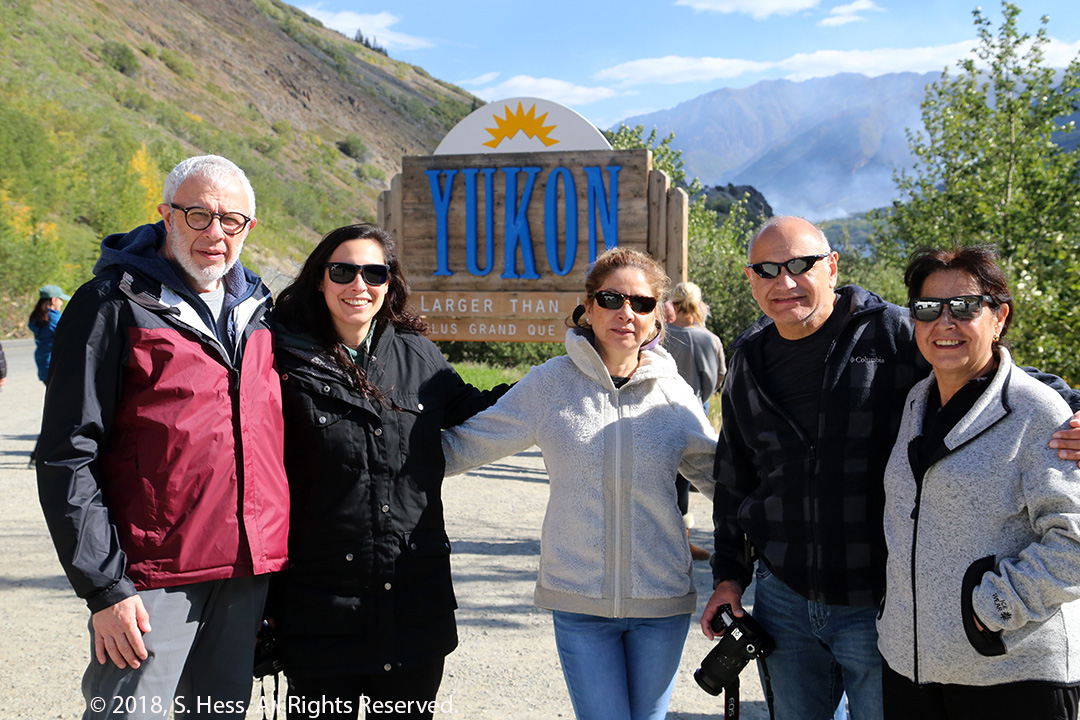
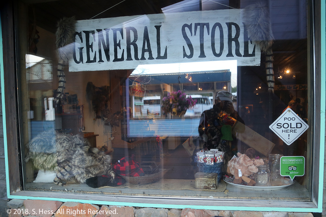
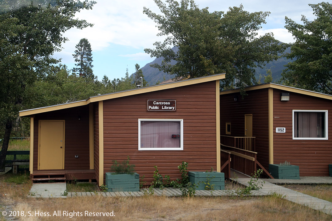
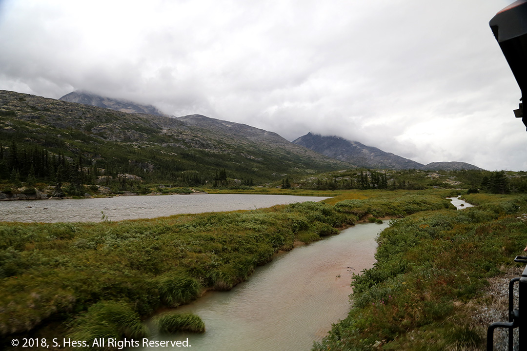
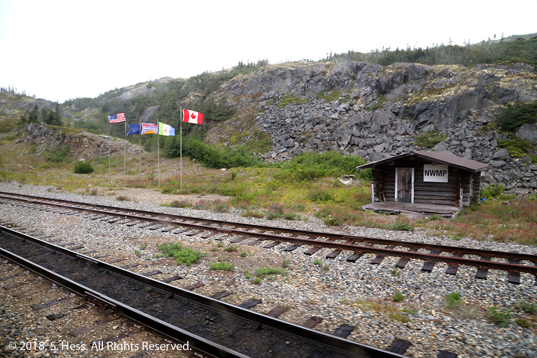
The “adults” took a tour bus far north as Carcross, Yukon Territory on the South Klondike Highway. Skagway is one of two towns on the Inside passage that has a road that connects to the highway system and the outside world… Haines, a few miles South is the other. The bus stopped periodically so that we could stretch our legs and view the scenery. We spent a few hours in Caribou Crossings, an attraction that had a museum, barbecue (lunch included in the excursion), sled dogs, and, of course, a general store.

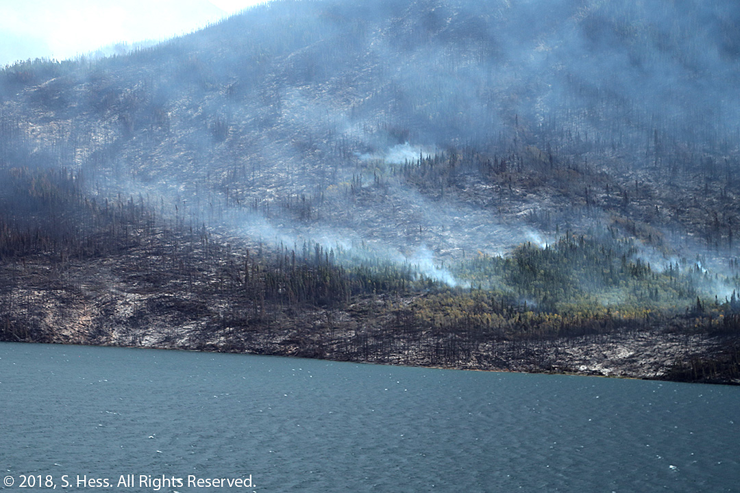
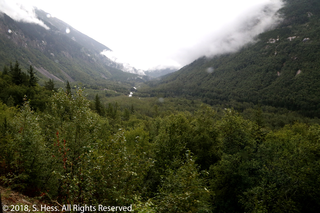
After an hour in Caribou Crossings, we headed back south to Fraser, British Columbia, and White Pass and Yukon Railroad for the return to Skagway. We thought we were done with smoke from forest fires, but we were wrong. Between Fraser and Carcross we saw plumes of smoke from forest fires that were started the previous week by lightning strikes. I didn’t see any attempts to fight the fires. I understand that if the fire does not threaten population centers or infrastructure, they will let it burn out.
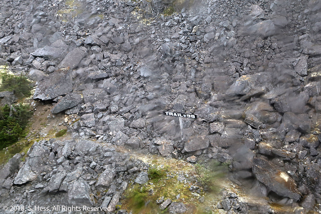
Susie and I took a similar version of today’s train trip in 1999 and it still amazes me that the track was completed in a short time considering the landscape to which it clings. Interestingly, the train is not just a tourist ride up a mountainside. It is also a flag stop railway. There are two flag stops on the journey where the train drops off or picks up hikers. Once back in Skagway, Susie and I headed back to the ship while our cousins walked around the town.


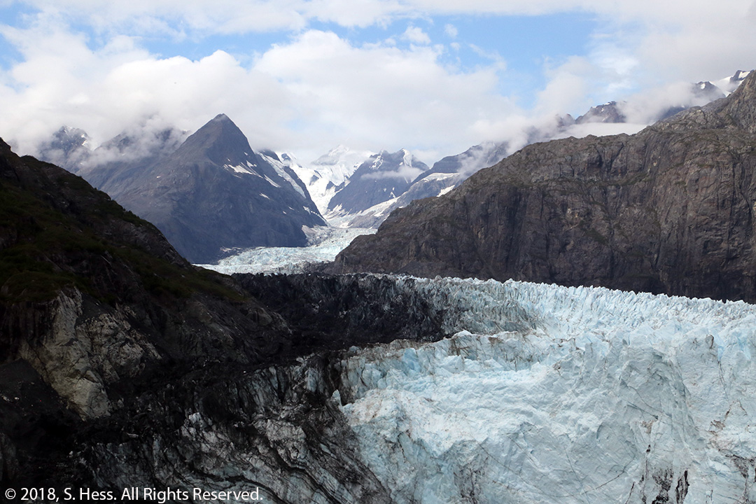
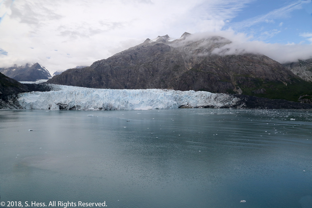
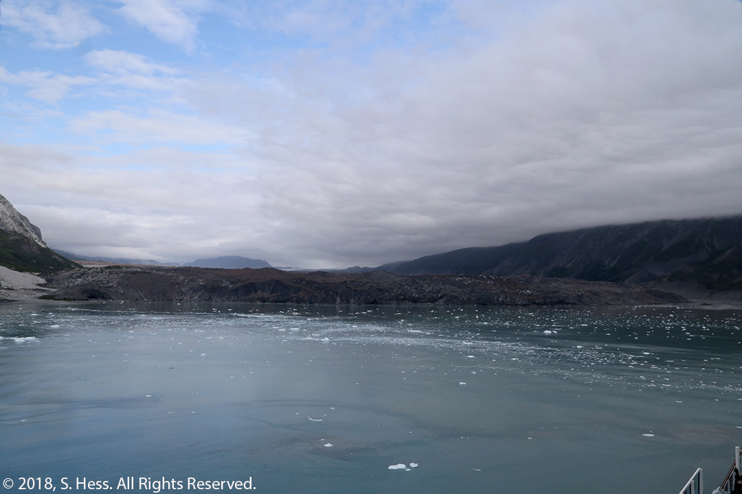
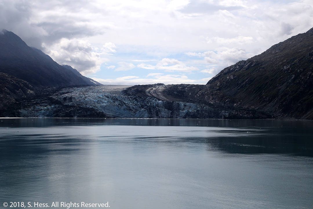
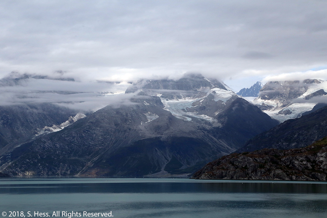
Day 5 – Glacier Bay, AK
This is a day at sea with and cruise in Glacier Bay (click link for the route). This is a first for Susie and me… the previous cruises in 1999 and 2001 did not go into the bay. The ship entered Glacier Bay and cruised up to the face of Margerie Glacier and the adjacent Grand Pacific Glacier at the head of the bay. Margerie Glacier is what most people a glacier to imagine and we spent most of the time viewing it. We saw and heard Margerie Glacier calve several times. None of the calving episodes were particularly spectacular. The Grand Pacific Glacier is covered with rocks and other debris ground from the surrounding mountains and is most definitely not white. After leaving the head of Glacier Bay, we traveled partially up Johns Hopkins Inlet before turning and passing Lamplugh Glacier. We passed several other glaciers on the route in and out of the bay, but these three glaciers were the highlight of the cruise. Click for a Glacier Bay fact sheet.


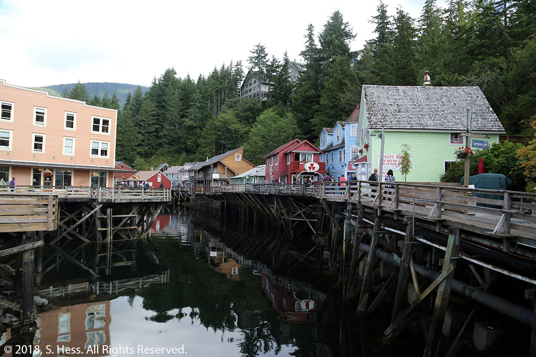
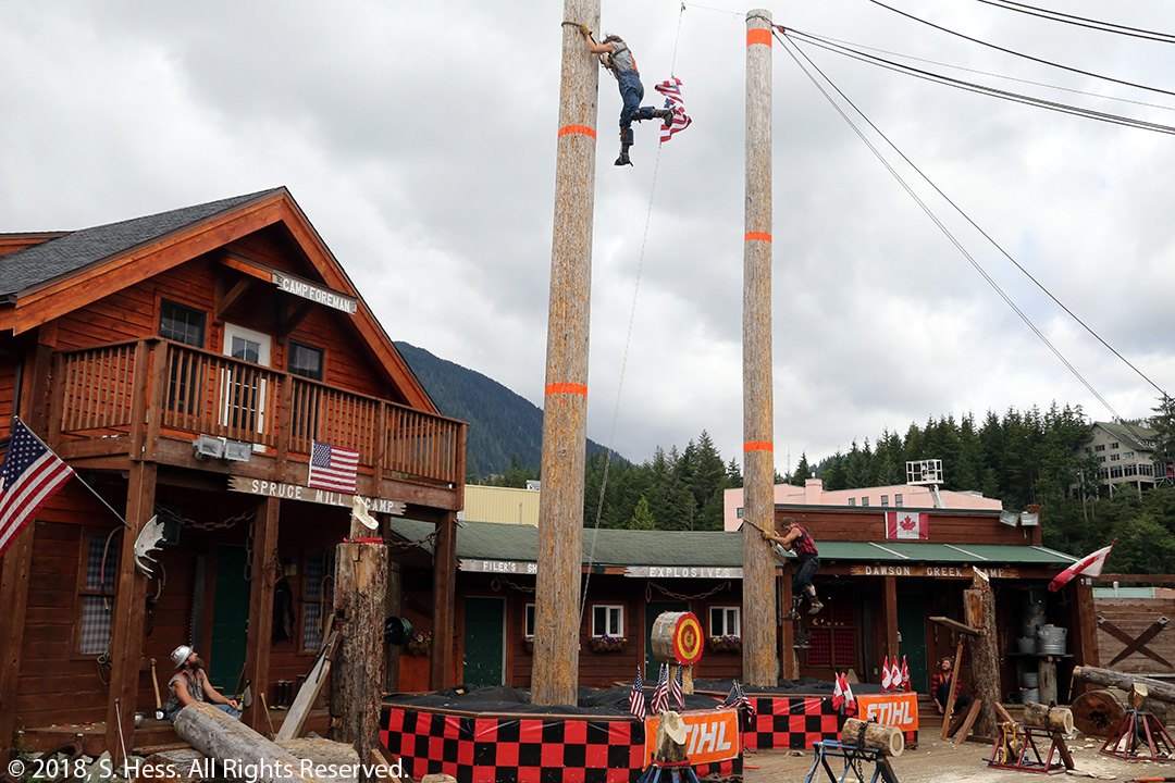
Day 6 – Ketchikan, AK
Leaving Glacier Bay, the ship returned to the Inside Passage for an overnight trip to Ketchikan, arriving at 7:00 am. We only had six hours in port which is enough time to spend a fortune in the many stores that are within a few blocks of the docks. I jokingly tell people that Ketchikan is the Tlingit word for shopping.
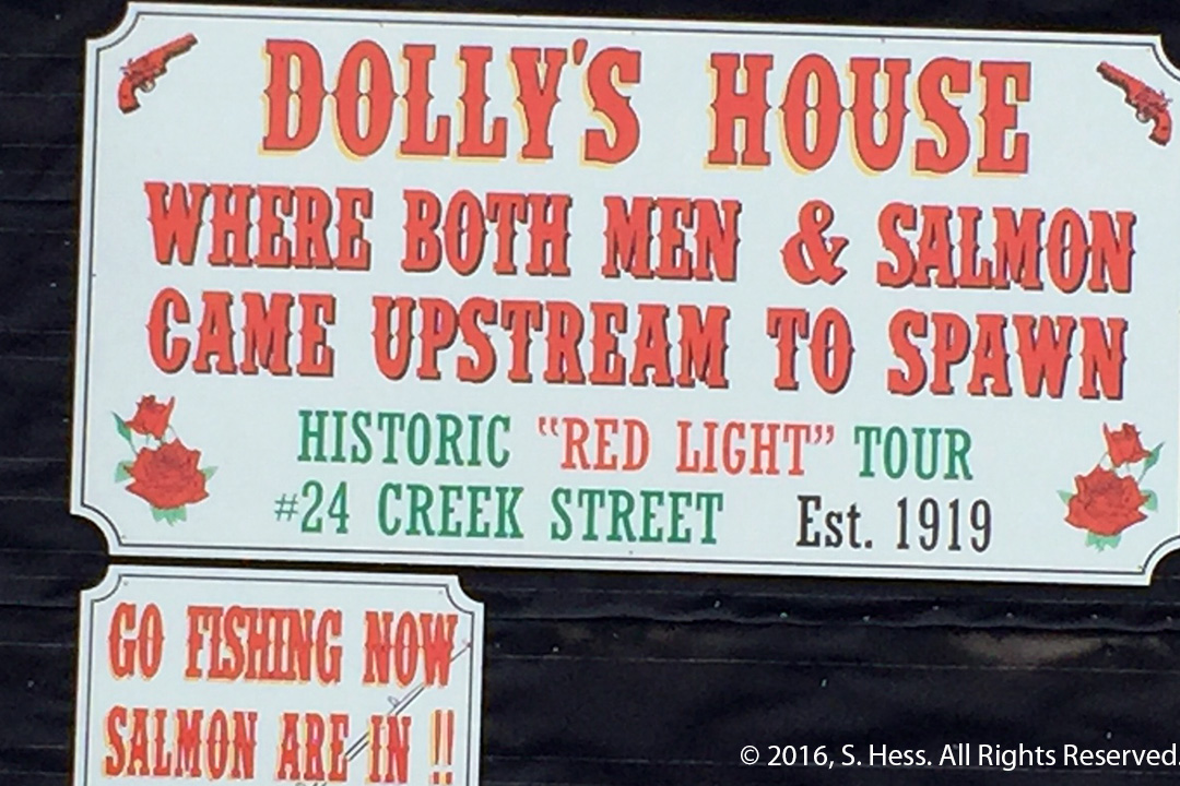
Susie and I had spent time in Ketchikan before so we (Susie) were not interested in the stores. While Carrie and Josh took the boys on a kayaking excursion, we took Eve to Totem Bight and a logger’s competition. Our Chilean cousins joined us on our excursion. We also took a walk on Creek Street, the old red-light district that has been converted to another shopping area.

Day 7 – Victoria, BC
Leaving Ketchikan, the ship traveled between Haida Gwaii and the British Columbia mainland and out at sea to the west of Vancouver Island. While at sea, Carrie, Josh, the grandkids, Susie and I received an invitation from the Captain to a tour of the bridge. This was a surprise to us and was arranged by Josh’s sister’s brother in law. He also arranged a complimentary Anniversary Package that included a dinner at one of the ship’s specialty restaurant this evening. The ship arrived in Victoria at 7 pm and we only had five hours on shore. Our whole group took the excursion to Butchart Gardens. By the time we got to the park, daylight was fading. The gardens are illuminated with artificial lighting which makes for a beautiful view but not so beautiful photography. At midnight the ship departed Victoria and arrived in Seattle at 7 am.
East to New York
Since we were taking our own luggage, we were on the first group to depart the ship. We left the ship at 7:15 am and within 30 minutes we were in our car ready to head east. It was Saturday and we were through Seattle and on I-90 heading east in no time. Our first day’s destination was Missoula, MT and entailed crossing the Cascade Mountains again and entering the Rocky Mountains. It was a long trip on a day that started at 5 am Pacific time and ended around 5 pm Mountain time.
We left Missoula early in the morning heading for Glendive, MT, 8+ hours of driving. Once we got east of the Rockies we encountered strong wind and some rain, but they didn’t present any serious problems.
The next day took us across the flat prairie lands of North Dakota. The prairie wind was hitting us broadside which meant holding the steering wheel a little harder than usual. We crossed the Missouri River at Bismarck and the Red River which forms the border between North Dakota and Minnesota. East of the Red River the terrain becomes a little bit hillier and we encountered rain showers. As we arrived in St Cloud, the rain let up and I thought we were done with it. I parked the car under the portico of our hotel and went in to check in while Susie sat in the car. There were several guests ahead of me on line and when I went back to the car the rain had started again, driven horizontally by the strong winds. I got soaking wet unloading the car and had to change clothes. Complicating our situation was the fact that the automatic door stopped working and we had to force the door open. In the evening we met our friends, Joy and Doug, for dinner. They drove quite a distance from north of Minneapolis to meet us. Joy and Doug were our neighbors in an RV Park when our trailer broke down in 2010. We have since had them as guests in New York and met them for dinner in St Paul two years ago.
Our next stop was in Chicago. Getting to the suburbs was a good ride. Once inside the city, traffic nightmares cause me to want to bypass the city, but we kept on. To make our life more interesting we arrived at the Hyatt Regency Chicago to learn that they were overbooked and had no room for us. The hotel blamed Expedia for the problem, but I was not accepting that. I asked for a manager and she arranged for us to have complimentary rooms in another Hyatt property a few blocks away.
Susie had wanted us to stop in Chicago for a couple of nights for two reasons. First to visit her cousin, Sasha, whom we have not seen for some time, and her husband and two kids that we have never met. The second reason was to walk along the Chicago River and take a tour on the river, two things she was unable to do when we were here in 2017 because of her broken patella. Having only one full day to this, the weather stepped in and eliminated the tour option. Susie had also arranged a lunch with two of her friends from the American Library Association which occupied a couple of pleasant hours. In the evening we went to Sasha’s home and had a great visit and dinner with her family. Despite the morning rain, it was a great day in Chicago.
We left Chicago early so that we could avoid traffic, which, fortunately, is what happened. Our destination was Charm, OH, a regular stop for us when we are traveling through the area on I-90/I-80. We met our friends, Mary and Emanuel, for dinner on both nights we were there. We also got to meet the family of their son, Alan, who we got to know in Sarasota. Alan was working, and we were sorry we missed him.
Our only full day was busy. Spent the part of the morning with Rebecca, one of Susie’s graduate school students, who was visiting the area with her daughter. We acquainted them Keim Lumber, where we spent some money on exotic woods for future projects. Rebecca managed to buy a few small items for herself. After saying our farewells, we headed north of Charm to see Lehman’s Hardware in Kidron, OH. This is not an ordinary hardware store and sells hardware (including things you won’t find in the big box stores), non-electric appliances geared to the Amish community, toys and many other things (see link). We then went to visit our young Amish friend, Emma. We met Emma in Berlin, OH a few years ago and Susie has a continuous letter writing relationship with her since then. On arriving at Emma’s family farm, we were told that she had a job packing produce on a farm a few miles away. We spent some time with the family, Susie with the women and me with her father and two brothers and then headed out to find Emma. I don’t know how the GPS got us there… the roads kept getting narrower as we went along. The last one was clearly not designed for automobile traffic. We finally got to the farm and spent some time with Emma before heading back to Charm.
Our last obligatory stop was in Lancaster County, PA. We stop here to stock up on jams, jellies and other goodies at Kitchen Kettle Village in Intercourse, PA. It was a pleasant drive over lightly traveled highways… I guess that everyone was already at their Labor Day weekend destination.
Our final day was also the easiest one. We had breakfast at our hotel and headed out about 6:30 am on nearly empty roads. I expected to have a lot of traffic as we approached New York City, but we had only one traffic jam, at the junction of The Gowanus and Brooklyn-Queens Expressways. This is a normal bottleneck that was surprisingly easy to transition. We were at our house by 9:45 am.
Final Note

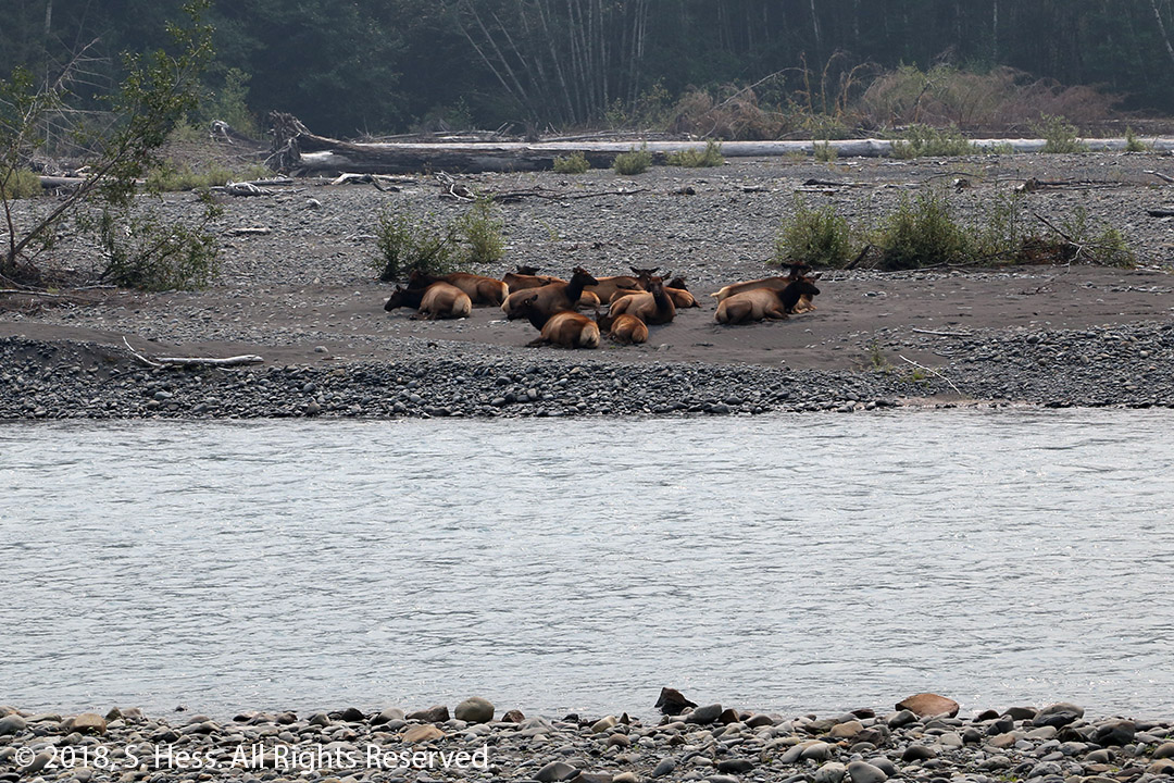
As I stated earlier, our 50th anniversary was the reason we took this cruise. It turned out to be a great celebration for us to be with our children, grandchildren and our Chilean cousins. More importantly, it was a way to introduce our grandkids to Alaska, which as everyone knows is one of our favorite destinations. Ben, Henry and Eve got to see glaciers and wildlife that they had not seen before. I think they may want to come back and see more of this great state.
So, what is next for us? In January 2019 we are traveling to Tanzania and Kenya for a photo safari. In May we plan to be in Israel for the Bar-Mitzvah of Lior, our Rego Park neighbor. I hope we have better Internet access on those trips, so we can maintain this blog daily.