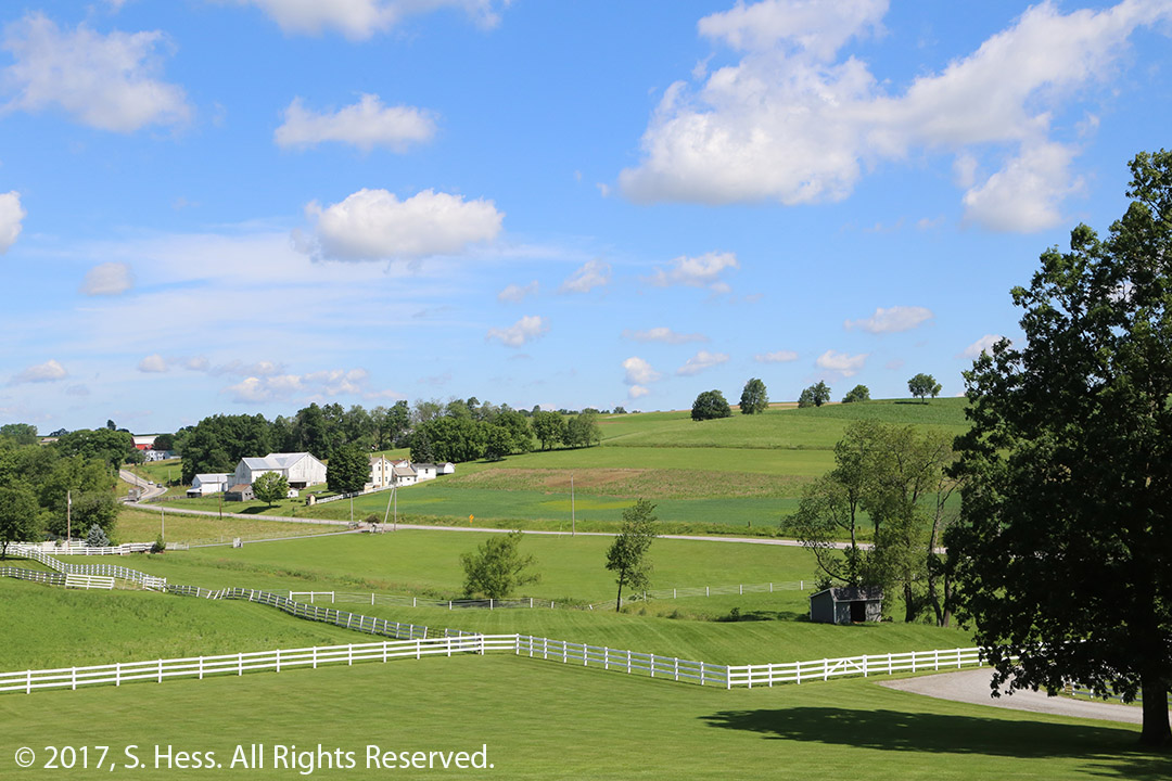
I wanted to post this entry two days ago, but when we got to our home is Sarasota we had a “hot”surprise. The temperature inside was over 90 degrees, ten degrees above the thermostat setting. I set the thermostat to 75 degrees and after a hour nothing changed… it was as hot and humid inside as it was outside. The air conditioner compressor was running but the fan was not. By the time we had an air-conditioner service company repair the unit and shopped for some food, I was not in a mood to sit down and write. Saturday came and went so this is being sent on Sunday morning.
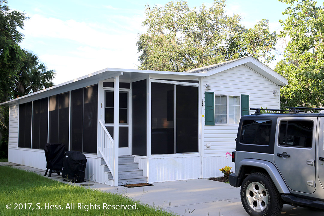
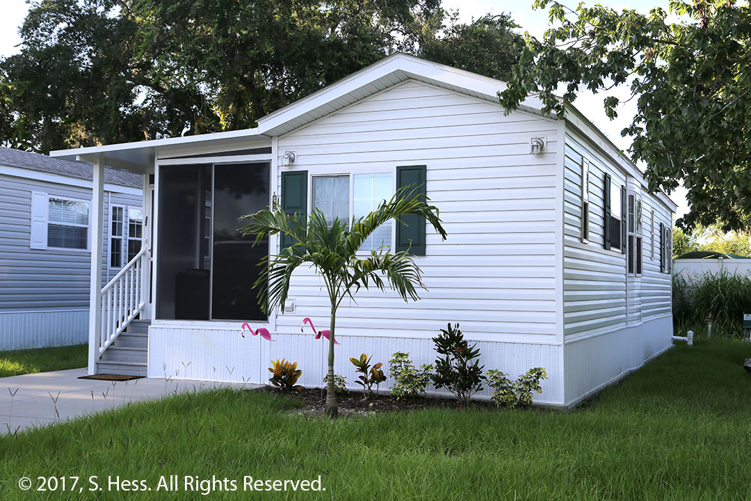
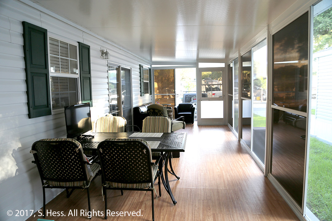
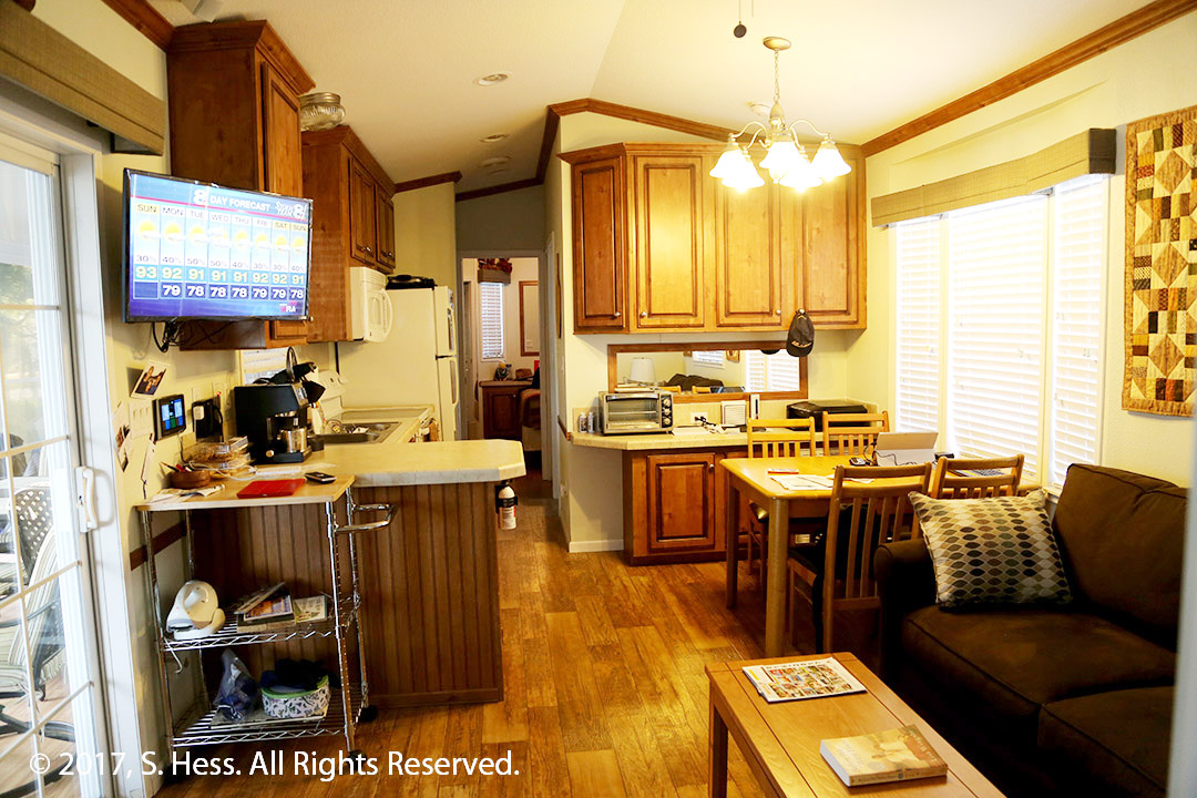
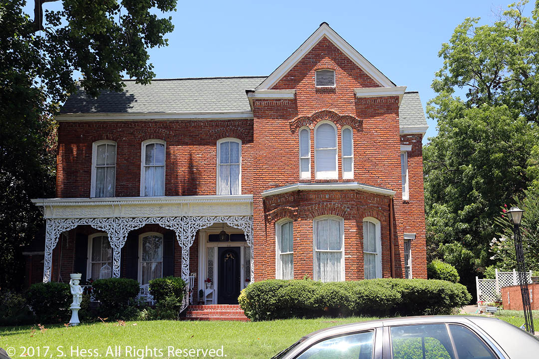
This is our last day on the road for at least a month. We will be staying in our “Park Model Home” at Sun n’ Fun RV Resort. A park model is similar to a single wide mobile home. Our Casita del Sol, as we call it, has two bedrooms, two baths, full kitchen, small dining area and a living area all in 496 square feet. As you can imagine, none of the rooms are large. The home also has an attached, enclosed lanai that runs the length of the home (roughly 40 ft). The back end of the lanai has a “shed” that has storage shelves and a washer and dryer.
Left sideRight sideLanaiLiving room, dining room and kitchen. Master bedroom and bath in background. Second bedroom and bath behind me.
Our departure from Sarasota is tentative, but will probably be after August 16th. Susie will needs to have some physical therapy for her knee and we won’t know until next week how many sessions she will require.
I won’t be posting any daily entries which might be quite boring… we went to the pool, we went to the beach etc. However we will be doing some trips to local state parks and Celery Fields for wildlife viewing and photography and that may result in some posts.
We left the hotel in Pensacola under partly cloudy skies. The forecast is the same as always in this area in the summer… 40% possibility of scattered storms. We continues to stay off the Interstate until we neared Tallahassee, FL.
We headed south to Pensacola Beach which is on Santa Rosa Island, a narrow barrier island. Pensacola Beach occupies the western portion of the island. Most of the island between Pensacola Beach and Navarre Beach is part of the Gulf Islands National Seashore. Once you leave Pensacola Beach and its high rise buildings behind, you enter a narrow stretch with beaches on both the Gulf and Bay side. While Pensacola Beach is crowded, the beaches to the east had few people scattered here and there. I was under the impression, courtesy of Google Maps, that the road continued much further then Navarre Beach and continued on past the intersection past the causeway leading to the mainland. I quickly learned that the road only went a few hundred yards further east into a beach parking lot… U-turn time.
Once back on the mainland, we picked up US-98, which took us through Fort Walton Beach, Destin and a few other smaller beach towns. Because of the hotels and condos on the beach side of the island, you only get a glimpse of the beaches. The whole strip looks like any beach town in the U.S. with its hotels, condos and beach shops.
When we reached Panama City Beach we opted to discontinue following the Gulf coast and headed inland via US-231, FL-20 and FL-12. The terrain was completely different than the beaches. Miles and miles of stands of Southern Pine lined the road. Most of the woods were tree farms in various stages of growth. We picked I-10 about 25 miles west of Tallahassee and were in our hotel 25 minutes later. By the way we didn’t encounter rain on this trip.
Looking back at the beaches that we passed in Mississippi, Alabama and Florida the last two days, I think I would opt for the stretch east of Pensacola Beach in the Gulf Islands National Seashore. You can stay on the mainland in hotels that are cheaper than on Santa Rosa Island, drive east to the National Seashore and have a piece of beach all to yourself. If you don’t mind the crowds, Pensacola Beach has the same powdery white sand.
We decided to continue avoiding Interstate Highways for at least another day. The plan also included a ferry ride from Dauphine Island, AL, across the entrance to Mobile Bay to Fort Morgan, AL.
We left New Orleans early because we figured that we might miss a ferry and have to wait up to 45 minutes for the next one. When we left, the sky was mostly sunny and we thought we would have a great day. We got onto US-90 in the Lower Ninth Ward of New Orleans and headed east. From the highway we could see a lot of Hurricane Katrina damage and some new housing. Ozzie, our tour guide yesterday, a Katrina survivor, theorized that many of the residents didn’t want to come back to their old homes. Many of those that were willing to come back couldn’t because they either had no proof of title or didn’t have clear title to their homes so they could not take advantage of government support to rebuild or repair.
Not long after we passed the Lower Ninth Ward, we crossed over a number of bayous. After crossing the Pearl River, which forms the boundary between Louisiana and Mississippi, the terrain started changing and we drove through thickly wooded country.
Entering Bay St. Louis, MS we started seeing our first casinos which continued until the Alabama border. In Pass Christian, MS, US-90 runs along the beaches. Around this point, the weather started changing as the clouds built up and soon brought us intermittent rain. We followed the beaches until a little east of Biloxi, with its large casinos. After US-90 crossed Biloxi Bay, we left the beaches, but could still catch a glimpse of the Gulf of Mexico.
In Grand Bay, AL we left US-90 and headed on AL-188 towards Dauphine Island. The rain became more frequent and we decided that it may not be such a pleasure to ride an open ferry across Mobile Bay. Instead of heading south on AL-193, we headed north towards I-10. Of course, the fates had some fun with us and the weather improved significantly. I-10 took us through Mobile into Florida.
We stopped at the Florida Welcome Center for a break and picked up some brochures about Pensacola. One of the brochures was about the National Naval Aviation Museum at Naval Air Station (NAS), Pensacola. We decided to visit the museum. Once again fate had a different idea! When we got to within 1/2 mile from the entrance to the Air Station, traffic came to a halt. It took us about 40 minutes to get to a point where we could see the entrance to NAS Pensacola and the traffic backed up from all directions. We made another decision and rerouted ourselves to our Pensacola hotel for the night.
This morning we did something we have never done in New Orleans in all the times we were here… we took a city tour. The tour was operated by Celebration Tours. Specifically, we took the New Orleans City Tour. Why take a tour? We have been in New Orleans many times and focused on a very small part of the city, downtown, warehouse district, and the French Quarter. This tour gave us a taste of other parts of the city so that in the future we could spend more time exploring other sections.
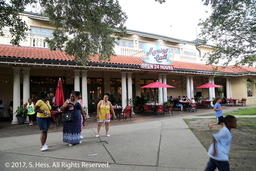
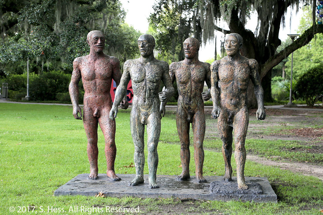
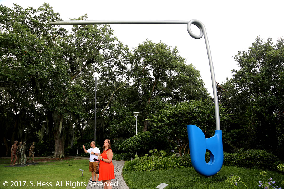
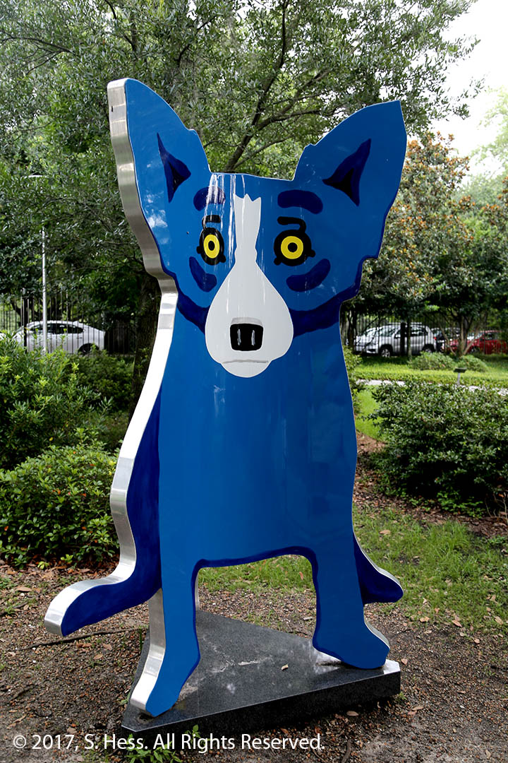
We had limited opportunity to take pictures because we only made one stop in City Park. The park is considerably bigger than New York’s Central Park. It contains gulf courses, The New Orleans Museum of Art, a sculpture garden with original art, and the Morning Call Café.
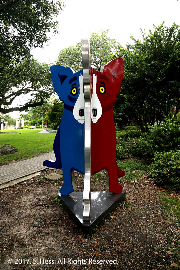
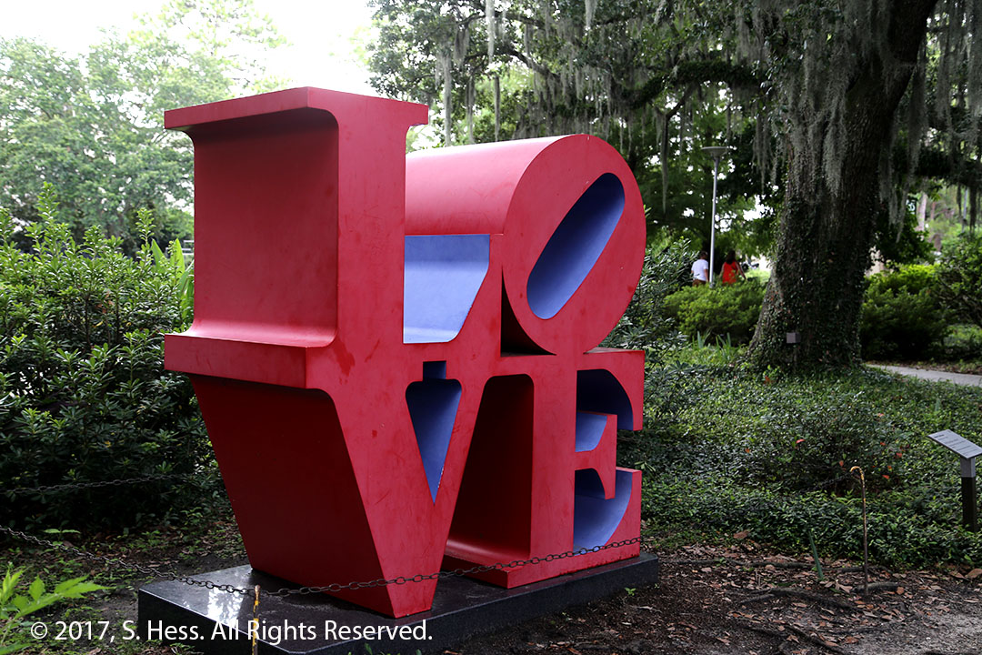
Morning Call in City ParkA pool in the Sculpture GardenRiace Warriors by Elisabeth FrinkCorridor Pin, Blue by Claes Oldenburg and Coosje van Bruggen. Imagine the diaper this held together .We Stand Together by George Rodrigue. There is a blue dog, a yellow dog and red dog. When you view the sculpture from the angle below you get a two-toned dog.We Stand Together at a different angleLove, Red and Blue by Robert Indiana. We understand that this is the original sculpture
Ozzie Laporte Jr, our tour guide, gave me access to his collection of New Orleans pictures. The pictures are the property of Mr. Laporte and are used with his permission.
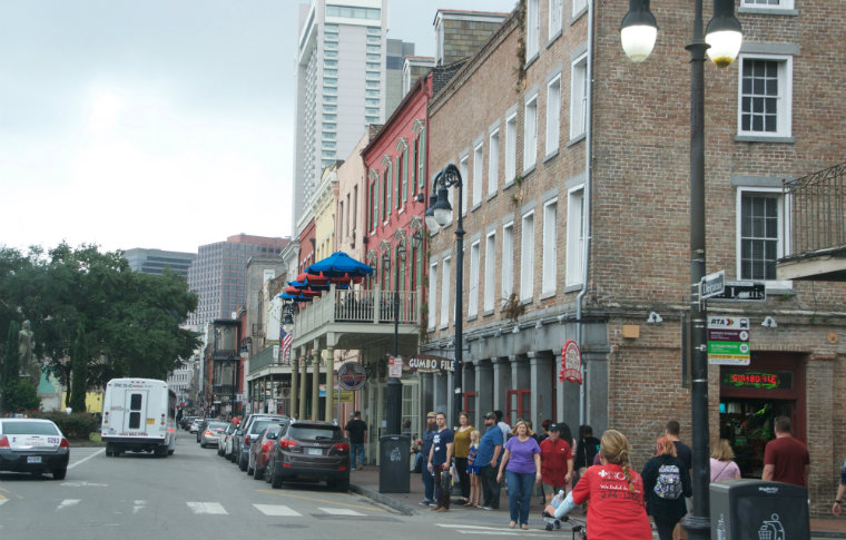
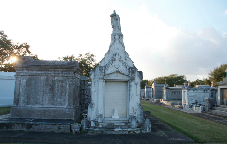
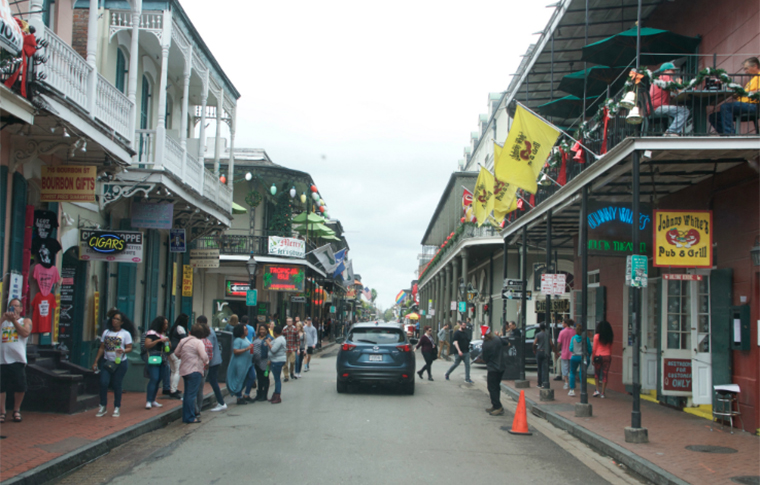
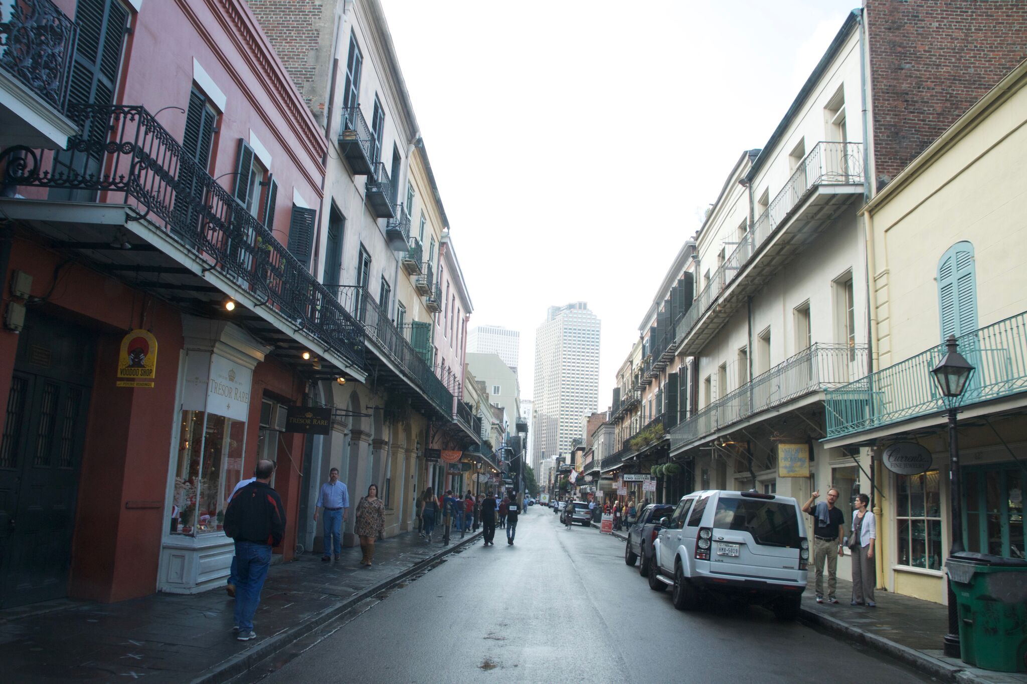
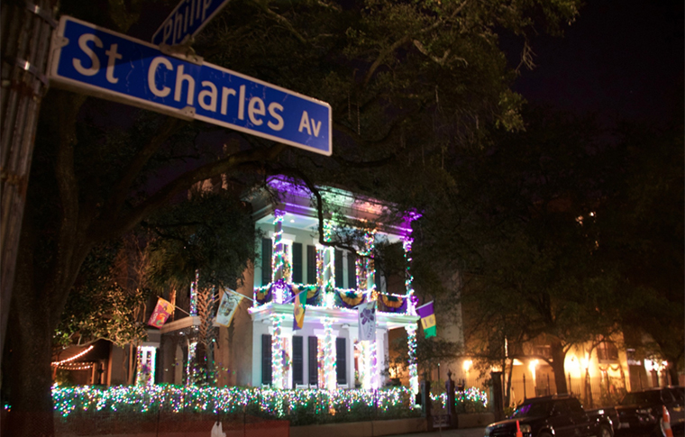
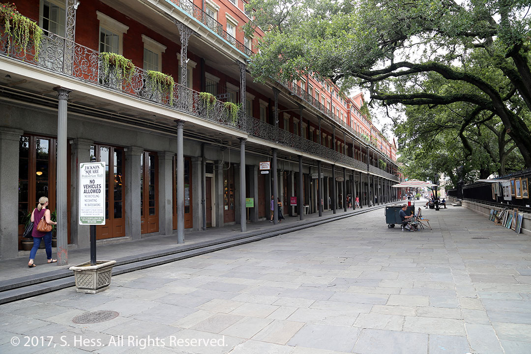
Decatur Street at Jackson SquareDecatur and St Louis Streets, French QuarterCemeteryFrench Quarter SceneFrench Quarter sceneSt. Charles StreetNew Orleans Girl Fight Gallery
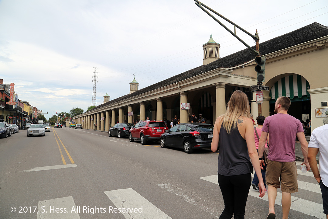
Ozzie, our tour operator dropped us off at the hotel and after a quick bite we were on the move again. We walked to the French Market and back (see dotted line on map). This is a milestone for Susie… the round trip is 2.2 miles. This is the furthest she walked since she broke her kneecap. The walk to the World War II Museum and back was the previous record at a mile. We stopped periodically to give Susie a break.
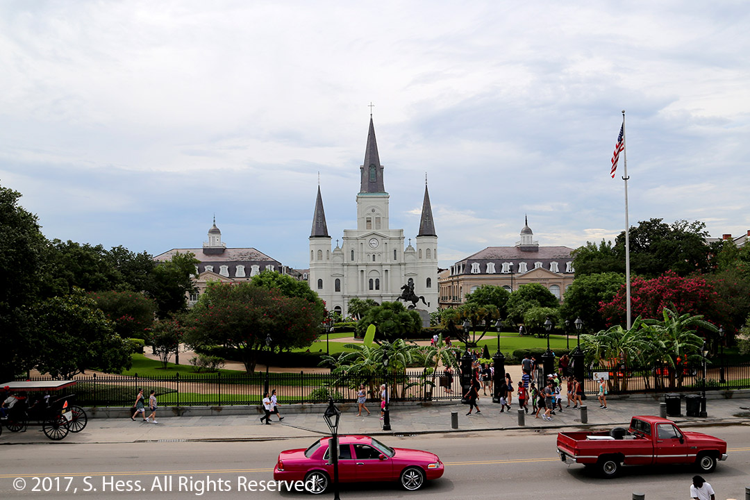
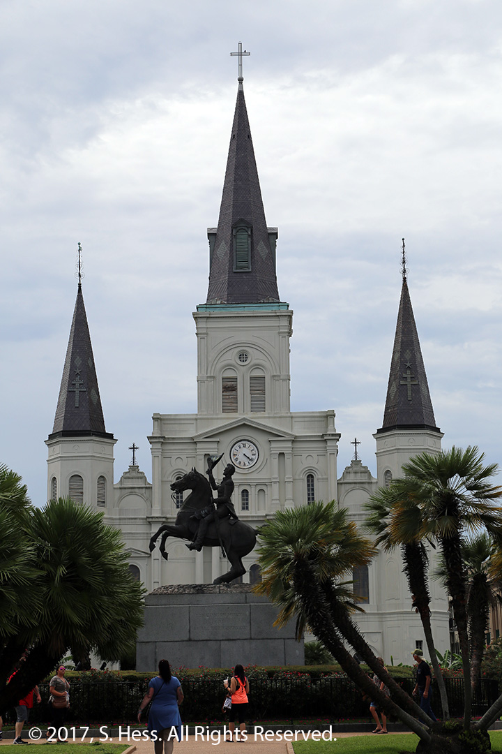
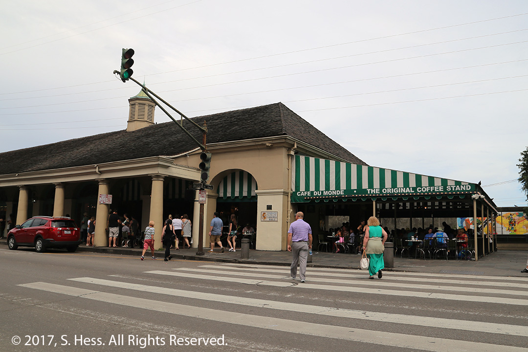
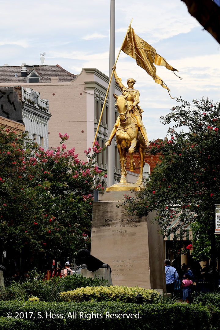
Jackson Square with St Louis Cathedral in the center backgroundAndrew Jackson statue in Jackson SquareAs were walking by Jackson Square we saw this mule in training. It was spooked by a puddle of water and had to be walked through it.St Peter Street adjacent to Jackson Square. I don’t remember ever seeing it so quiet.Café Du MondePart of the French Market adjacent to Café du MondeJoan of Arc statue near the French Market
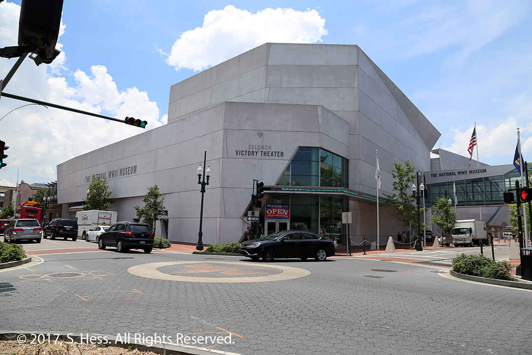
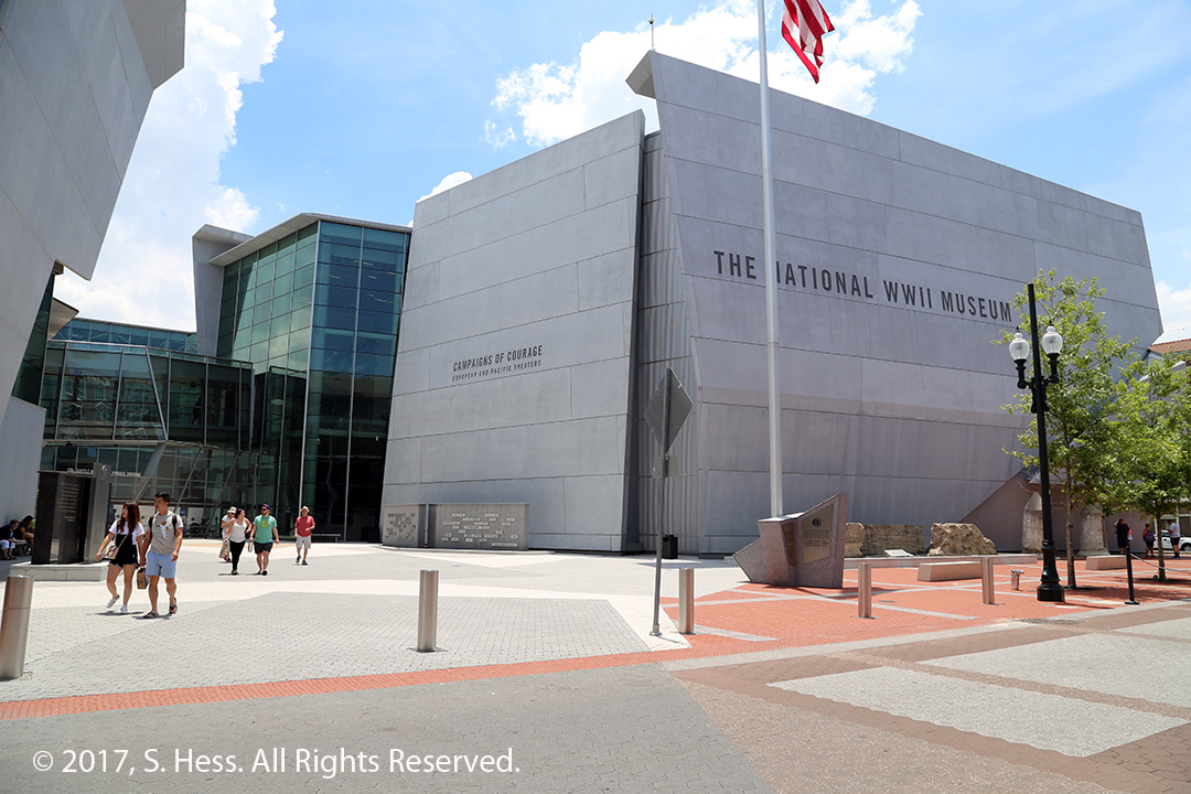
At mid-morning we headed to the World War II Museum. This is our third trip, the most recent being in the winter of 2015. Our local friend Tony told us there have been some new exhibits added since our last visit so we had to go. Tony got us complementary tickets to the museum though a friend who works there. We didn’t need that incentive to go see the new exhibits. The museum is comprised of the main building which houses the Arsenal of Democracy exhibit, the Solomon Victory Theater, the Campaigns of Courage Pavilion, The Boeing Pavilion (houses World War II aircraft), the John E. Kushner Restoration Pavilion and the Louisiana Memorial Pavilion.
This was the original museum building.Solomon Victory Theater. This is where the movie is shown.The Campaigns of Courage Pavilion
The first thing we did is to go see the movie, Beyond all Boundries. This movie evokes an emotional response from most people who watch it. Susie is in tears and I’m angry that we humans can’t seem to solve problems without resorting to war.
Our next stop was to see the new exhibit, The Road to Tokyo, which covers the war in the Pacific. We had seen The Road to Berlin twice before so we didn’t do it this time. Both exhibits are now housed in the new Campaigns of Courage Pavilion, which was still under construction on our last visit.
The other new exhibit, The Arsenal of Democracy, which covers the Home Front. This exhibit shows how the people at home helped with war effort.
I highly recommend that anyone visiting New Orleans makes a point to see this Museum. It takes more than the roughly four hours that we spent here today to adequately view the exhibits. I’m sure that we will visit this museum again.
We left the museum around 2:30pm and walked back to our hotel. We got to the Hotel just before a series of thunderstorms hit the area. Some of the lightning strikes were very close to where we are. I would rather be watching the light show from the inside of the hotel than be driving or walking through it.
This evening we met with our friends Phyllis and Tony for dinner at Antoine’s Restaurant on St. Louis Street in the French Quarter. The restaurant opened 1840 and is still operated by descendants of the founder. Click on the link above for more information about the restaurant. After the dinner Paul, our waiter, took us on a tour of the restaurant and showed us some of the 14 dining rooms and the 165 foot long wine cellar. We really want to thank Phyllis and Tony for introducing us to the pleasures of Antoine’s.
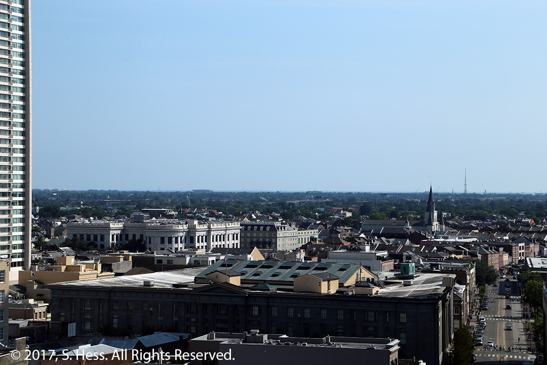
When we got up this morning, I looked out of the window and could barely see the Marriott Hotel on Canal Street, a few blocks away. We were in the midst of a fairly strong storm and the rain was coming down hard. Thirty minutes later, the sun was shining. These kinds of storms are common this time of year.
After this morning’s storm we could see beyond the French Quarter from our 18th Floor perch
We had been to New Orleans many times over the past 25 years and we are sure to be back again… the 2018 American Library Association Annual meeting will be held here. In all those visits we made here, we traveled to a lot of places in and out of the city. There are several places and things we talked about doing and wound up saying, “we will do it next time.” This trip represents the “next time” for some of the things on our list.
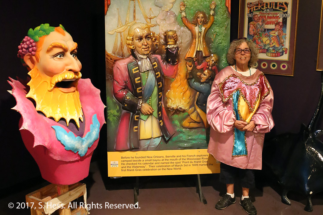
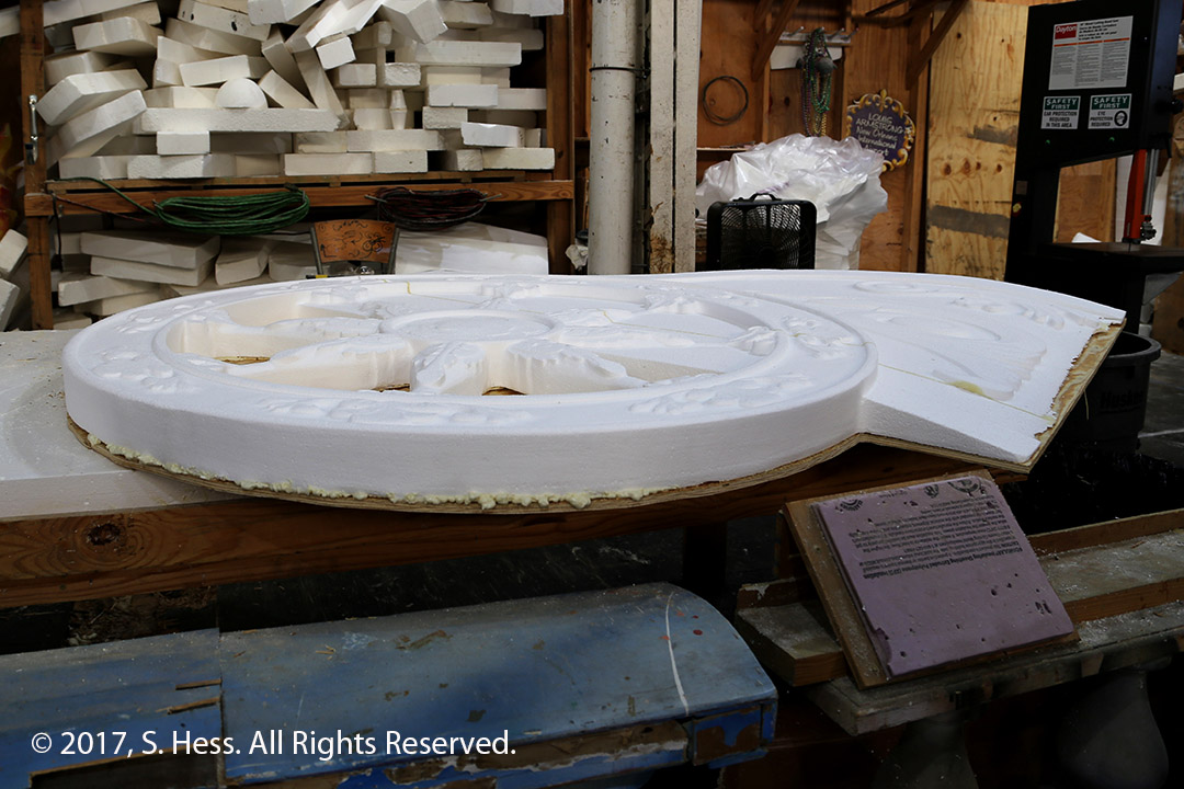
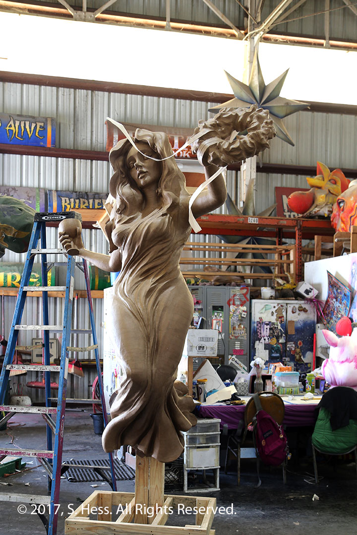
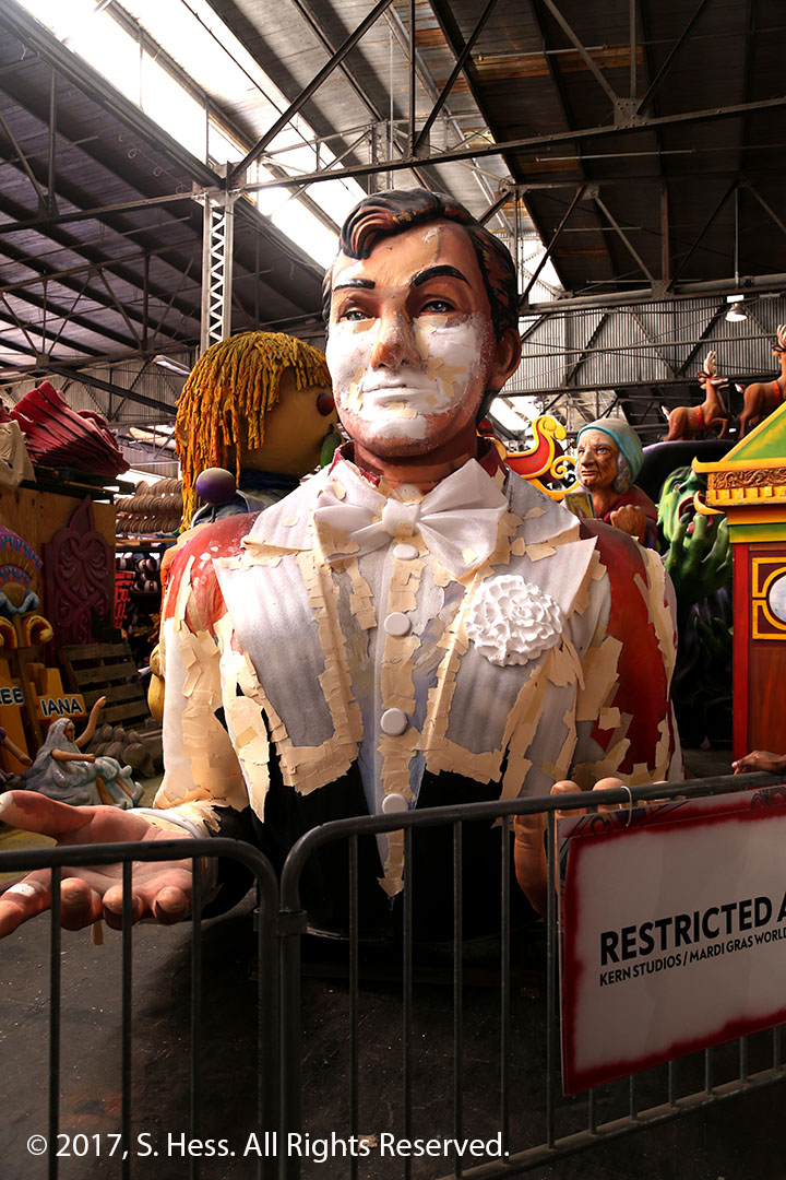
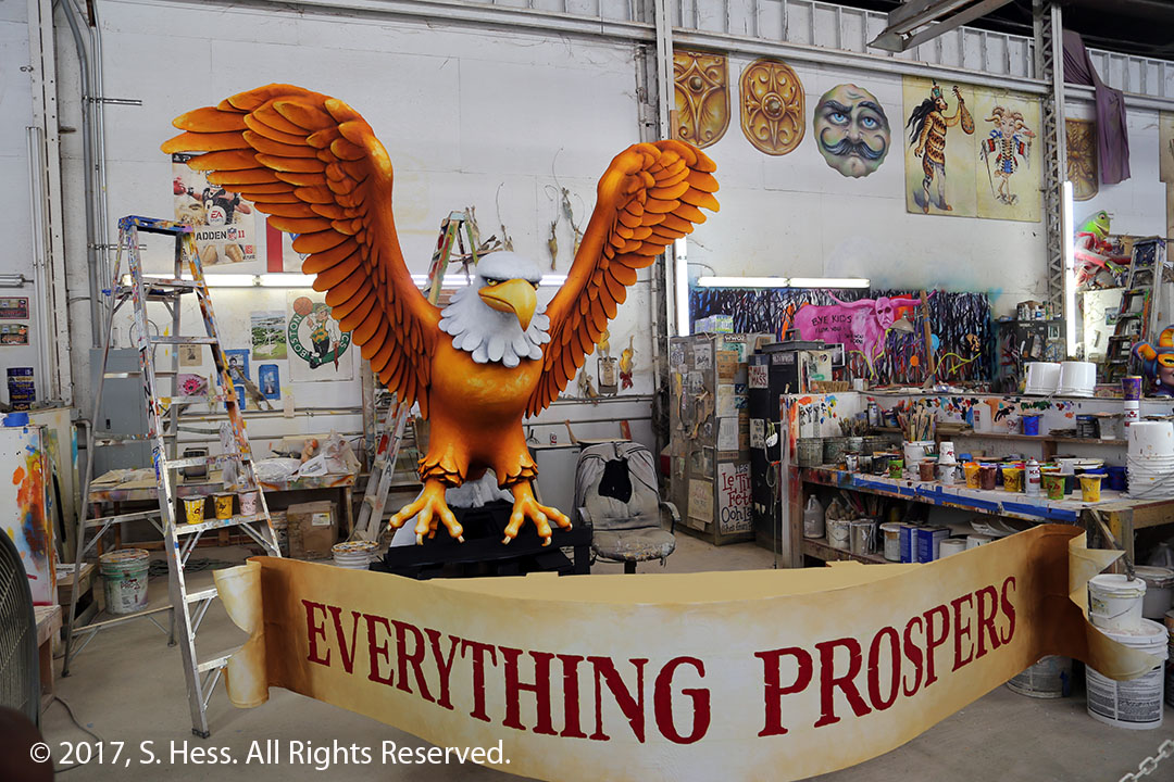
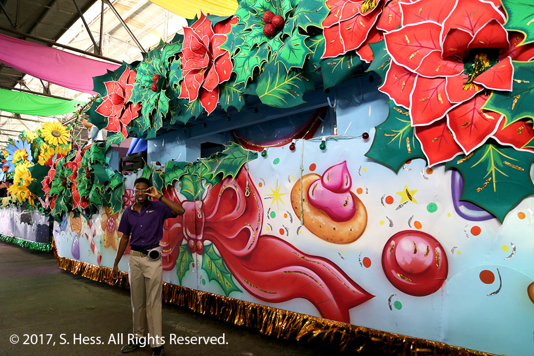
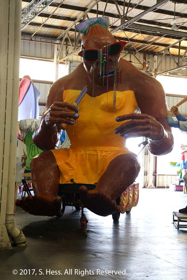
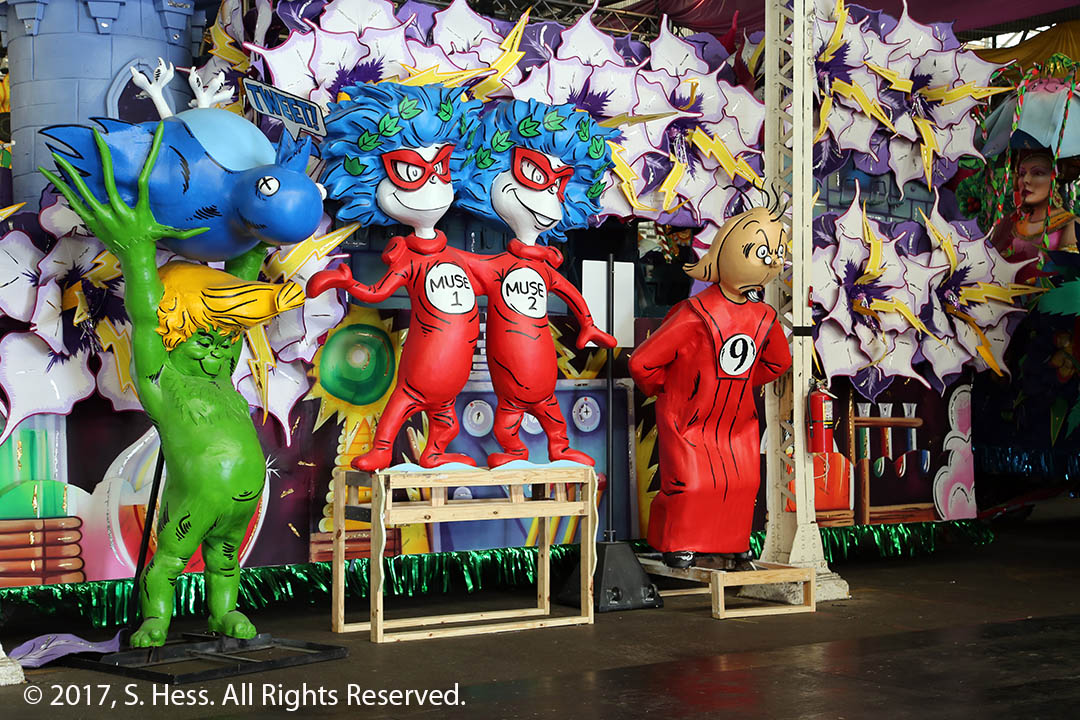
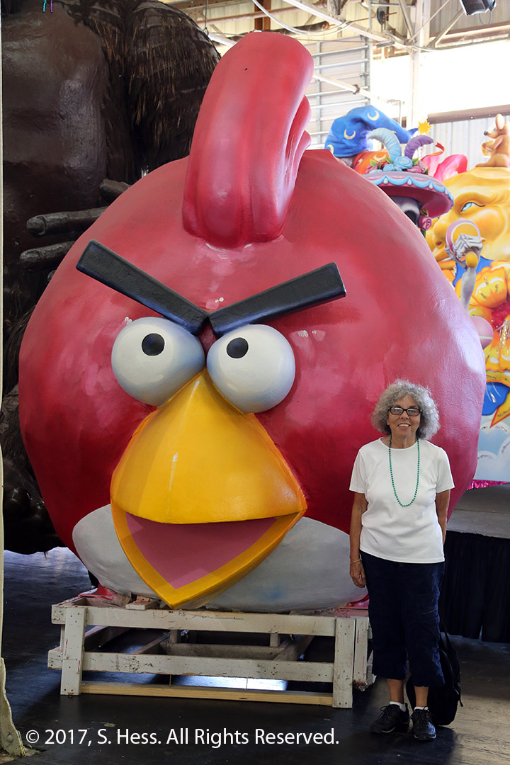
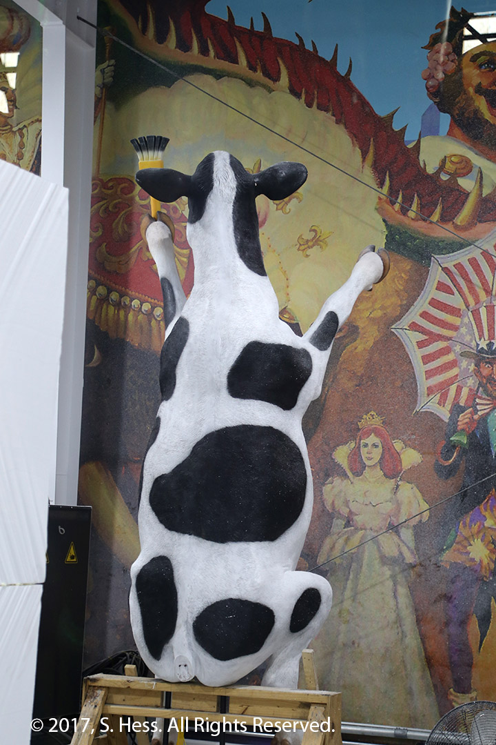
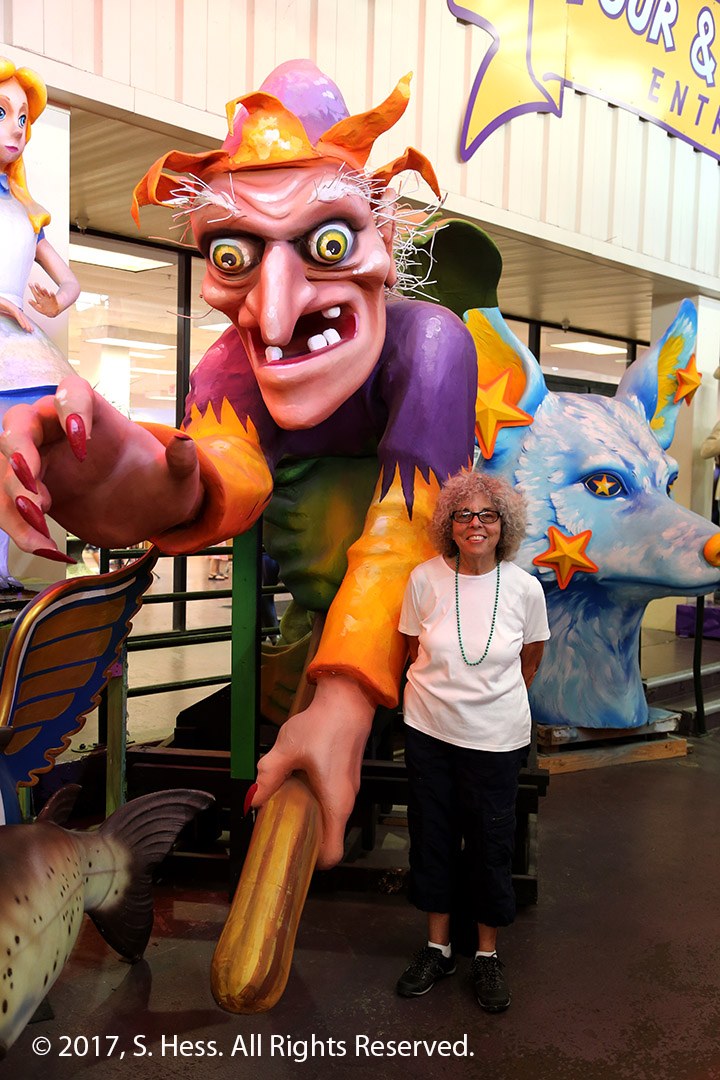
After breakfast we drove to one of the items on our “to do list,” Mardi Gras World. Mardi Gras World is located in Blaine Kern Studios facility on the New Orleans riverfront. The studio has been making floats for Mardi Gras parades since 1932. Our tour guide took us through the studio and described the work that goes into making the floats. After the formal tour is completed, you are free to walk through the building and take photographs of the floats and the components. Blaine Kern also makes 3D Advertising objects… if you drive down the highway and see a cow hanging on a Chic-fil-A billboard, it was made in this facility.
Susie dressed for Mardi Gras. The guy to her left looks confused and Bacchus looks frightenedStyrofoam is shaped to the desired form such as this wheel.After the foam form is shaped, it is covered with brown paper mache and is ready for painting.Last year this form was The Phantom. The mask has been removed and some other modifications made to turn this into James Bond in Goldfinger for 2018 floatThis eagle will be on one of the 2018 floatsThe participants spend hours on the floats during the parade. They come on board with food and drink (most likely alchoholic). They can’t stop to relieve themselves so the float contains two rooms with a porta potty (see door above ribbon).Queen Kong gets a new dress painted on and a manicure every year.Dr. Seuss charactersSusie and the Angry Bird… Hope it isn’t hungry because Susie looks like a tasty morselThe fiberglass Chic-fil-A cows are made in New OrleansWhich is Witch
In 2009, we were in New Orleans for our nephew’s wedding and took a trip south to the river delta. Plaquemines Parish includes the last 70 miles of the Mississippi before it enters the Gulf of Mexico and we drove south until the road ended at the Venice Marina. Four years earlier, Hurricane Katrina caused major damage to the parish communities. Once we crossed the Mississippi to the right bank, we saw a lot damaged property along side the road. We decided to drive down today to see how much has changed. We only got down as far as Port Sulphur before we turned back because a thunderstorm was heading our way. We did note that little of the damage remained. New housing, a lot of it elevated well off the ground, was seen in the 40 miles we traveled.
This evening we had dinner with Susie’s cousin Kathy, husband Hal and their children David and Rachel. Since this was our first ever meeting with Kathy, Susie feels that she closed the Fabricant family circle that had been broken for about 62 years. We spoke about our respective families and started getting to know each other. We promised to get together again, certainly when we attend the American Library Association meeting here next June.
On this trip we followed the Mississippi River from Hannibal, MO using local roads only. While we deviated to smaller local roads, our primary route was US 61. Driving from Baton Rouge to New Orleans using I-10 would normally take a little more than an hour to complete. Staying with our plan to run on local roads took us around three hours, not counting stops. Fittingly, the second half of the trip was on US 61.
The weather forecast for this morning was for scattered storms along our route. As we left the hotel we could see ominous dark clouds on the horizon and hear the rumble of thunder. We hit rain about 15 minutes into the trip and ran through a series of showers for the next 20-30 minutes. It stayed partly cloudy and dry for the rest of the trip to New Orleans.
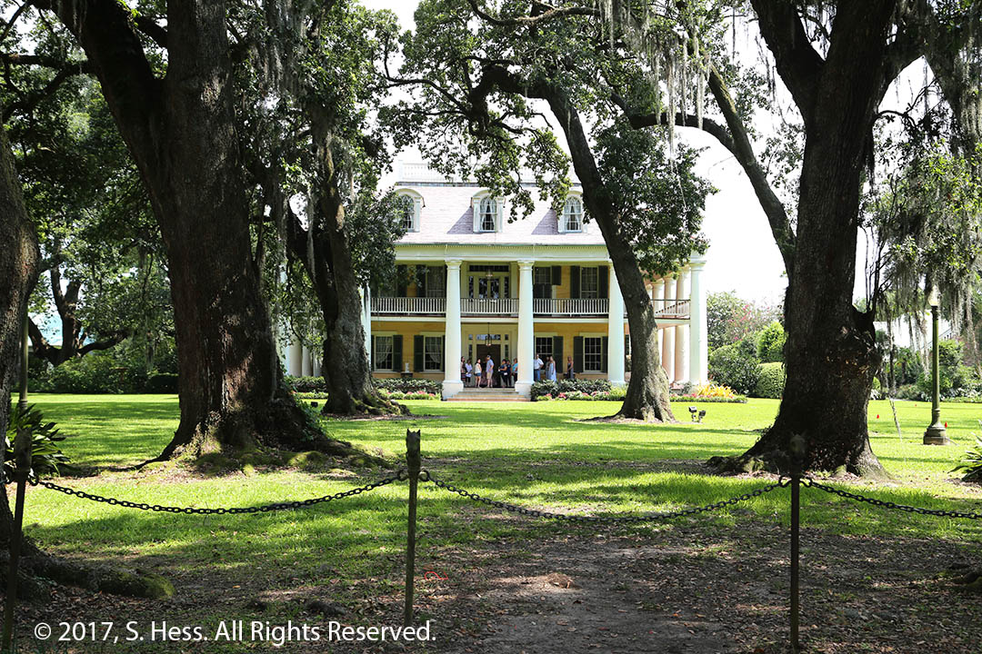
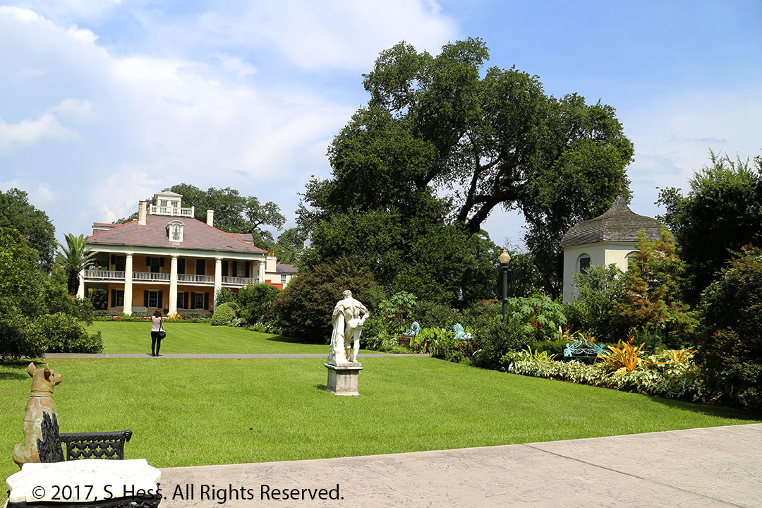
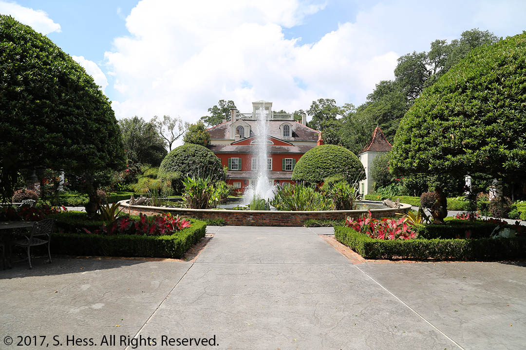
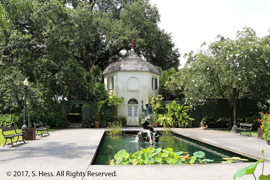
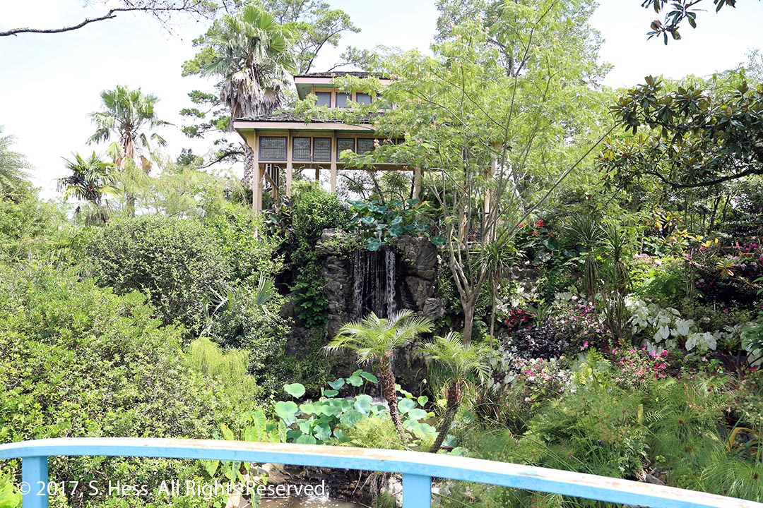
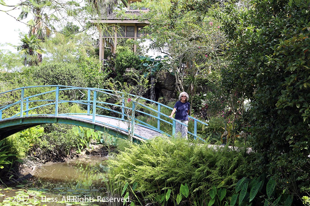
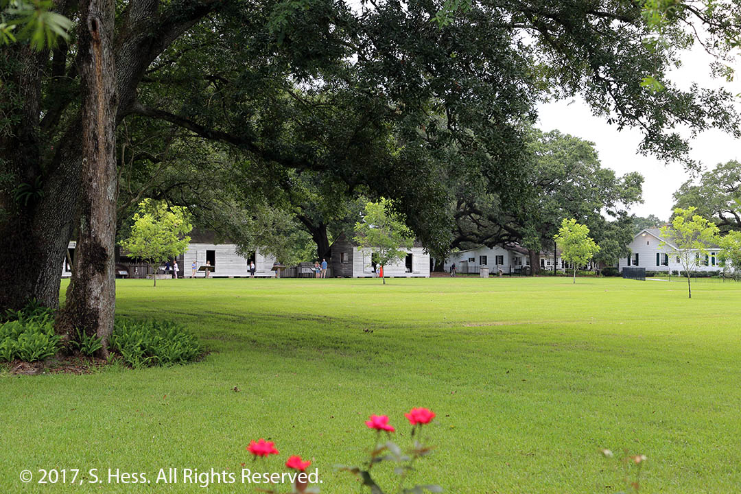
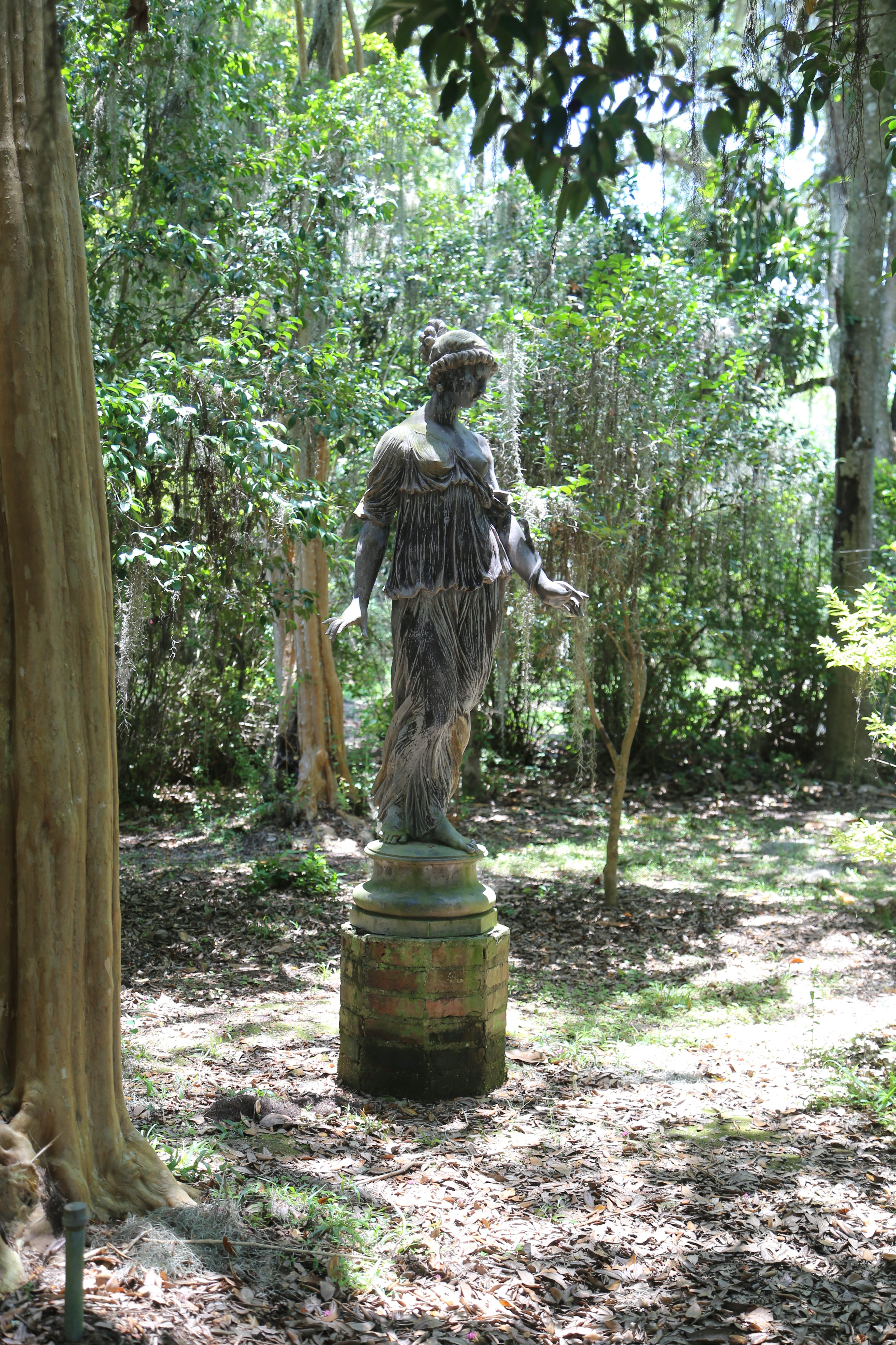
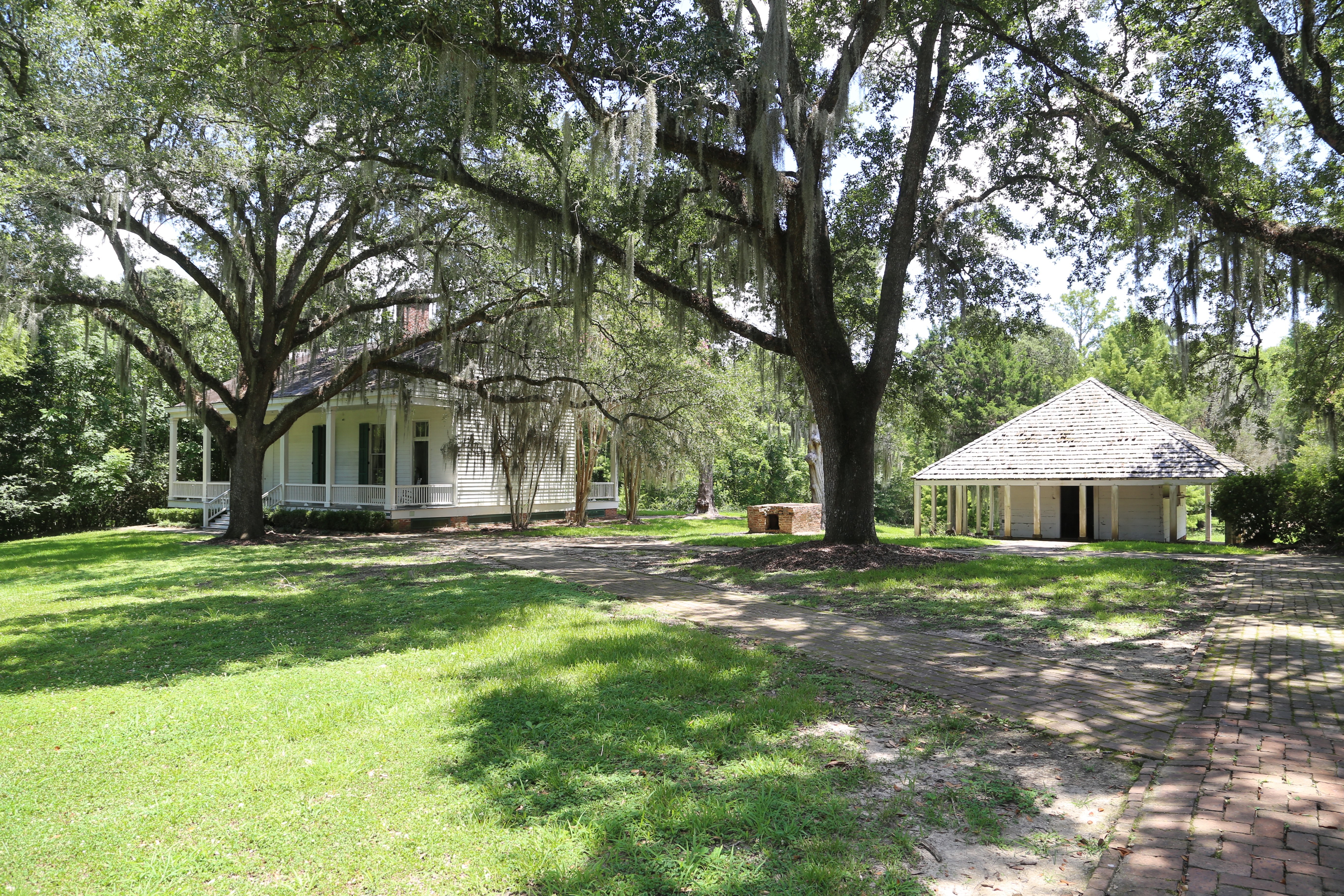
Our first stop was the Houmas House Plantation (see The Sugar Palace, a YouTube Video). This plantation house is called the “The Crown Jewel of Louisiana’s River Road.” As was our luck at the Rosedown Plantation, we just missed the house tour so, a bit disappointed, we opted for the self guided garden tour. The Houmas house property, which included the site of the house and thousands of acres of land, was purchased from the Houmas tribe and named after them. The house has gone through several owners and design changes. Interestingly, we know that the plantation had many slaves, but saw no slave housing.
The Oak Alley at Houmas House PlantationEast side of Houmas HouseRear of Houmas HouseNeptune’s Fountain at Houmas HouseJapanese Garden at Houmas HouseSusie at the Japanese Garden at Houmas House
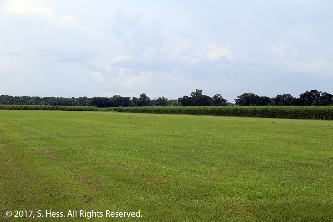
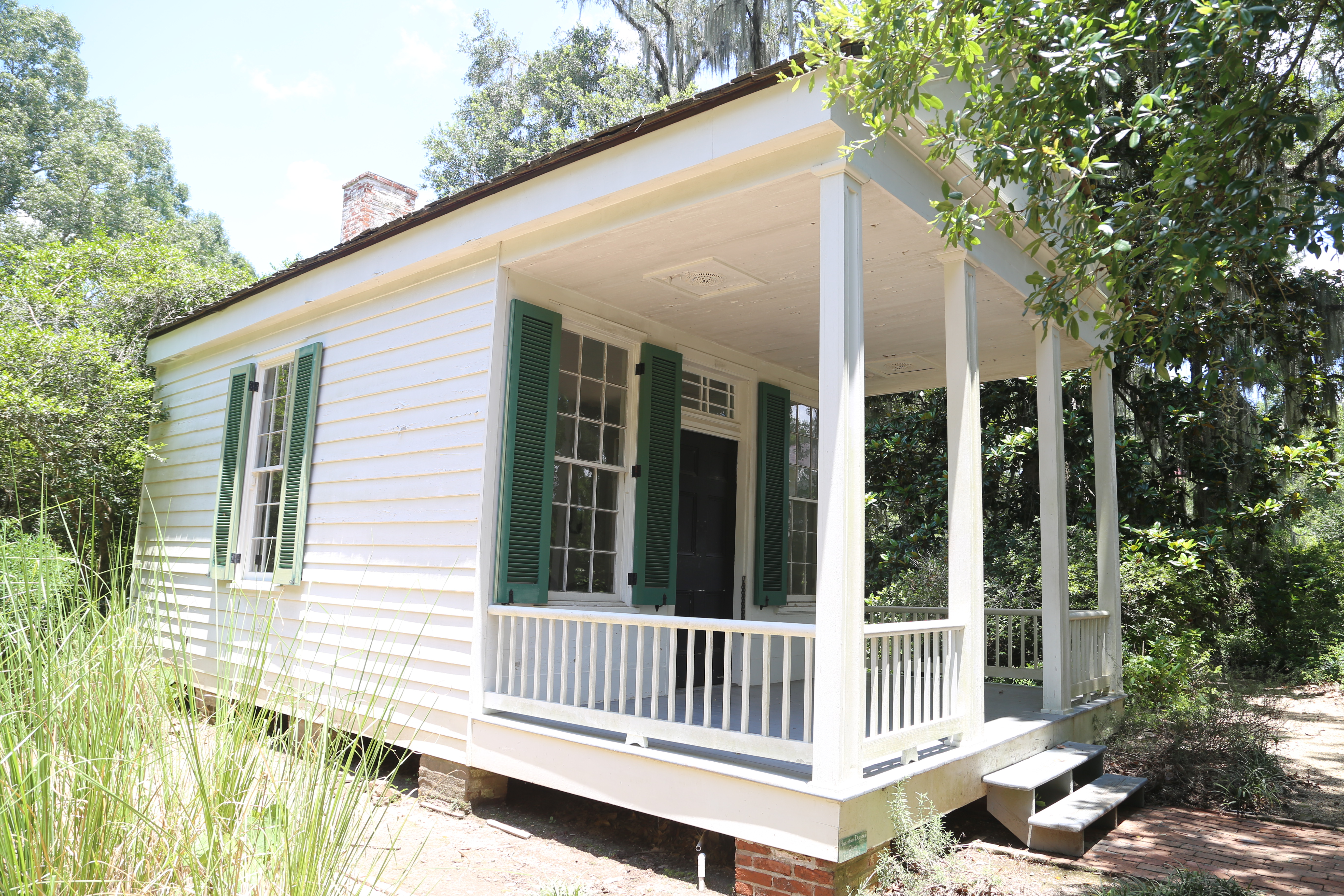
Sugar made a lot of the plantation owners rich and they built a number of ornate plantation houses for themselves and their family. Some of the mansions still exist along the river south of Baton Rouge and several are open to the public. We had wanted to see Oak Alley Plantation. However when we got to the parking lot we could see that it was fairly full and several tour busses were parked. We figured that it would take quite a while before we could get on a tour and left. Before we left I managed to get pictures of the slave quarters from the vicinity of the ticket booth. As you travel along the river you can travel for miles and have the levee on one side of the road and sugarcane fields on the other. Agriculture is not the main economic force along the river… oil production and processing plants are a frequent sight.
Slave quarters at Oak Alley PlantationSugarcane Fields
After we left Oak Alley, we headed across the river and picked up US 61 for the run to New Orleans, one of our favorite cities. One of the reasons we are stopping in New Orleans is to meet Susie’s cousin Kathy, who, like her sister Susan in St Louis, is a cousin we have never met.
An easy travel day… only 170 miles separate Baton Rouge from Vicksburg and we only had two scheduled stops on today’s itinerary. In light of that we took it easy and didn’t leave Vicksburg until about 8:30am, an unusually late start for us.
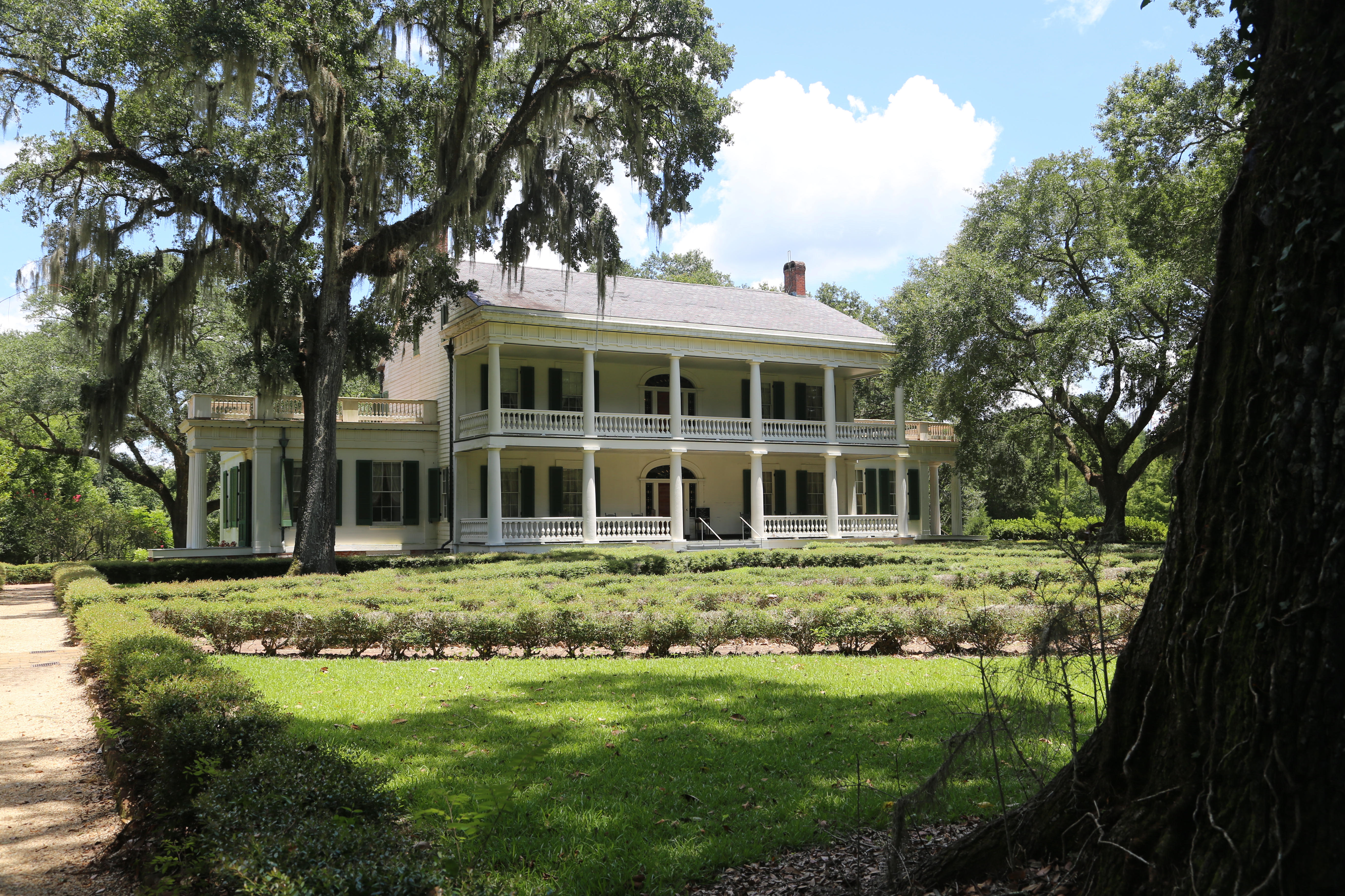
Our first stop was historic Natchez, MS. Natchez has been a population center since at least the time when the Mississippian Culture built their community on the bluffs overlooking the Mississippi River. They were followed by the Natchez tribe, French, Spanish, English and American traders and settlers. In the mid-19th Century, cotton was the economic engine of Natchez. Rich planters built mansions on the bluffs above the River. Many of these antebellum mansions still exist and this was one of the reasons we wanted to stop here and photograph these mansions. We learned that you can’t just stop and take pictures of the exterior of most mansions… you have to pay for the whole tour. The mansion Susie had wanted to see the most is Longwood. When we got to the gate, we were told we would have to pay $18 each for the privilege of driving around the property… we made a U-turn and left. Other mansions also sit behind walls and gates and charge a price just to get some photographs.
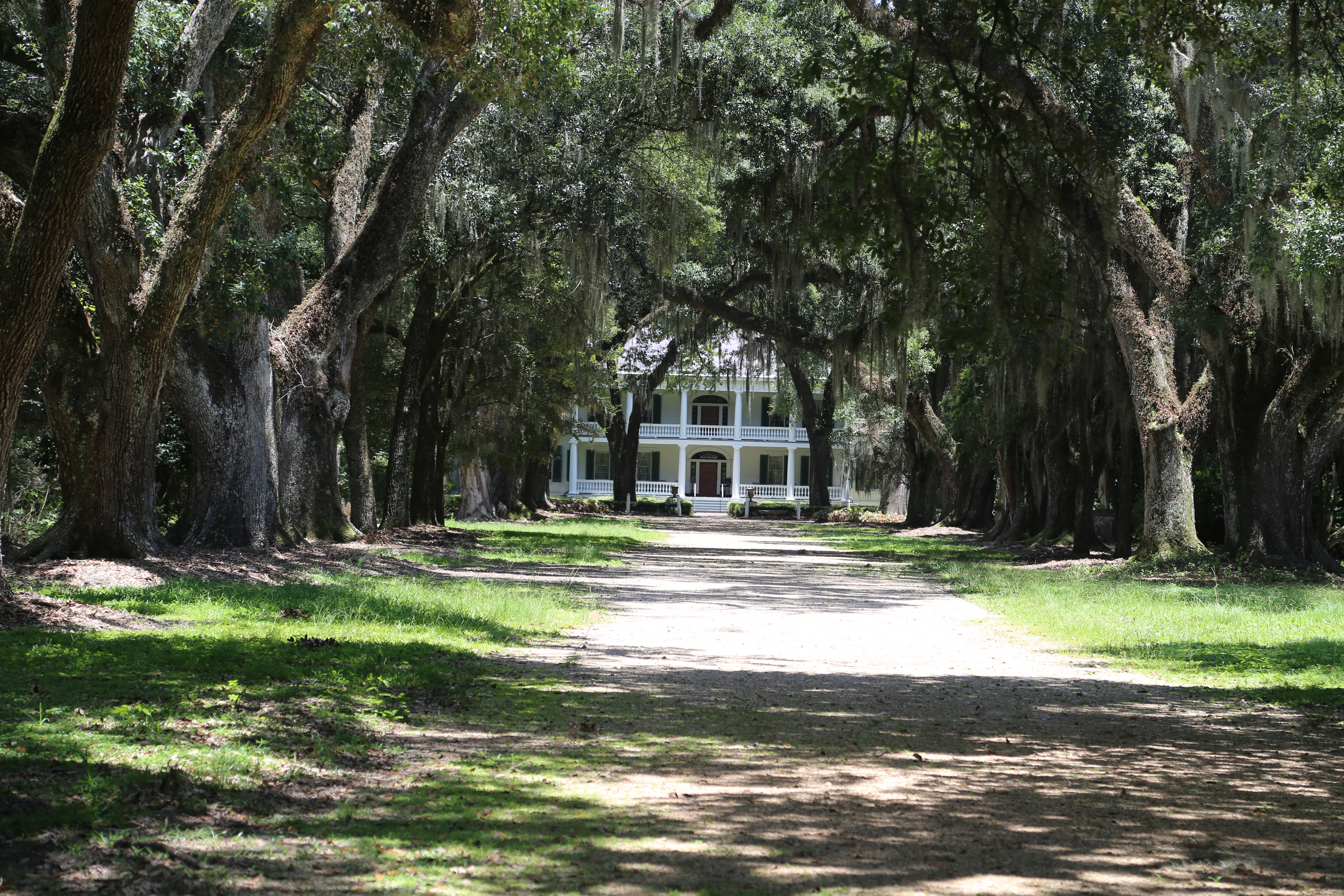
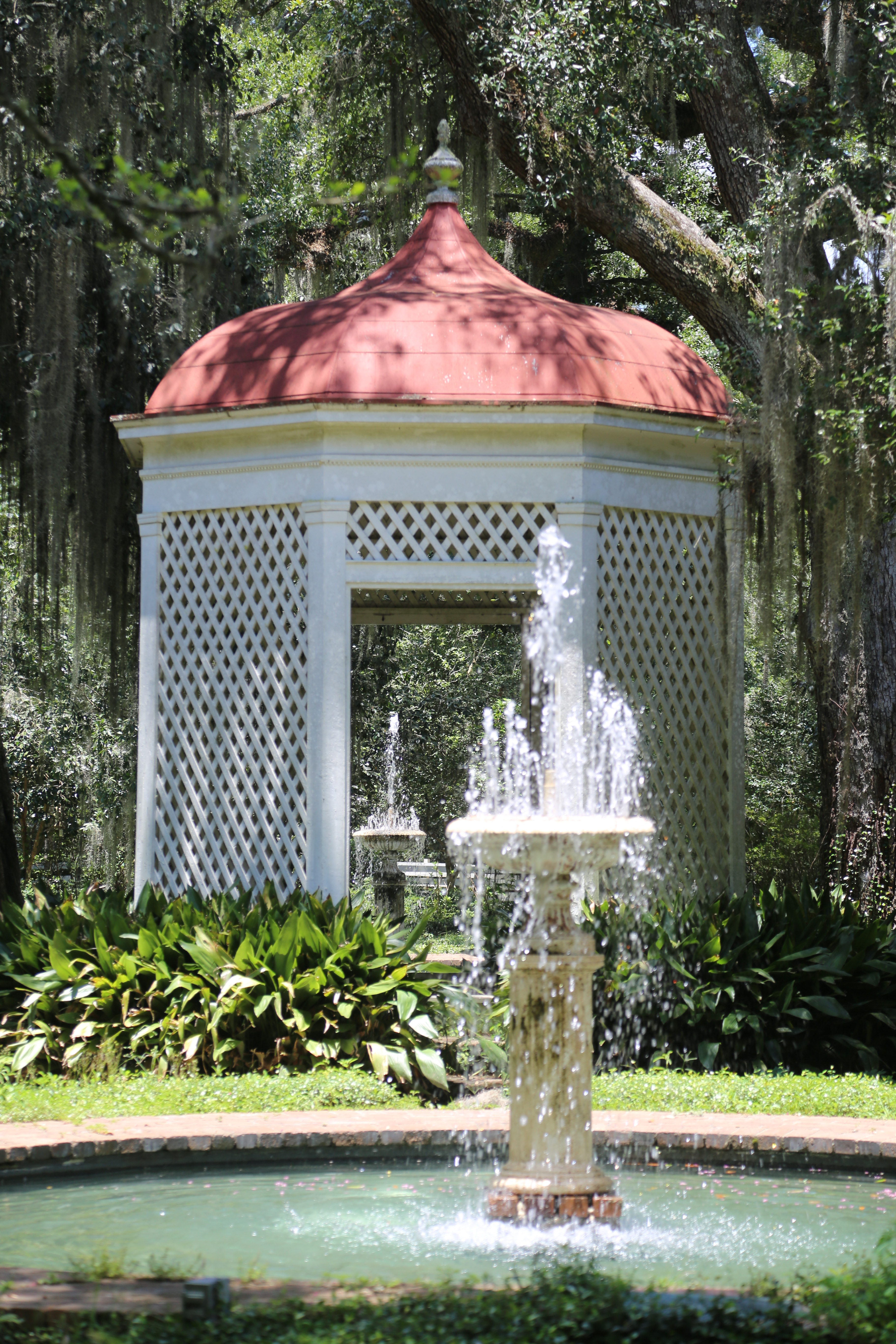
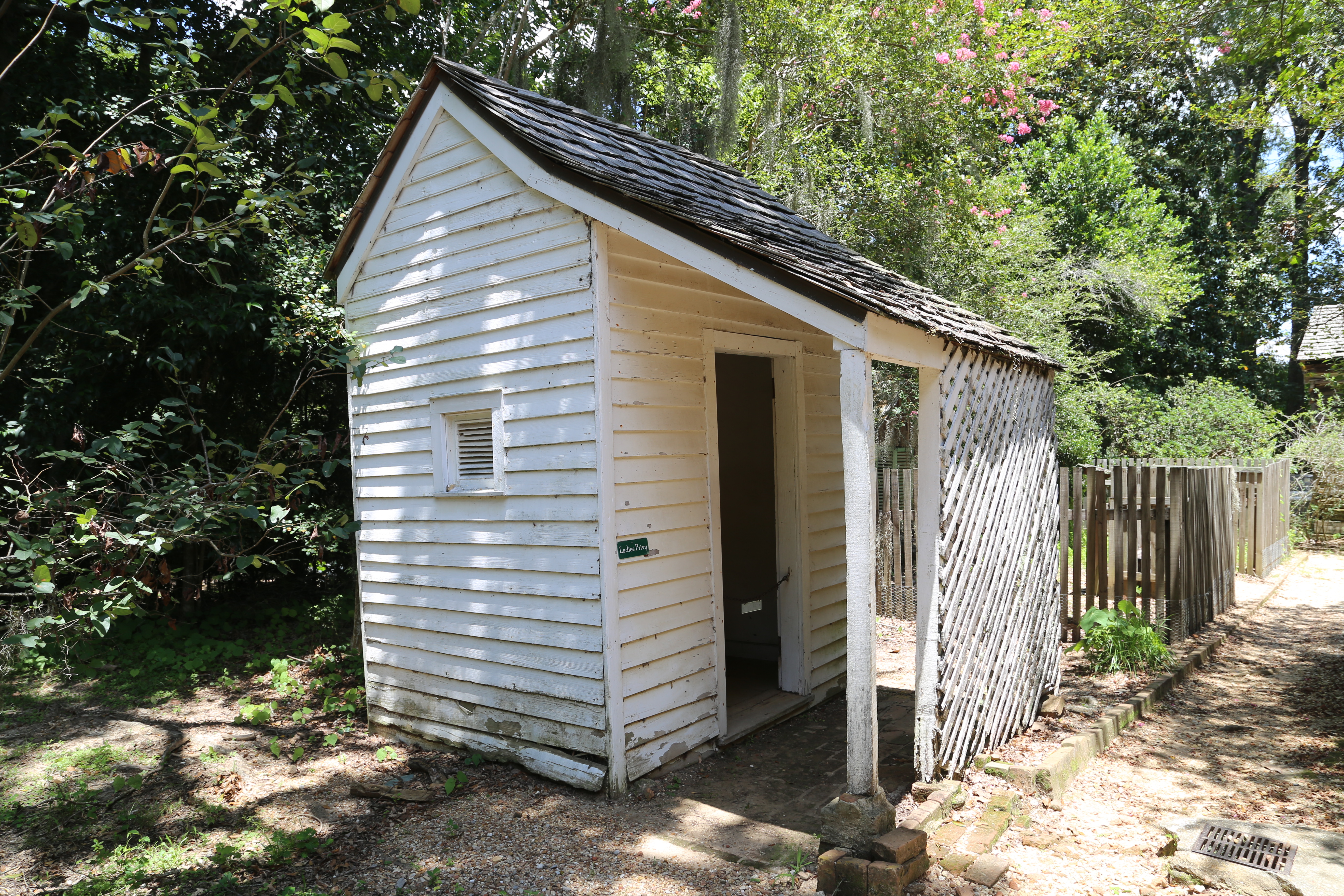
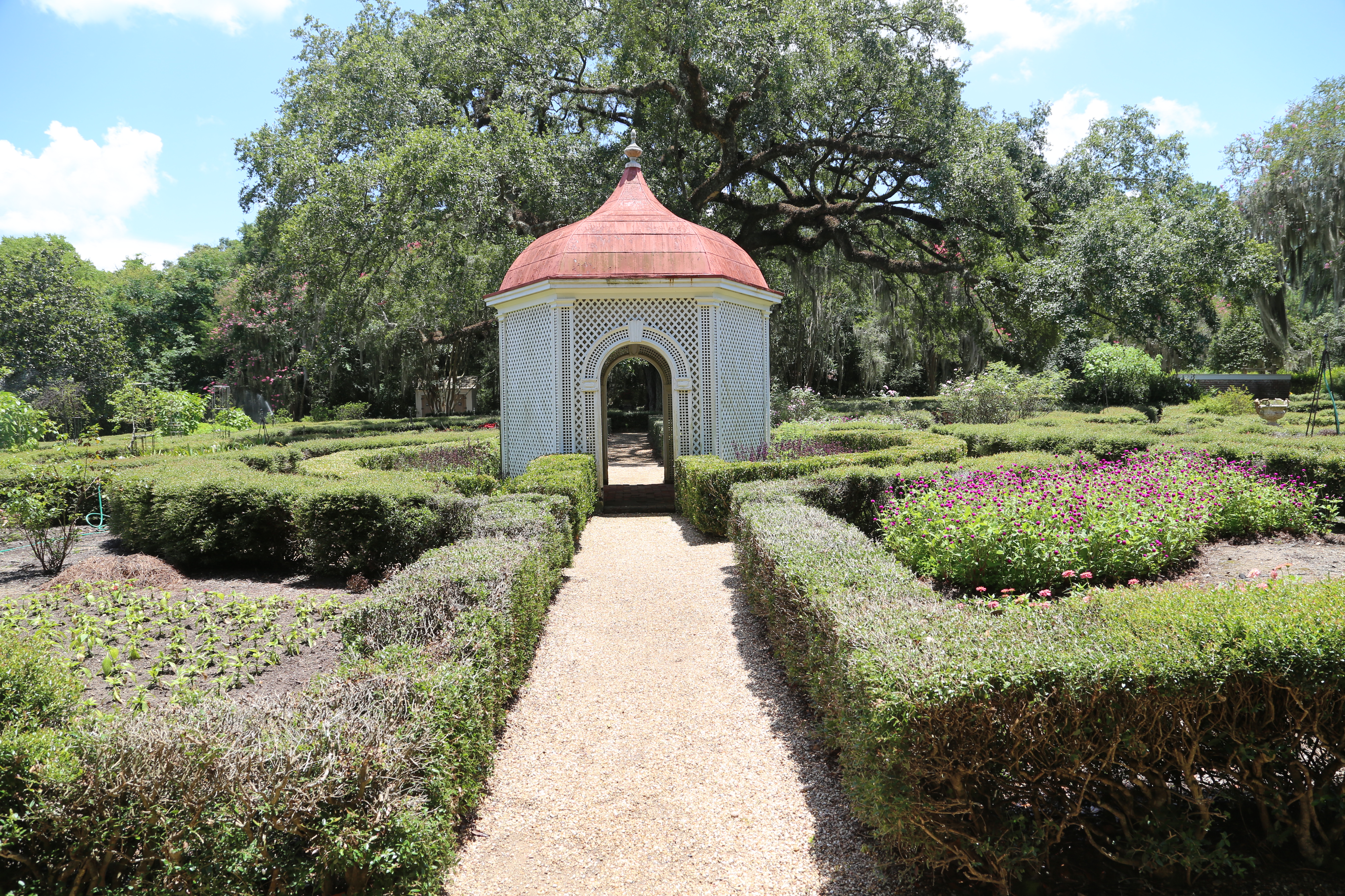
Our next stop was St. Francisville, LA, which is the location of Rosedown Plantation, now a State Park. We arrived just in time to miss the 1pm tour of the grounds and house. We would have to wait until 2pm to do the next tour. This left us with the option taking an unescorted tour of the grounds which came at a much lower rate than the complete tour. On the Garden tour, we didn’t see any slave quarters… slaves worked in the house and gardens. It appears that the property needs some restoration. The Rockery is falling apart and other features need maintenance.
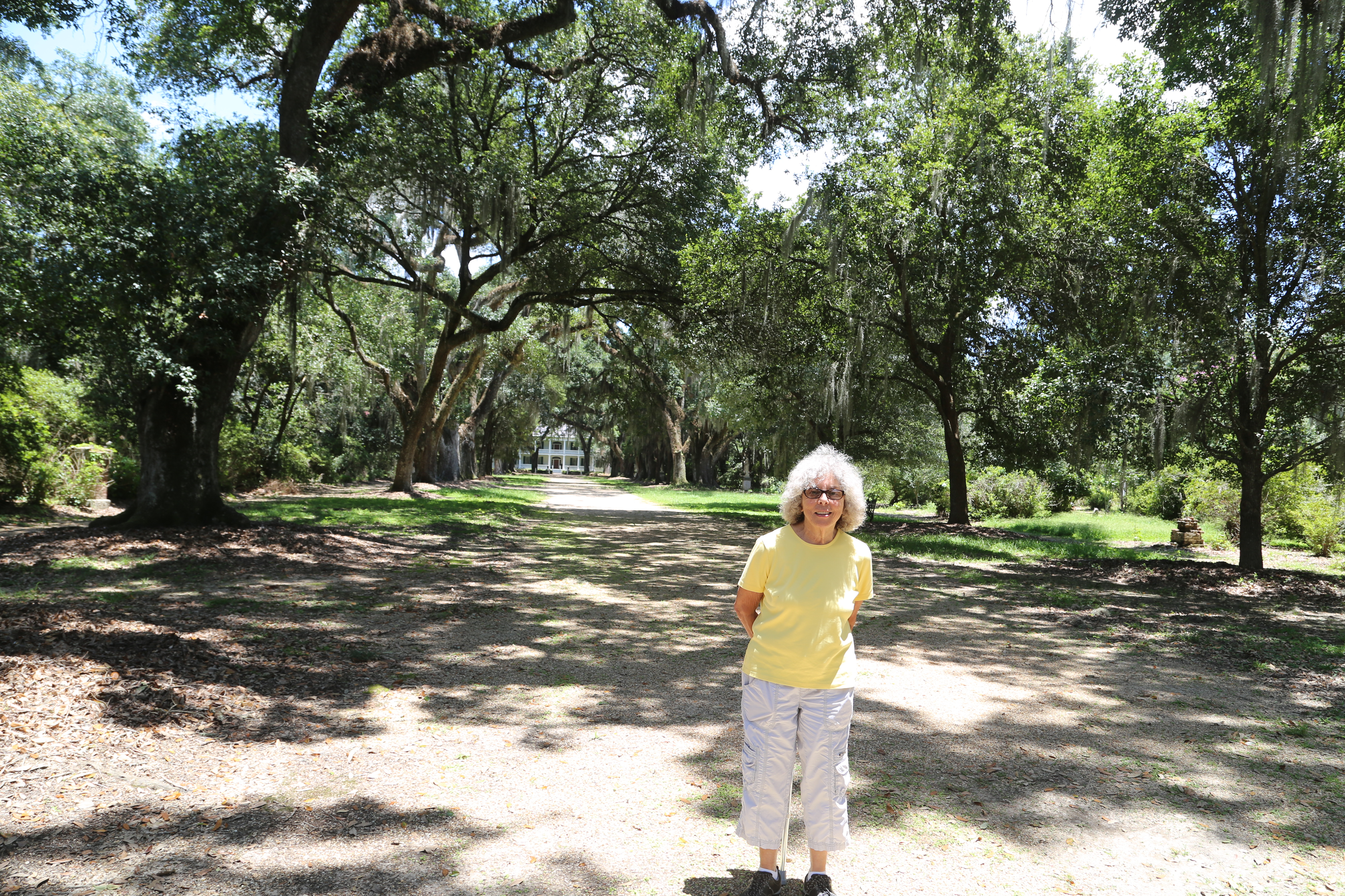
Susie standing in Oak Allee. The trees were planted in 5 years before the house was built.Oak AlleeNine Italian Carrara marble statues were purchased in 1851. The four in the carriage turn in front of the house represent North America, Asia, Africa and Europe. The four along the Allee represent the seasons.Doctor’s House.Rosedown Planation HouseThe summerhouse was one of three in the gardens. The twin fountains were added in 1957.The Rockery, built in 1858. Rock gardens were popular garden ornamentsThe ladies Privy. It was a three holer.Nina’s Wing & Milk shed. Nina was the last of the Turnbull family to live on the property.Formal Gardens
Our final stop is Baton Rouge. This an overnight stop and we don’t plan any sightseeing in town. While camping in Williamsburg, VA, we met a family from Baton Rouge and the adults and kids became friends. We made several trips to Baton Rouge and met them in other places. We have two plantations we want to visit tomorrow on our way to New Orleans, a little over an hour via I-10 but several hours by way of local roads.
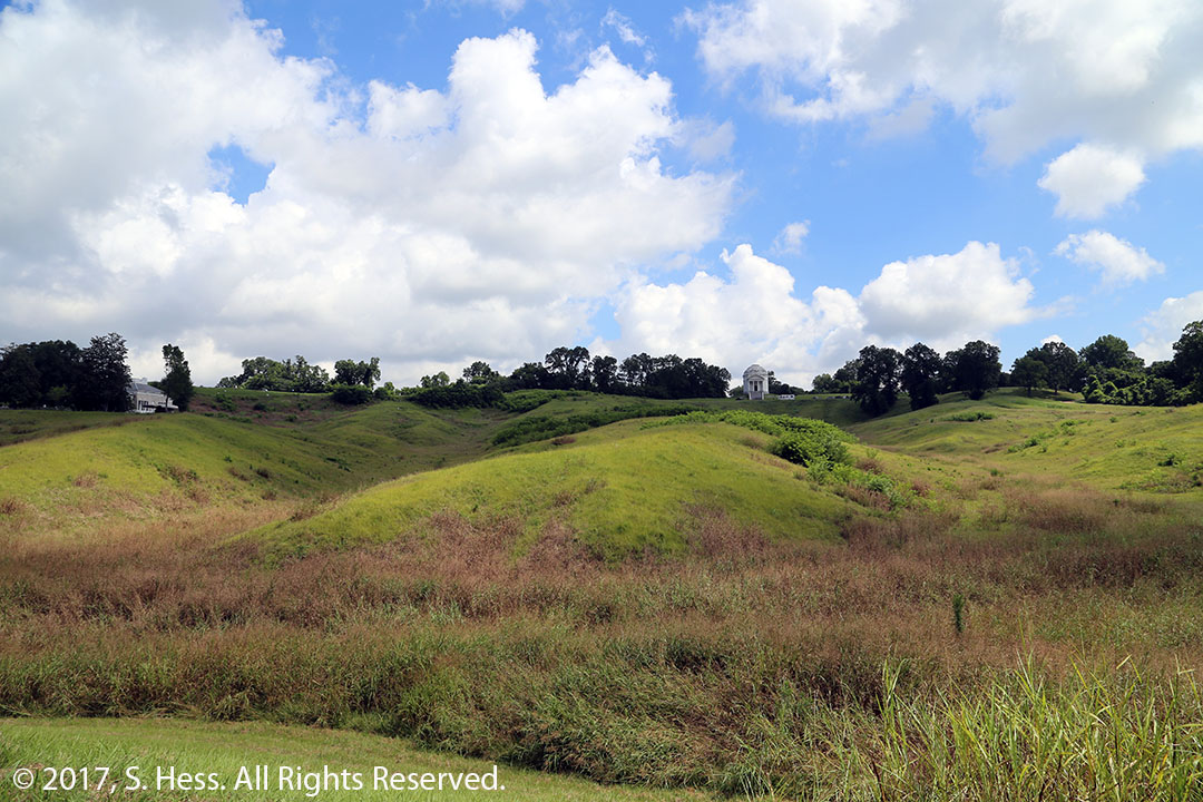
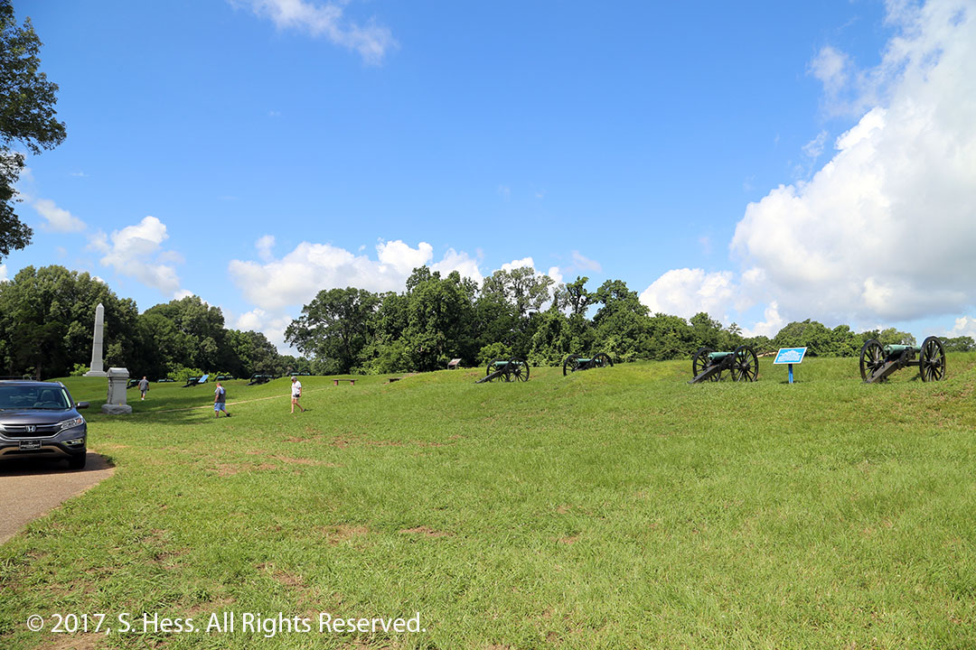
The Battle of Vicksburg was one of the most significant battles of the Civil War because it led to the Union’s control of the Mississippi River and effectively cut the Confederacy in half. The Confederate forces had the advantage of holding fortified high ground but the Union had twice the manpower. General Grant twice attacked the Confederate lines with little gain and high casualties. Grant decided to besiege the city, ultimately resulting in the surrender of the Confederate forces.
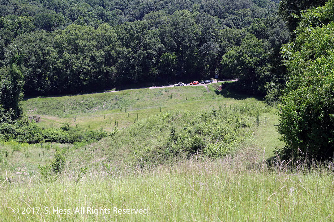
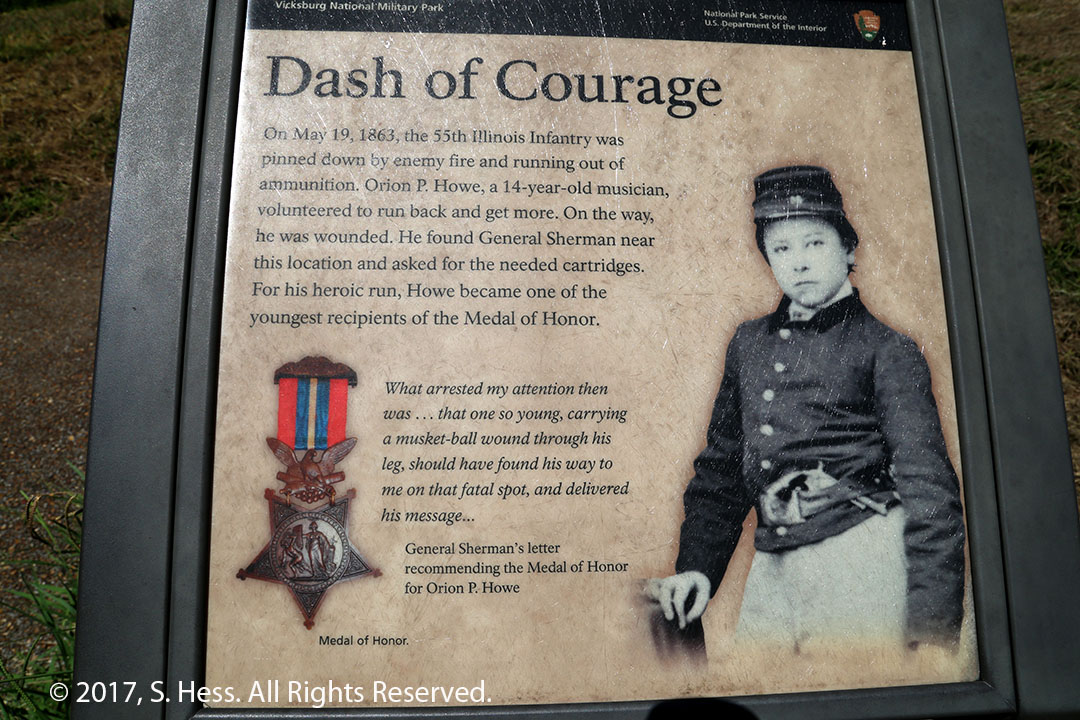
This is the type of terrain that the battle for Vicksburg was fought on.View from a Confederate position looking down on the Union position. Union engineers dug a tunnel under the ridge (where the cars are parked) and then dug a covered trench to allow them to get closer to rebel fortifications.Child Medal of Honor recipient.
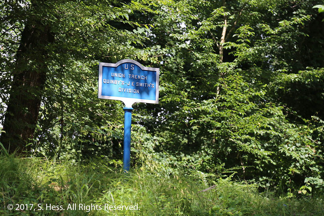
After the Civil War Union and Confederates soldiers worked to identify and mark battle lines and unit positions. The Battle of Vicksburg is one of the best marked battlefields.
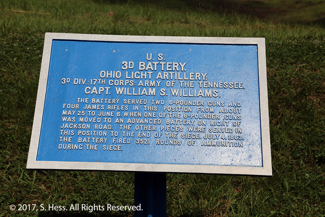
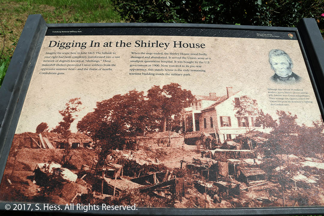
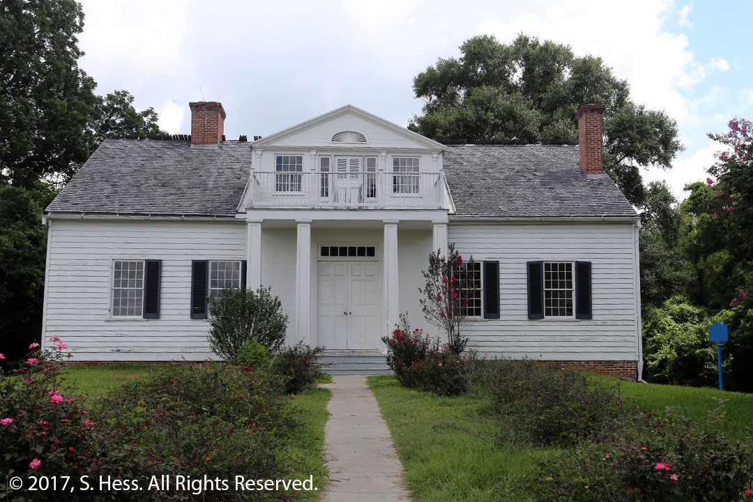
Union line marker. Confederate markers have a red background.Detailed Position Marker3rd Battery Ohio Light Artillery position.This picture depicts the Shirley house during the Siege of VicksburgThe Shirley House today. Its owners were slaveholder that were sympathetic to the Union cause. The teenage son was a Union Army volunteer.
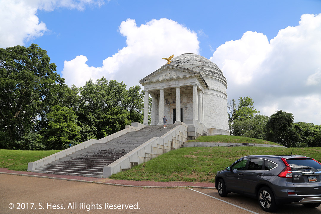
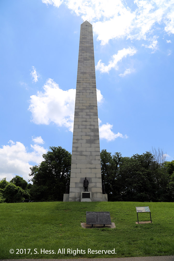
The Vicksburg Military Park has over 1,000 monuments. These monuments honor units from the states involved in the battle, as well as individuals.
Illinois MonumentNavy Monument
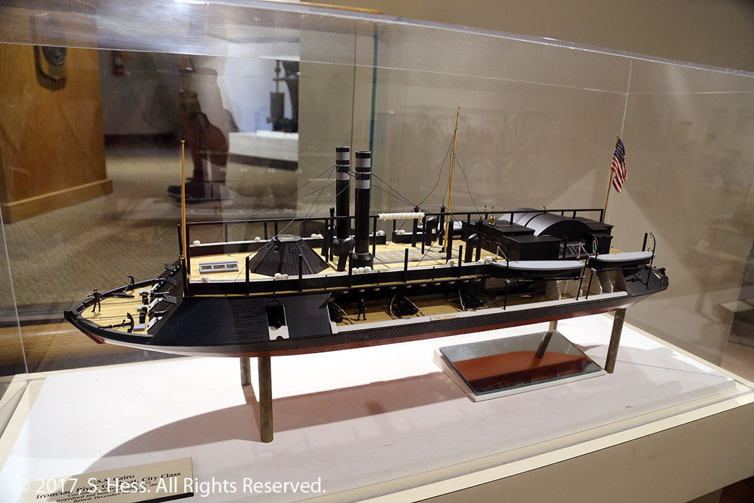
The USS Cairo Museum is within the Park and has the partially reconstructed ironclad gunboat.
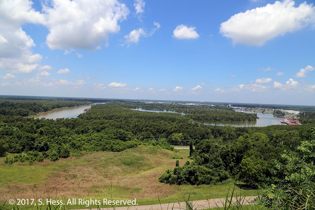
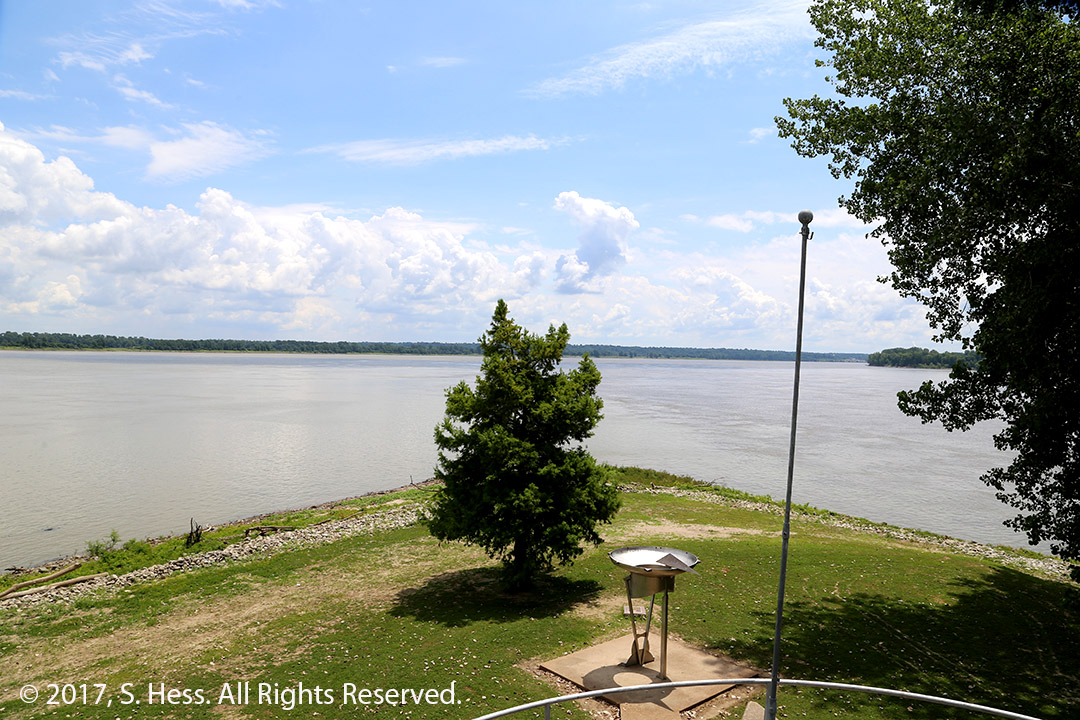
Partially reconstructed USS Cairo. It was sunk by a mine. All the crew members were rescued.Cutaway Model of the USS Cairo at the USS Cairo Museum.The Mississippi River used to flow below the bluffs, near the USS Cairo Museum, on the north side of Vicksburg. In 1876, the river suddenly changed course and now flows on the south side of the city. It put the port of Vicksburg out of business until the Yazoo River Diversion Canal was created allowing river traffic to access Vicksburg.
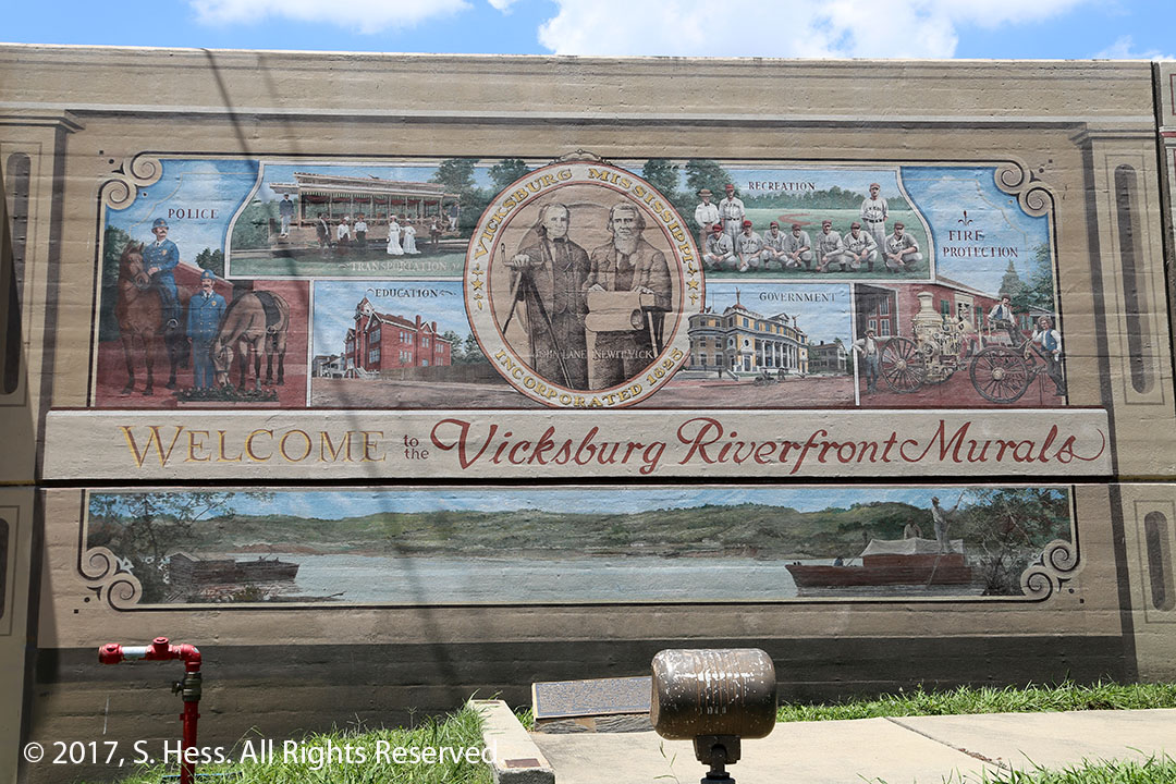
After touring the Park for about two hours, we headed for downtown Vicksburg and the levee that is supposed to protect the city from flooding. Just like Paducah, the levee wall has become a place for murals. Leaving the levee, we followed the Vicksburg Scenic Tour for part of its route. The temperature had reached 97 degrees and we figured it was time to get into the air-conditioned hotel room.
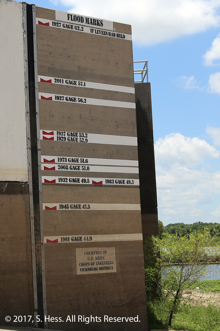
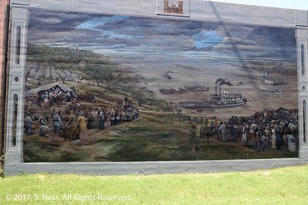
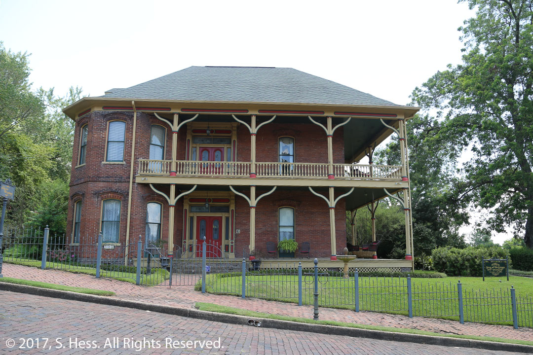
The Vicksburg Flood wall has a series of murals representing scenes of the city’s history.Flood crest markings on the levee wall. In the 1927 flood, the levee failed before the river crested at 62.2 feet.This mural shows the aftermath of the 1927 flood. Thousands of people had to be evacuated by steamers and barges. See flood crest markers below.Belle of the Bends, built in 1876 is one of the houses on the Vicksburg Scenic Trail.Baer House completed in 1870.
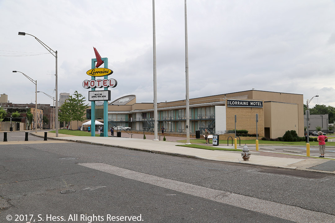
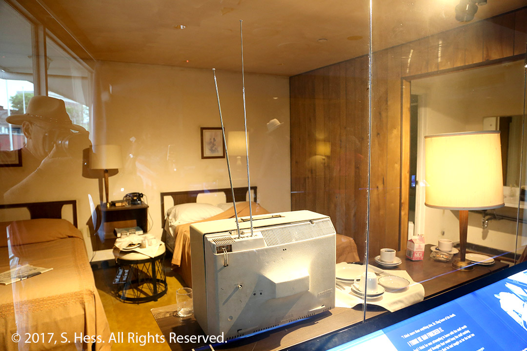
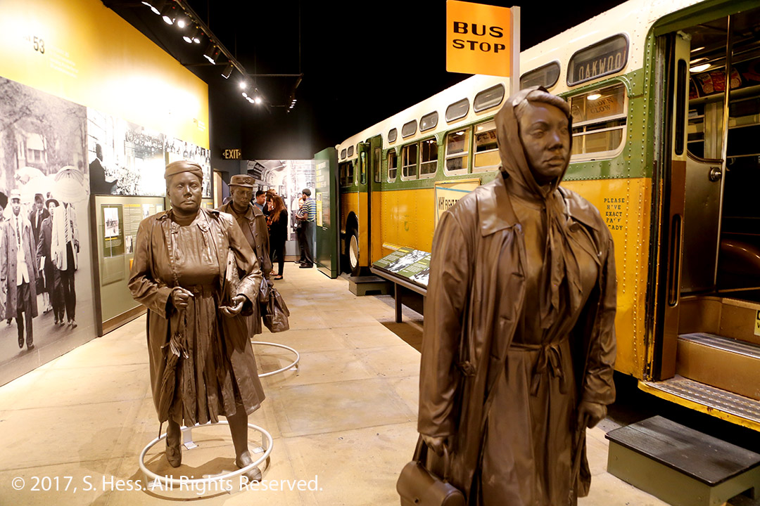
Our first stop this morning was the National Civil Rights Museum in Memphis, a short distance from our hotel. The museum is located at the site of and incorporates part of the Lorraine Motel. Martin Luther King, Jr was assassinated in from of Room 306, on April 4, 1968. Because the museum opens at 9am and we had a number of places to visit on our route to Vicksburg, we didn’t spend as much time as we should have to go through all the exhibits. If you are in or near Memphis, make a point of visiting the museum and allow at least two hours to see the exhibits. Photography in the museum is permitted without flash. Low light in most exhibits made photography difficult.
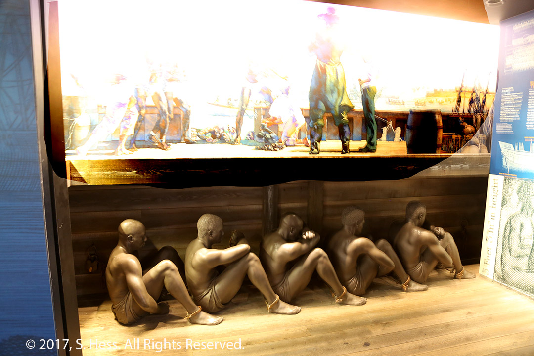
Exterior of the Civil Rights MuseumExterior of room 306. This is where King stood when he was shot.Interior of room 306 in the Lorraine Motel. This was Martin Luther King’s Room on the day he died.Exhibit showing how the slaves were kept below deck on the slave ship. The space each slave occupied was 3 feet high and three feet long.Exhibit covering the Birmingham bus boycott
After leaving the museum, we picked up US Highway 61, the Great River Road. It is also known as part of the Mississippi Blues Trail. We only covered a small portion of the trail. The area we traveled through is known as the Mississippi Delta, not to be confused with the Delta of the Mississippi River. The terrain of the Delta is flat agricultural land where the highway goes straight as an arrow for miles.
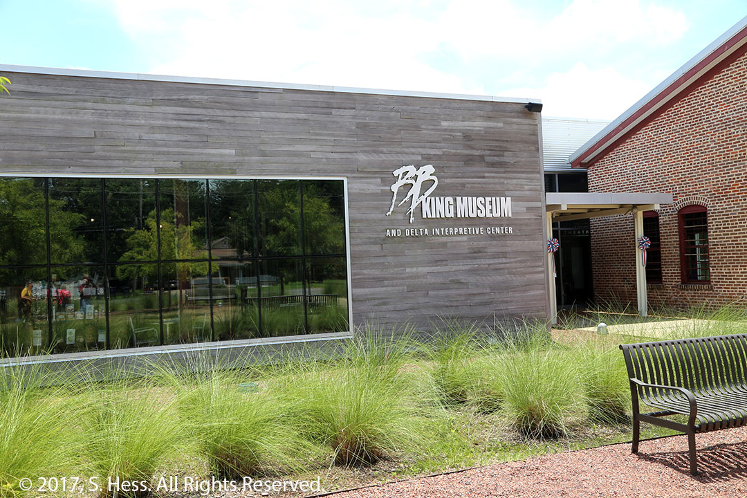
There are many Blues related places to visit on and off US-61, but time constraints limited us. The main place we wanted to visit was The B. B. King Museum in Indianola, MS. B. B. King, one of the most famous Blues musicians, was born in Indianola and is buried on the grounds of the Museum. Lighting conditions in the museum were similar to those in the Civil Rights Museum.
B. B. King Museum, Indianola, MSBottle cap studded Gibson Guitar
We continued on from Indianola to Greenville and followed MS Highway 1 back to US-61 which took us to Vicksburg, MS.
We thought that there would be a lot of action in Memphis on the 4th of July, but it was not so in the downtown area to which we limited ourselves. Most of the action that we know of was centered on Mud Island River Park (zoom out on map).
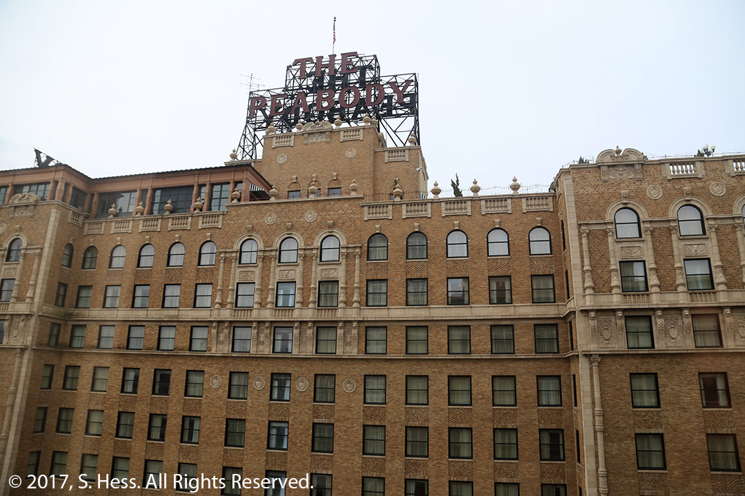
The first activity for us was going across the street to the Peabody Hotel to view the ducks parading to the fountain in the center of the main floor. The parade starts at 11am as the ducks descend from their rooftop home and parade out of the elevator into the fountain (watch YouTube Video). At 5pm the process is reversed. I tried to shoot a video of the parade from the mezzanine but the lighting conditions were not good. My video editing software is old and could not handle the process of enhancing the video.
The View from our hotel room is of the Peabody Hotel
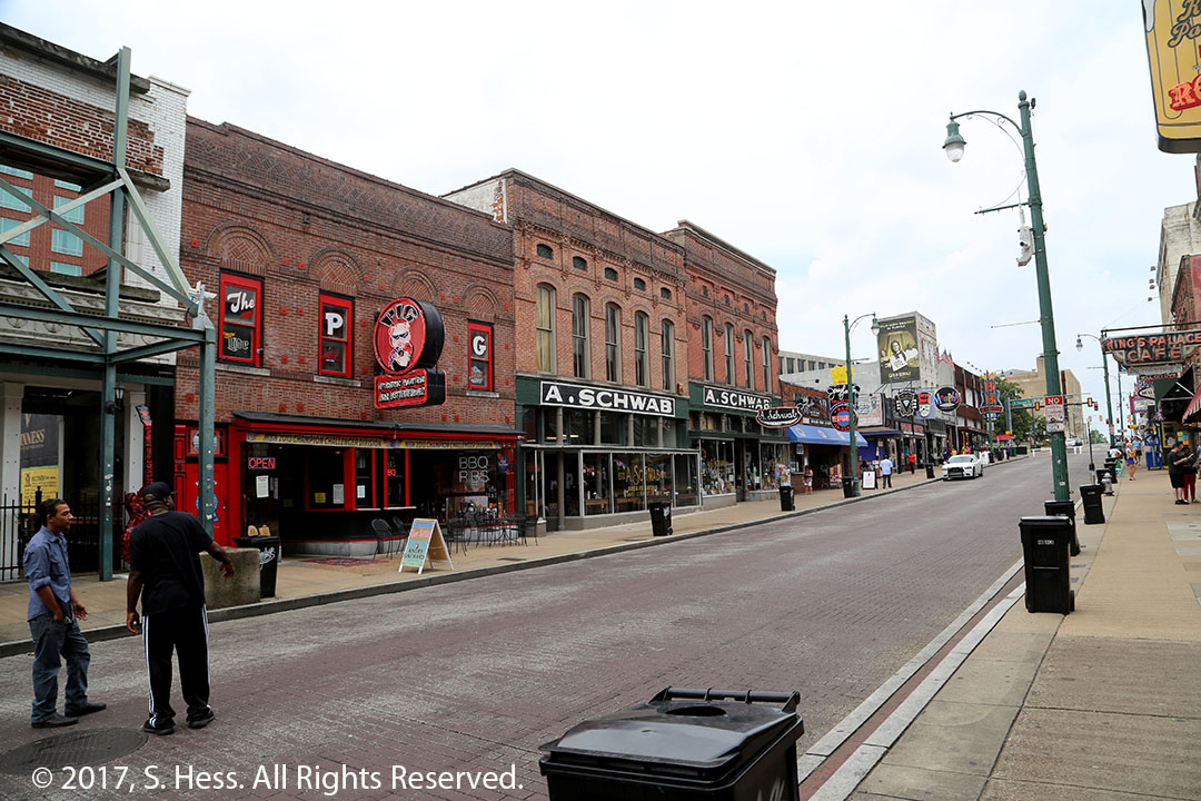
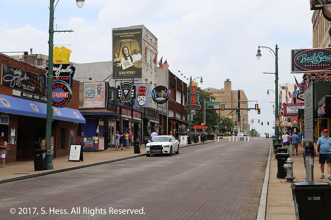
Next we walked to Beale Street. Most of the action is between South 2nd and South 4th streets. When we arrived, many of the businesses were just opening and the crowds were thin.
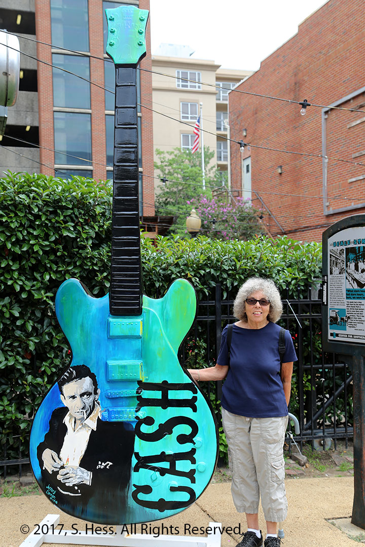
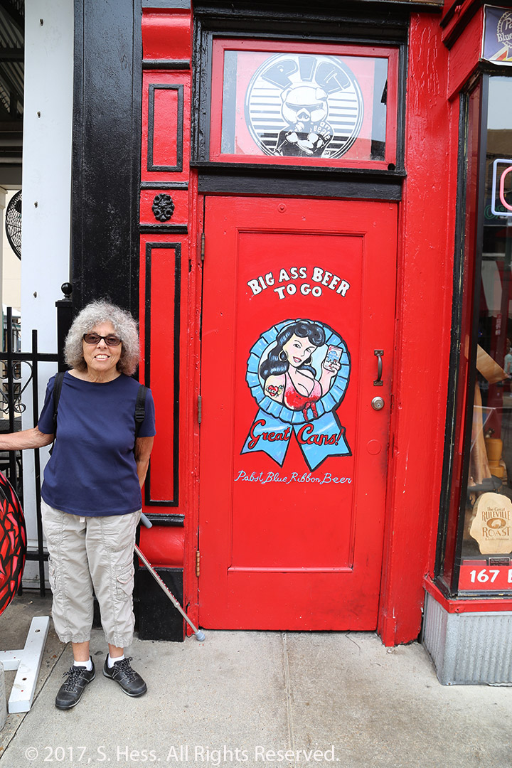
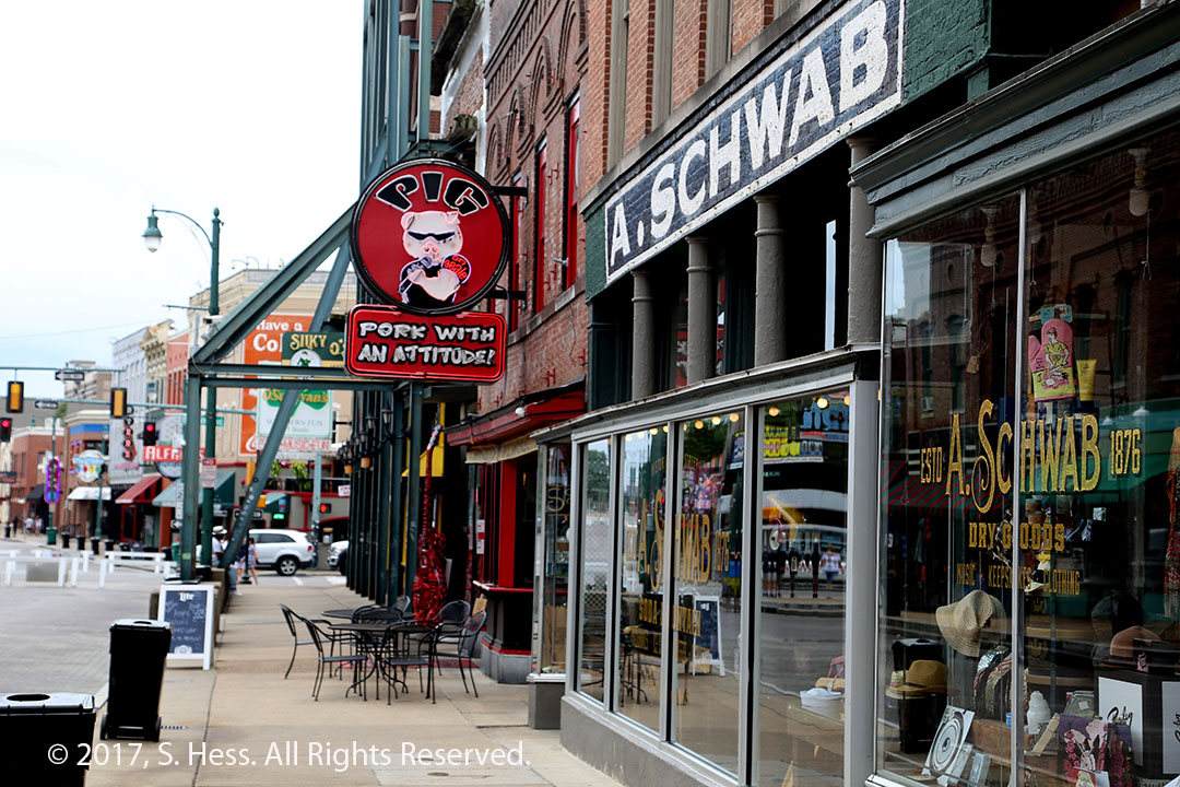
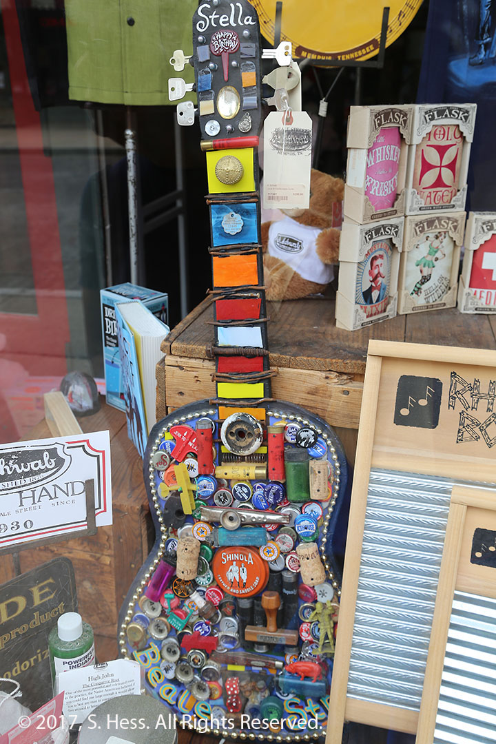
Beale Street SceneBeale Street SceneSusie and a tribute to Johnny CashSusie and her favorite beer… just kidding. Note the cane she uses as a prop… gets a lot of sympathy? She doesn’t use it to walk.A. SchwabGuitar art piece on sale at A. Schwab
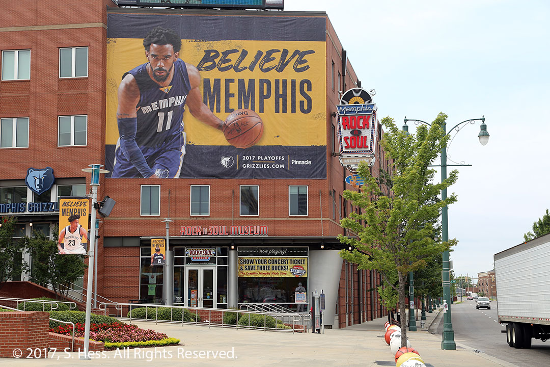
We walked over the Rock and Soul Museum, located just off the intersection of B.B. King Boulevard and Beale Street. The museum is an affiliate of the Smithsonian Museum. It is definitely a place to visit if you have an interest in rock music. We took about an hour to walk through the museum and could have spent more time there. We returned to Beale Street and visited A. Schwab, which was once a general store and bills itself as one today.
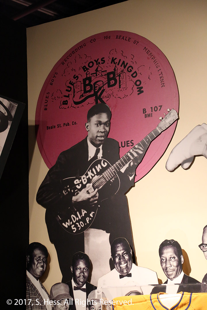
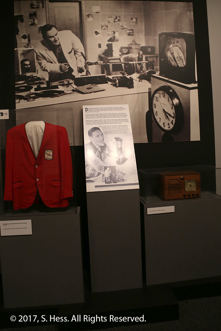
Rock and Soul MuseumThe name B. B. King came out of what he was called when he worked at WDIA, Blues Boys Kingdom.In addition to a number of displays in other rooms, a whole room in the museum is devoted to Elvis Presley.A display dedicated to Dewey Phillips. The main character in the musical Memphis was based on his life.
This evening we had planned to eat at the Rendezvous Restaurant, across the alley from the hotel. I have eaten there while a business trip, thirty years ago and again with Susie a few years ago. As luck would have it, we couldn’t eat there last night because it is closed on Mondays and it is closed today because it’s the 4th of July. We walked out to get dinner in a sports bar across the street when the sky opened up. Luck was on our side and the rain let up when we left the restaurant.
Last night there was a fireworks show at the AutoZone Stadium, which is one block away. We couldn’t see it, but sure could hear it. This evening a fireworks show is scheduled on the roof of the Peabody Hotel. As you can see from the first picture in this in this entry, we should have a good view. We did get a view of some fireworks from what we assume was Mud Island.
We have been on the road for two weeks and only encountered a little rain while driving from Charm to Chicago. When we left Paducah, the skies were ominous and my pessimistic side said, “we are going to be in for some rain.” My optimistic side (AKA Susie) said, “no it won’t.” Unfortunately the pessimist won. It rained on and off, and occasionally hard, for at least half of the ride to Memphis. Fortunately it was a short ride, roughly four hours.
The route took us through a lot of towns that seemed to have more life than we found on the River Road in Missouri. We saw a lot of the standard fast food places along the road and several fair size shopping malls. As we passed through Henning, TN we spotted a sign pointing to the Alex Haley Museum. It was raining so we didn’t try to stop. If we had stopped, we would have been disappointed… the museum is closed on Mondays.
Susie lost her rain jacket in St Louis so we needed to replace it. She found a Tanger Outlet in Southaven, MS, just south of Memphis. So we diverted to the outlet before heading to the hotel, arriving there in early afternoon. We stayed around the hotel for the rest of the afternoon.
When we went to dinner a few blocks away, we learned that there will be a minor league game at AutoZone Park, one block from the hotel. Following the game, there is supposed to be a fireworks show. Our window faces in the wrong direction so we may not be able to see it… we will keep you posted
You might ask, “why Paducah?” It isn’t on the Mississippi River, it’s on the Ohio River. Simple… on several occasions we planned to go to Kentucky and every time we did, we had a change of plans. Since we were passing this close, we decided to make a small detour so that Susie can claim her 50th state.
As we frequently do, we left St. Louis very early and headed down the River Road, which is US Highway 61 at least until Cape Girardeau. Our plan was to stop at the historic towns of Ste. Genevieve, Cape Girardeau and Cairo on the way to Paducah.
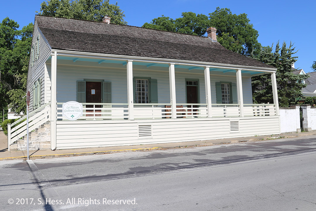
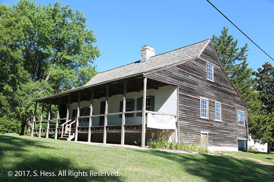
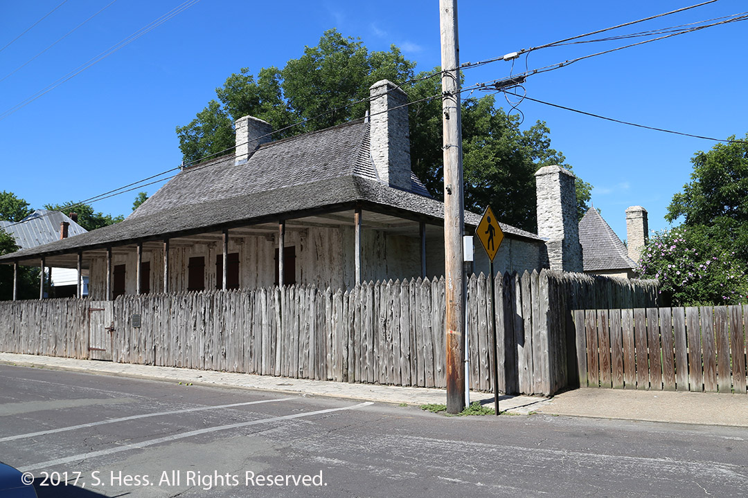
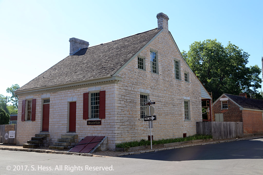
Once we left the St. Louis Metropolitan area, the terrain became rolling hills and we could not see the river. Ironically, US 61 is part of the Great River Road system. When we entered Ste Genevieve, the road signs directed us to the historic area and the visitor center. The person on duty suggested that we see the historic houses, many dating to the mid-18th century. We spent some time looking at the homes from the outside… most of them were not open until later in the morning.
Antoin & Parfait DulourJacques Guibord HouseBouvais – Amoureux HouseBolduc HouseFelix Valle House
We continued on to Cape Girardeau, about 60 miles south of Ste. Genevieve. We entered the town and saw plenty of signs pointing to the various university campuses, but nothing about the historic district and visitors center. It wasn’t until we were about to get on the bridge to the Illinois side of the Mississippi that we saw a sign and decided not to go back.
We crossed the river into Illinois and headed to Cairo. Thus far on this trip, we saw struggling small towns all along the route from Hannibal. Cairo is among the worst of all of them. I just wanted to see the confluence of the Ohio and Mississippi Rivers at the southern tip of the town. The southern tip contains Fort Defiance State Park. It has obviously not well maintained by the City of Cairo. The entrance to the park is just south of the entrance to the bridge across the Ohio and just north of the bridge going across the Mississippi. The sign to the park is not readily visible and before we knew it were heading to Missouri. After a U-turn, we headed back to the park, where I managed to get some pictures of the meeting of two great rivers.
Confluence of the Ohio and Mississippi.
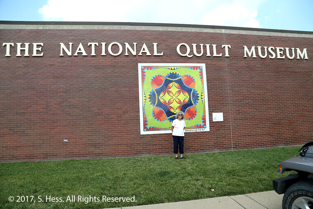
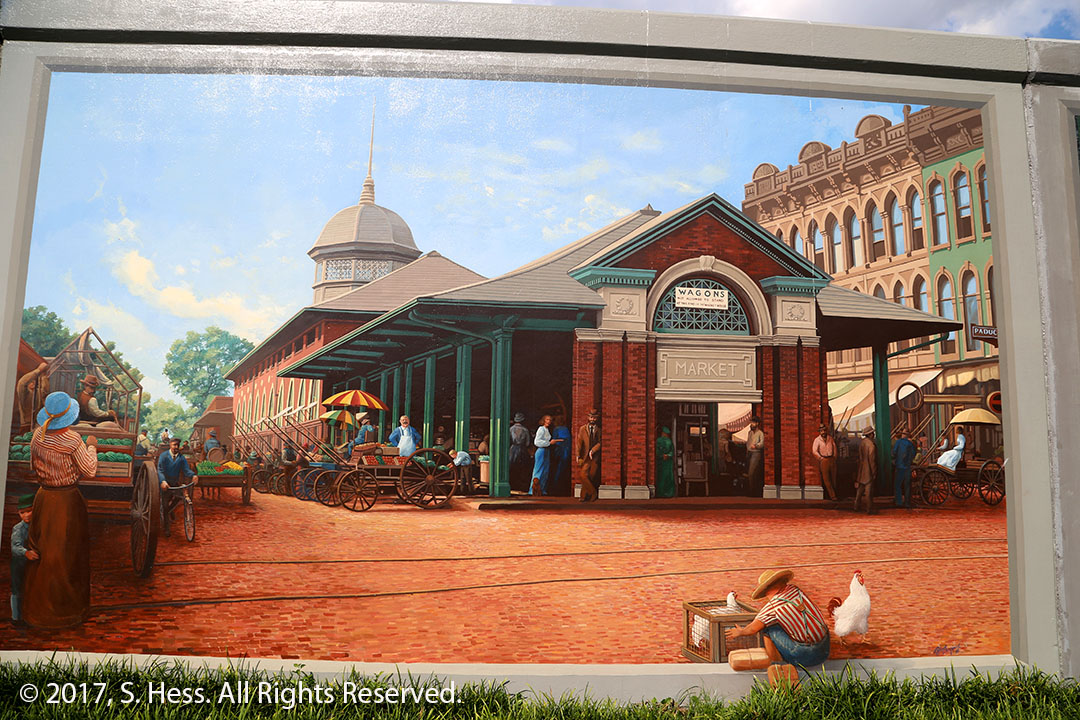
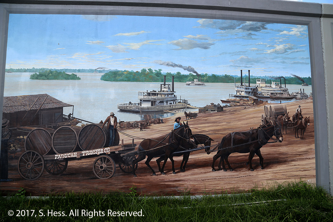
We left Cairo and entered Kentucky… Susie now has visited all 50 states. Paducah was a very pleasant surprise, especially the Historical District. Susie had three things she wanted to see, The National Quilt Museum, The Riverwalk and the murals on the flood wall… all walking distance from each other. The museum didn’t allow photography so I could not share pictures of some of the quilts on display. We walked along the Riverfront Walk and checked out many of the murals. We met Terri Grief, former president of the American Association of School Librarians, for dinner in the Historical District. A great conclusion for the day.
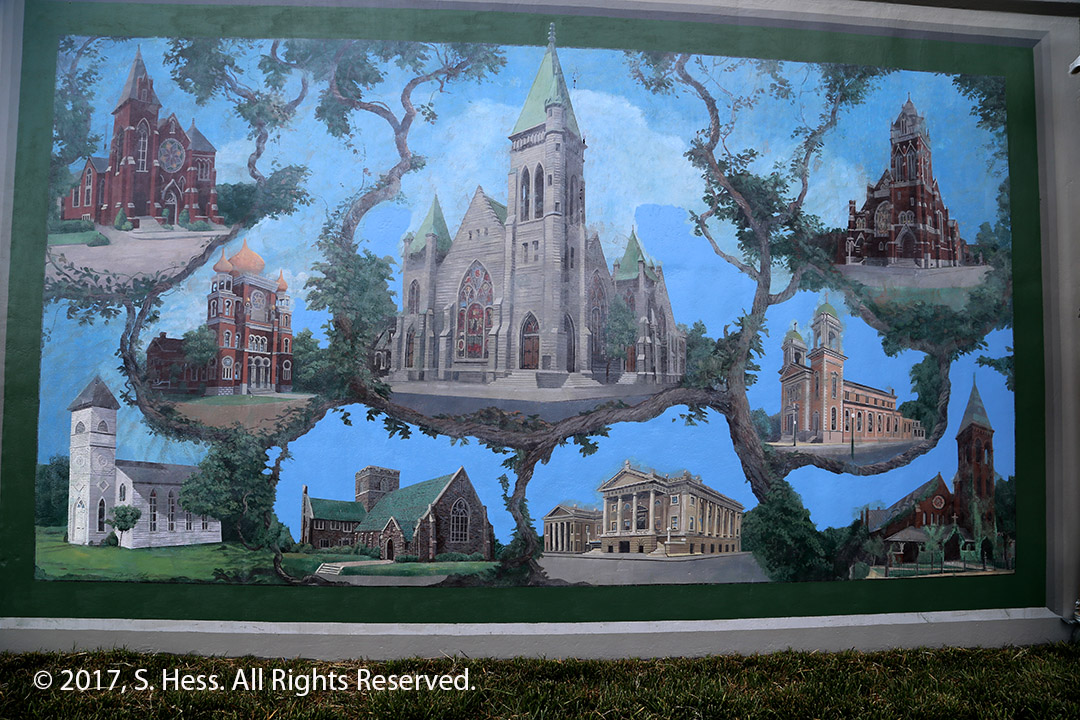
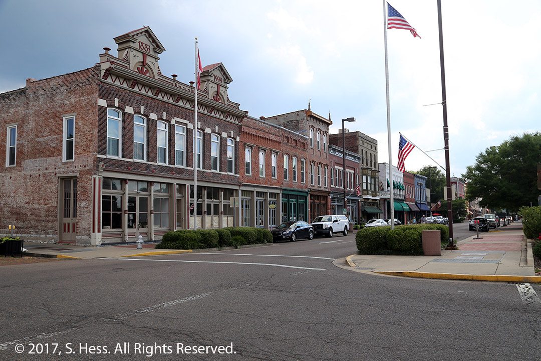
Susie at the National Quilt MuseumFloodwall MuralsThe Market. We had dinner across the street from The MarketPaducah Waterfront MuralHistoric Houses of Worship. The Synagogue, center left, is no longer standing… replaced by a modern structure… a wasteBroadway Street historic buildings
This morning we woke up to clear blue skies… a chance to get to what we missed yesterday. But first, we met with cousin Susan and part of her family for brunch. Thus began a frustrating morning. The restaurant where we were to meet her is a seven minute drive, but!! This is the 4th of July weekend and the city had its parade down Market Street. As we approached Market Street, we found all the cross streets blocked by police vehicles. We asked a couple of officers how we could get to our destination which is across the street from Busch Stadium. The instructions provided by the police officers sent us around in circles and we finally wound up on the Interstate and took it to our destination… total travel time was over 30 minutes.
Next frustration… I wanted to get back to the hotel before heading back to Cahokia. Guess what… no way without going back to New York and turning around. After some more bad advice from police officers, we decided to go to Cahokia. Because the nearest Interstate entrance that would take us across the Mississippi was blocked, we had to go quite bit west of downtown so that we could go east. Eventually we made it to Cahokia.
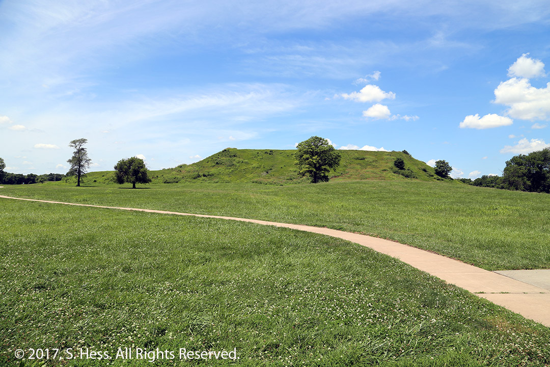
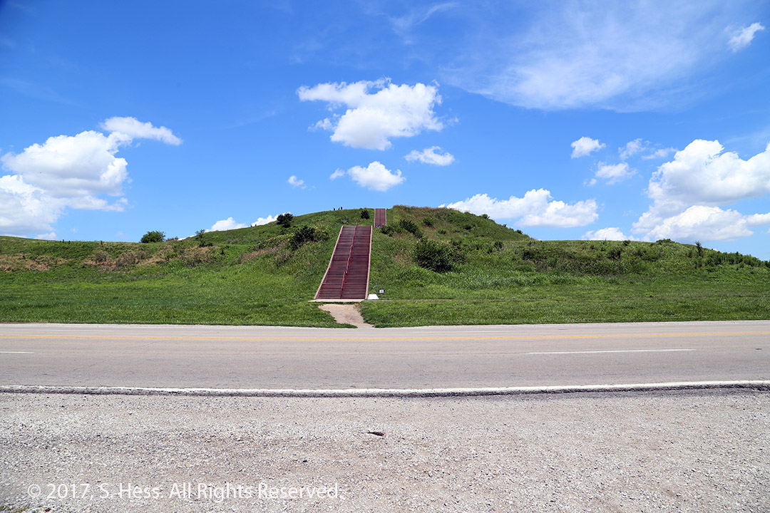
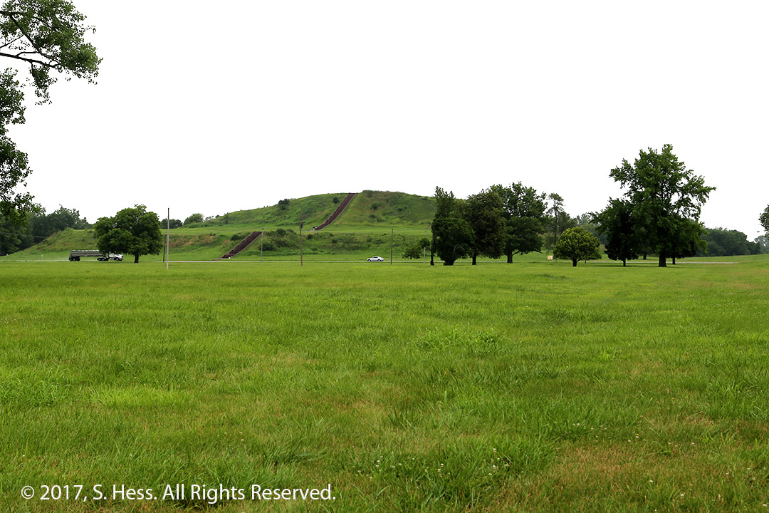
We parked next to Monks Mound and I walked 100 feet up the stairs to get to the top of the mound. Susie did not join me because of her knee. I finally got to see the view from the highest point in Cahokia.
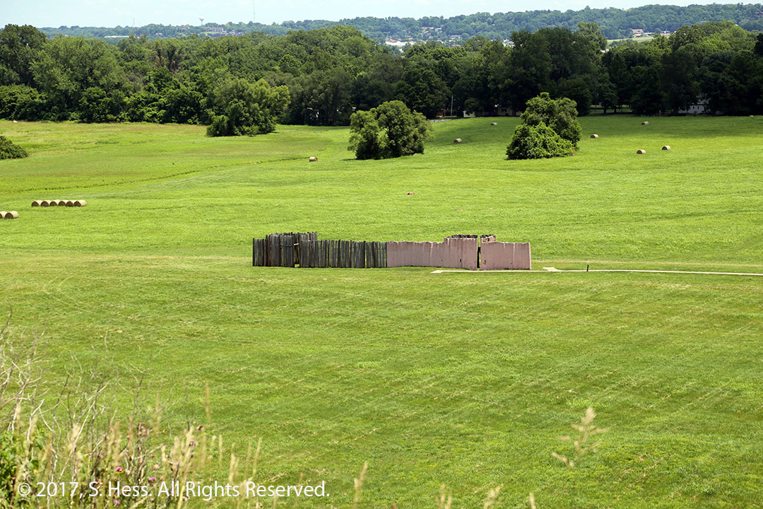
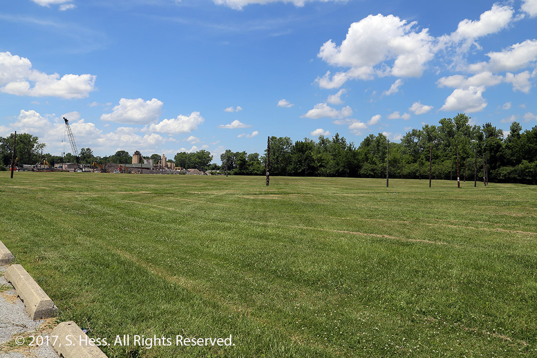
Monks Mound viewed from the east.The 100 plus stairs leading to the top of Monks MoundView South from the top of Monks MoundView east from Monks Mound. The structure is a reconstructed segment of the Palisade that enclosed the central section of ChokiaWoodhenge is a reconstruction of one of several calendars that were used to determine the changing seasons and special datesGateway viewed from Monks Mound (using 400mm lens). The distance is about 9 miles.
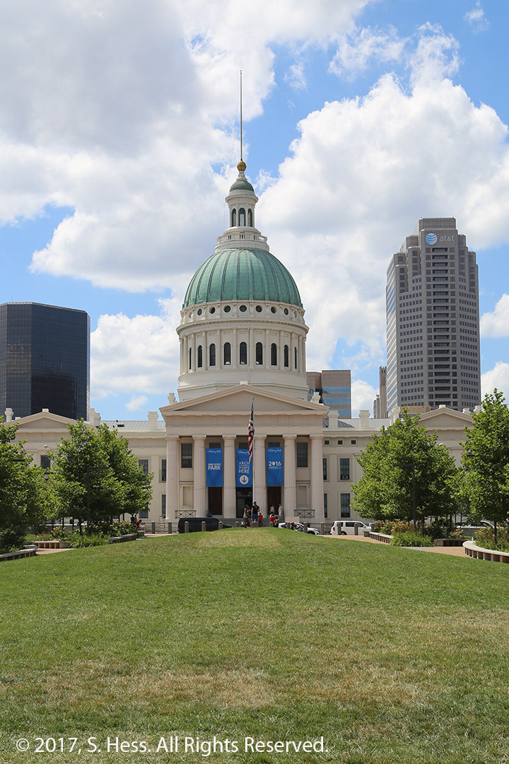
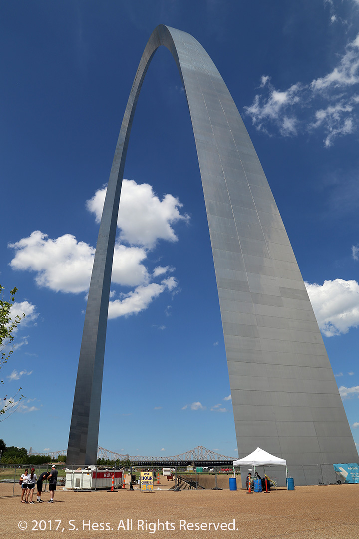
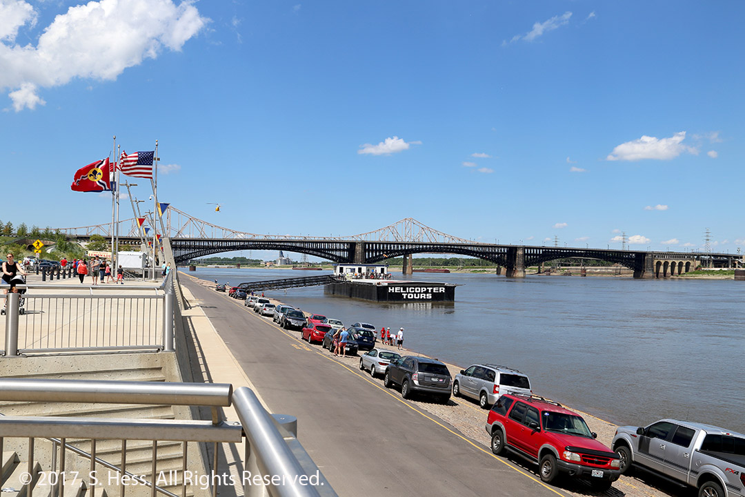
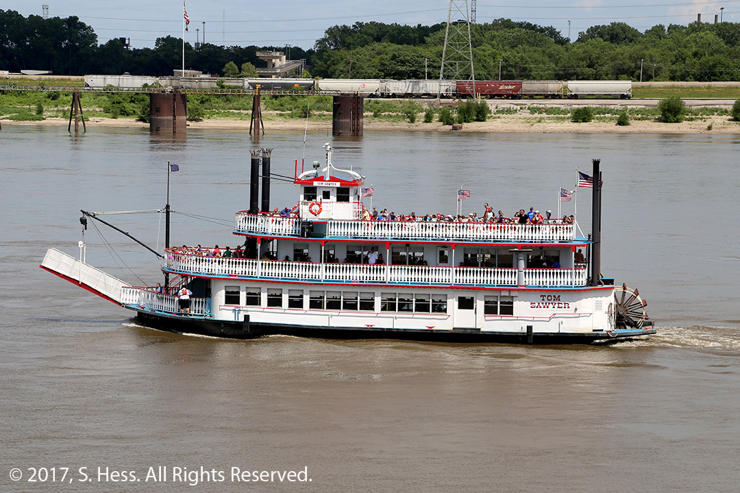
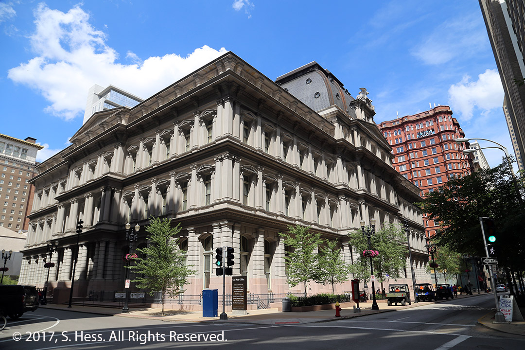
After leaving we went back to the hotel… the streets were finally open. I left Susie in the hotel and walked to the Gateway Arch. I spent about twenty minutes taking pictures and headed back to the hotel. With crowds in the area of the Arch I didn’t even try to get into the Arch and ride to the top… maybe next time.
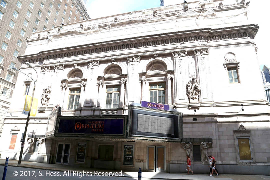
The Old Courthouse with the Gateway Arch behind itOld Courthouse as seen from the Gateway ArchGateway Arch from as close as I could get to it because of construction activityEads Bridge crossing the MississippiA riverboat that carries tourists on excursions on the riverOld Post Office buildingOrphium Theater
In the evening we met cousin Susan and her daughter Lauren and granddaughters for dinner. We had a great time getting to know our newfound cousins in St Louis.
I had three priorities for our stay in St. Louis, (1) spending time with newfound cousin Susan, (2) visiting Cahokia and (3) visiting the Gateway Arch. We are doing well on priority one.
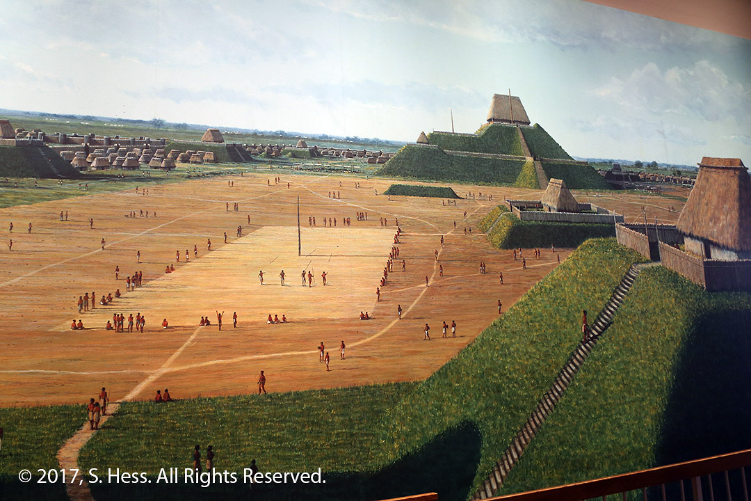
Cahokia was a Mississippian Culture city. The city was the largest settlement north of Mexico and had a peak population of around 20,000 people. All that is left of the city are some of the mounds. I have wanted to visit Cahokia since 1973 when I was in East St. Louis on business. Today was my first opportunity to make that visit. The dawned gray with occasional showers. The weather forecasters said that the rain probability would diminish by late morning. Surprise… they were wrong! Cousin Susan picked us up and we drove across the Mississippi to Cahokia. I got a few pictures that were a bit hazy because of the light rain and mist. When it looked like the rain had stopped, I started walking toward Monk’s Mound, the largest prehistoric earthen construction in the Americas, when the rain started coming down. I quickly returned to the Interpretive Center and finally gave up. I will try again tomorrow.
a portion of an artist Rendition of CahokiaMonk’s Mound is the largest mound in Cahokia. It is 100 feet high and 14 acres at its base.A multi -level mound near the Interpretive Center.
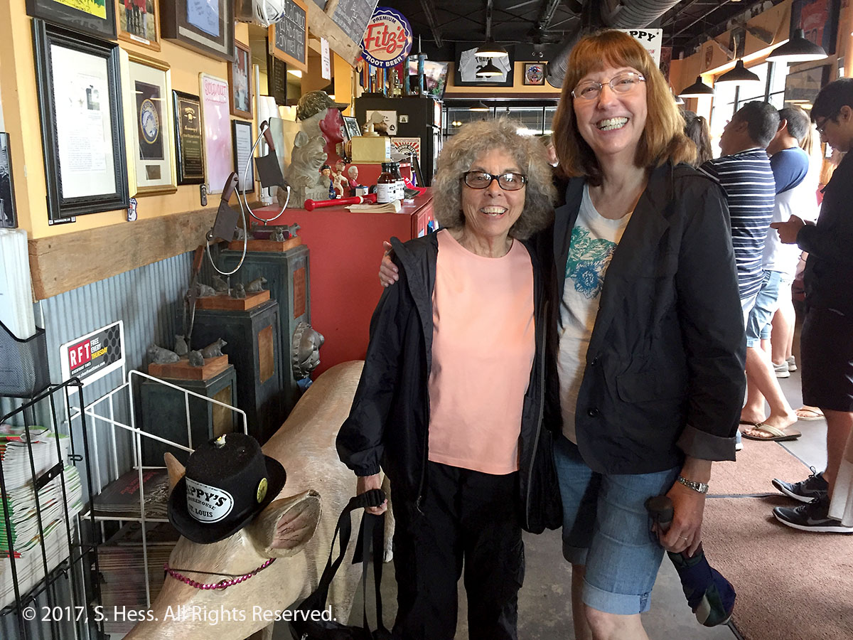
We returned to St. Louis and had a late lunch at a barbecue restaurant, Pappy’s Smokehouse. Great food, but expect to wait on line for a while. After lunch Susan drove us through Forest Park and then back to the hotel.
Two Susans… we didn’t get the pig’s name
In the evening we drove to Susan’s home where the two Susans viewed pictures and documents about their shared ancestry.
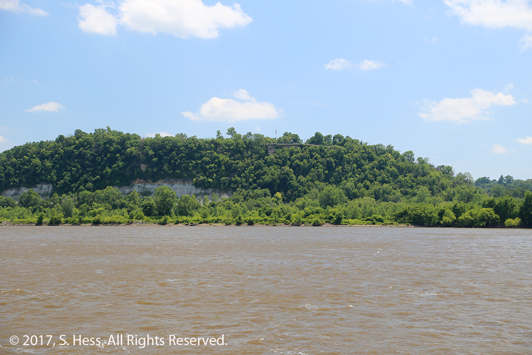
An easy trip today, 124 miles. I wanted to take the highway running closest to the Mississippi River, State Highway 79. I thought that we would see the river for most of the run until Winfield. I was wrong! Leaving Hannibal, the highway led us through a series of hills, with only an occasional glimpse of the River. We passed a couple of “Scenic Overlook” signs and pulled into one of them. As you can see from the picture below, the trees obscured most of the view. Eventually, the road flattened out and ran closer to the river.
Mississippi River South of Hannibal
It was little disappointing from the photographic perspective. However, we got a taste of small town America. We didn’t see any significant non-agricultural industry on the route until we got to O’Fallon and I-70. The area outside these towns was farm land and the corn and other crops looked good to us “city folks.” The small towns were sad, a lot of closed and abandoned store fronts. How far do people in these towns have to go to get groceries and other needs? Where do they get quality medical care? I don’t know the answer.
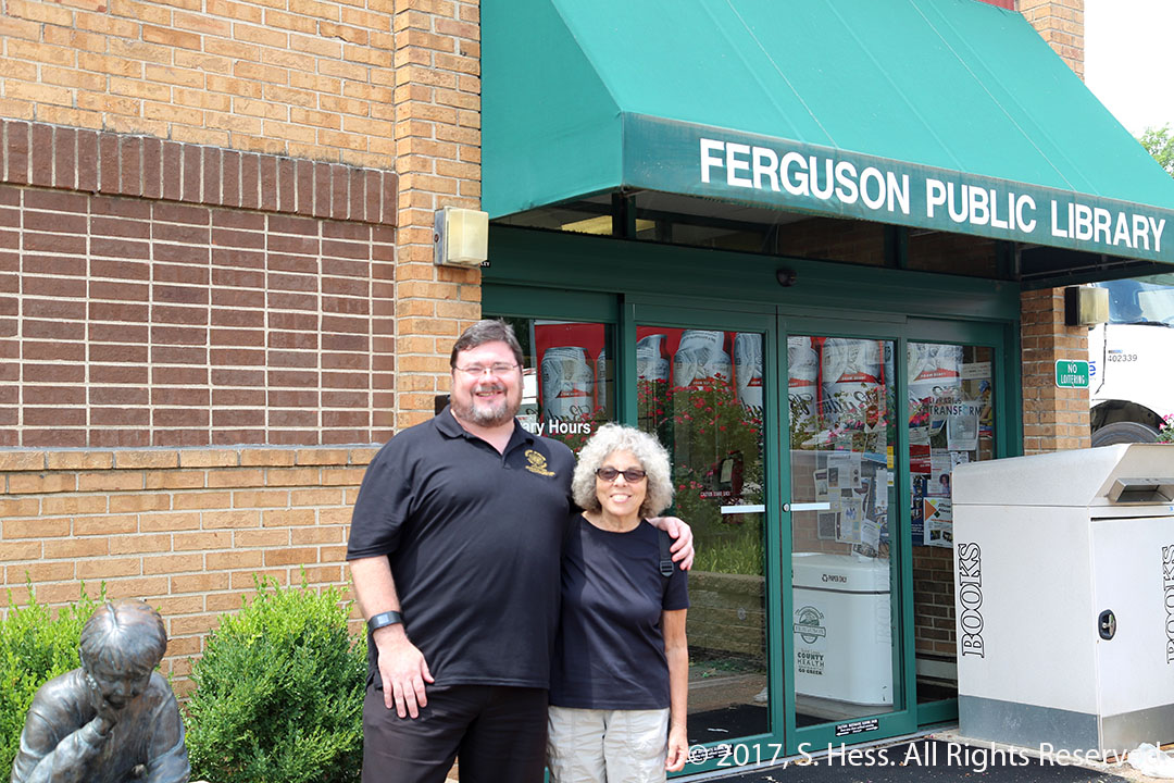
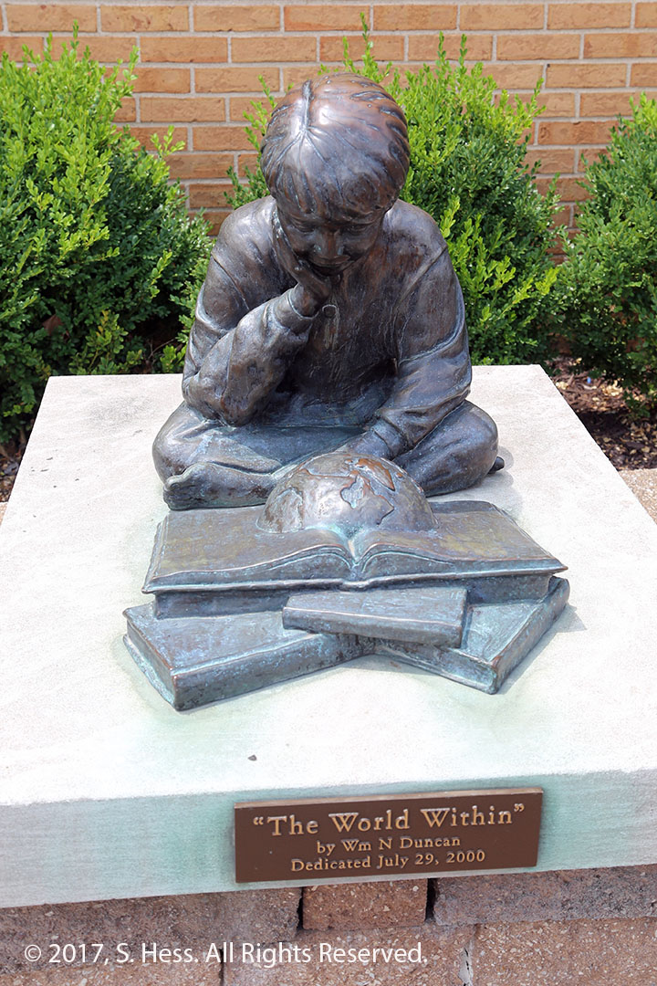
Our first and only stop was in Ferguson to meet Scott Bonner, the director of the Ferguson Municipal Public Library. We first met Scott at the 2015 American Library Association Annual meeting in San Francisco. Scott was awarded the Lemony Snicket Award for Noble Librarians Faced With Adversity, for his action in keeping the library open during the period following the shooting of Michael Brown. We first met him in San Francisco and crossed paths with him at other ALA meetings. After spending some time with him, we headed to the hotel in St. Louis.
Susie and Scott Bonner in Front of the Ferguson Public LibraryFerguson Public Library Sculpture.
This evening we met with Susie’s cousin, Susan, for dinner. The two had never met because the two fathers were estranged. We also hope to meet Susan’s sister Kathy in New Orleans.
Today was all about Samuel Clemens, better known as Mark Twain. Hannibal was his boyhood home and inspiration for the characters and locations in his books, Tom Sawyer and Huckleberry Finn.
We planned to start our day by going up to the Mark Twain Memorial Lighthouse at the top of Cardiff Hill. We got to the base of the steps leading to the lighthouse and quickly changed our mind about going up the stairs. Neither Susie’s or my knees could handle it. Depending who you ask, there are 240 or 340 steps to the top. We decided to do it later, by car.
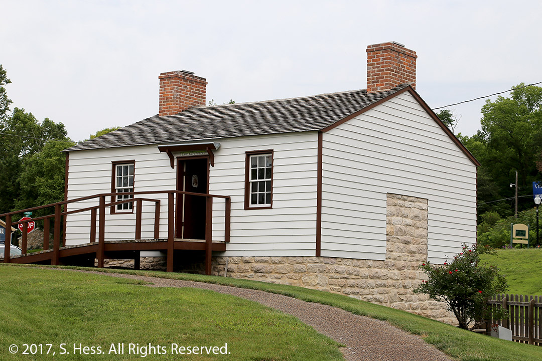
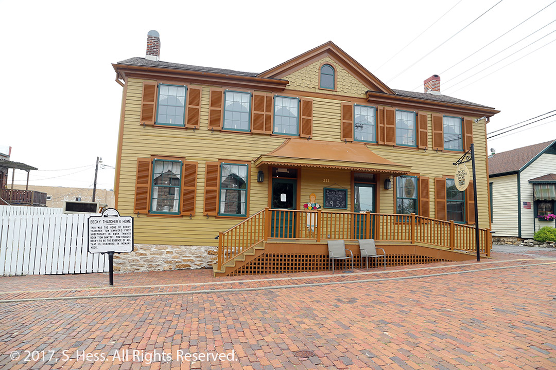
We walked across the street from the stairs to the Mark Twain Boyhood Home and Museum. The admission ticket gets you into the home and several other Mark Twain related sites in Hannibal’s historic district. Following a walk through the house, we went to the Becky Thatcher House and the Museum Gallery, which contains 15 Norman Rockwell paintings that were used to illustrate special editions of Tom Sawyer and Huckleberry Finn.
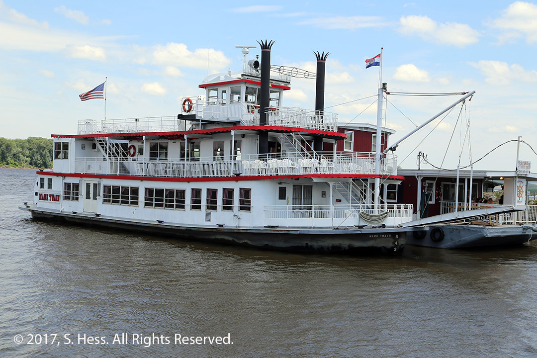
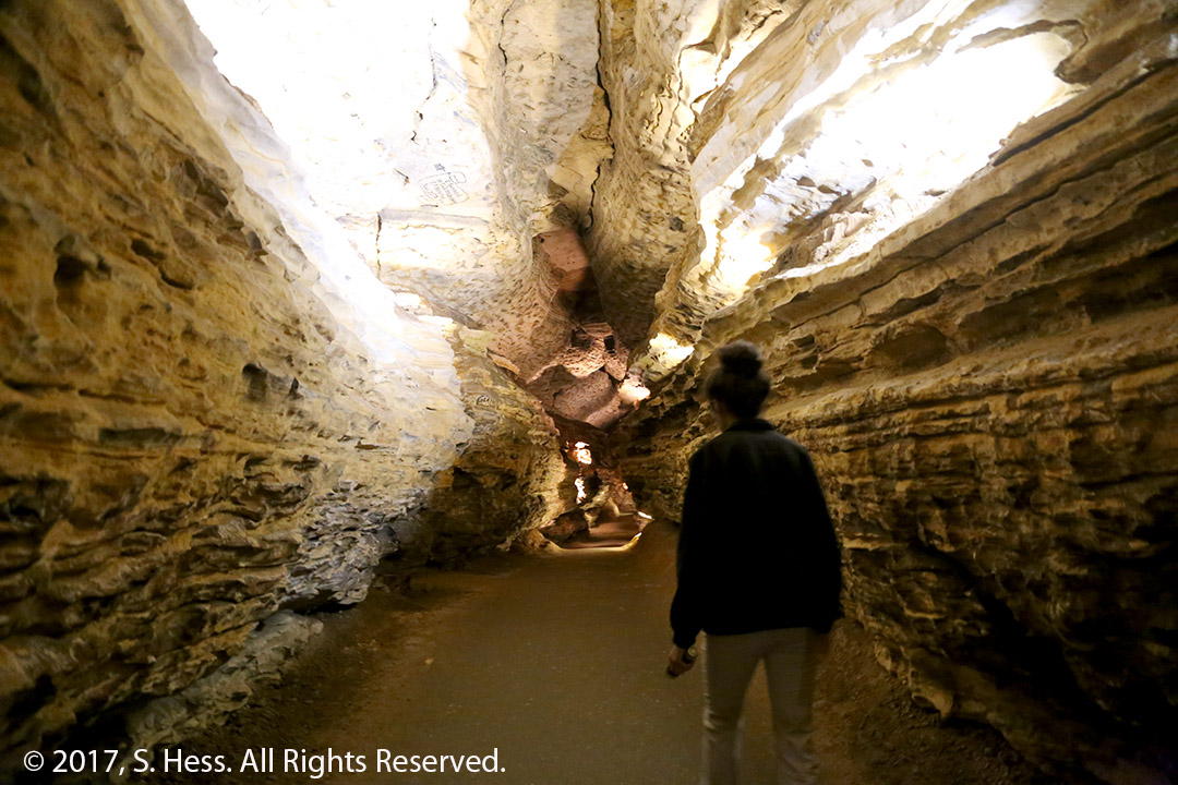
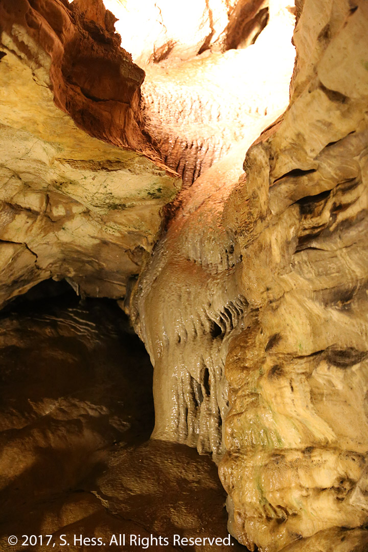
We walked back from Main Street to our Hotel and got into the car. Our first stop was the Mark Twain Memorial Lighthouse which offered a great view of the historic district. Our next stop was the Mark Twain Riverboat which offered an hour cruise on the river. After the cruise, we hopped into the car and headed to Mark Twain Cave, which was the inspiration for the cave in Tom Sawyer. Susie sat out the tour of the cave because of her knee.
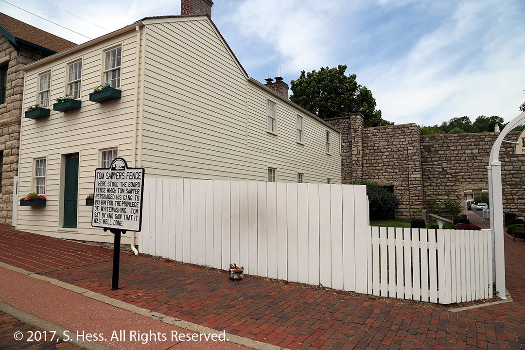
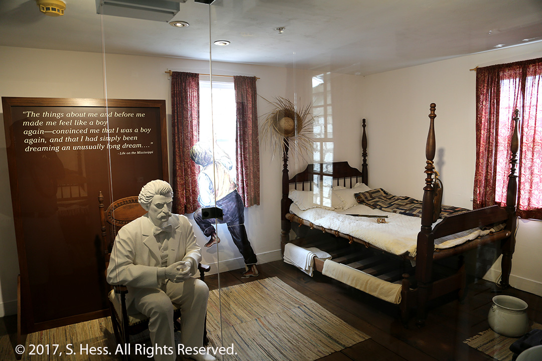
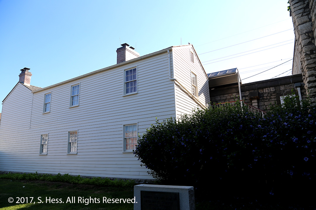
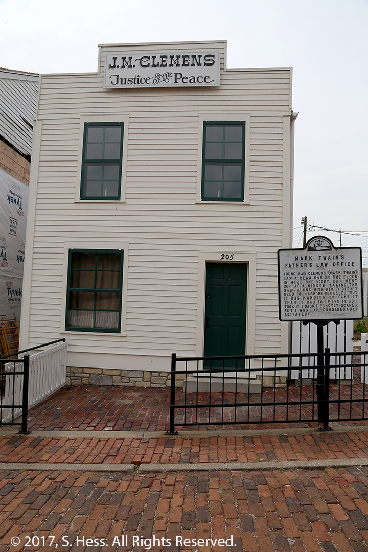
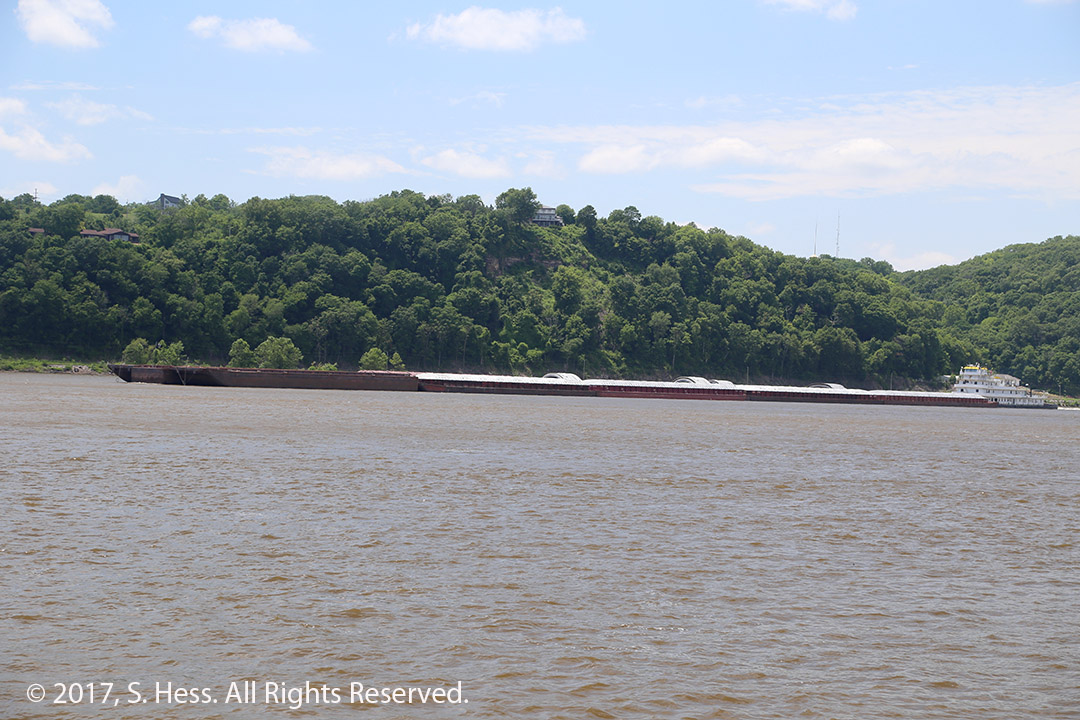
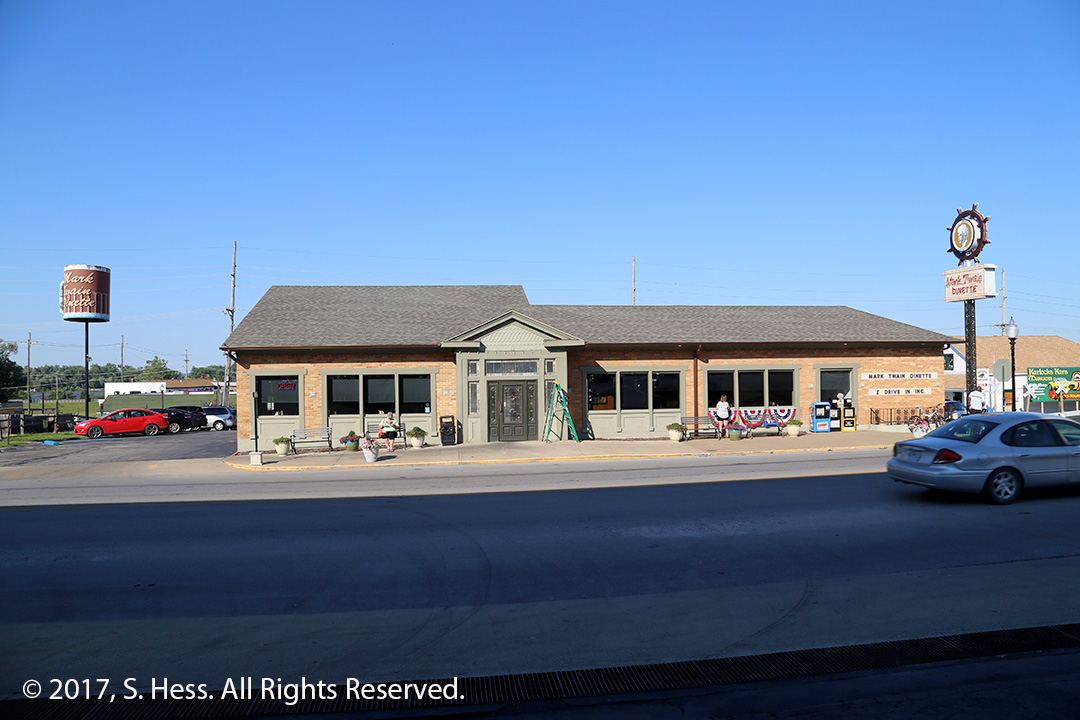
Mark Twain Lighthouse as viewed from Main Street.Hannibal Historic District viewed from the Mark Twain Memorial Lighthouse.Mark Twain Home and the whitewashed fence.Sam Clemens’ Room. It is the inspiration for Tom Sawyer’s bedroom from which he frequently escaped.Rear of Mark Twain’s House. The rear window on the second floor was in Sam/Tom’s room. Also visible is the drainpipe he used for his escape.Huckelberry Finn HouseBecky Thatcher’s HouseJM Clemens, Mark Twains’ father’s Office.Mark Twain RiverboatBarges Heading down river. The barges can be as long as 1,200 feet long and are a cost effective way of getting grain to the Port of New Orleans for transport all over the world.Lover’s Leap as viewed from the Mark Twain RiverboatOne of the many passages in Mark Twain Cave.Mark Twin Cave-FlowstoneMark Twain Dinette. Opened in 1942. There are menus on the wall dating back to the early days and $0.39 hamburgers. Today’s price is significantly higher.
An early morning for us. We had to be at McCormick Place for an 8:30am presentation hosted by Susie. She wanted to be there early to make sure the room was set up properly . We grabbed a quick Starbucks breakfast at the hotel and checked out by 7am. We figured that we may run into a lot of traffic heading south on Michigan Avenue, but none materialized and we were in the parking lot by 7:15am.
The presentation went very well and attendance was around 75, more than double the number we saw last year. After the meeting we walked slowly to the Hyatt Regency McCormick Place for a luncheon… we had a lot of time to kill. At 2pm we were in the car heading down I-55 to Joliet. Encountering no traffic, we made it to our hotel in under an hour.
June 27th
The main reason we stopped in Joliet was to visit Kathy, a quilting friend of Susie’s at our winter home in Sarasota, FL. We planned to be there at around 11:30am, spend an hour or so and head to Springfield. By the time we finished the visit at her home and at the farm it was 2pm… time flies when you are having a good time.
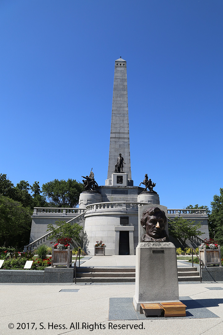
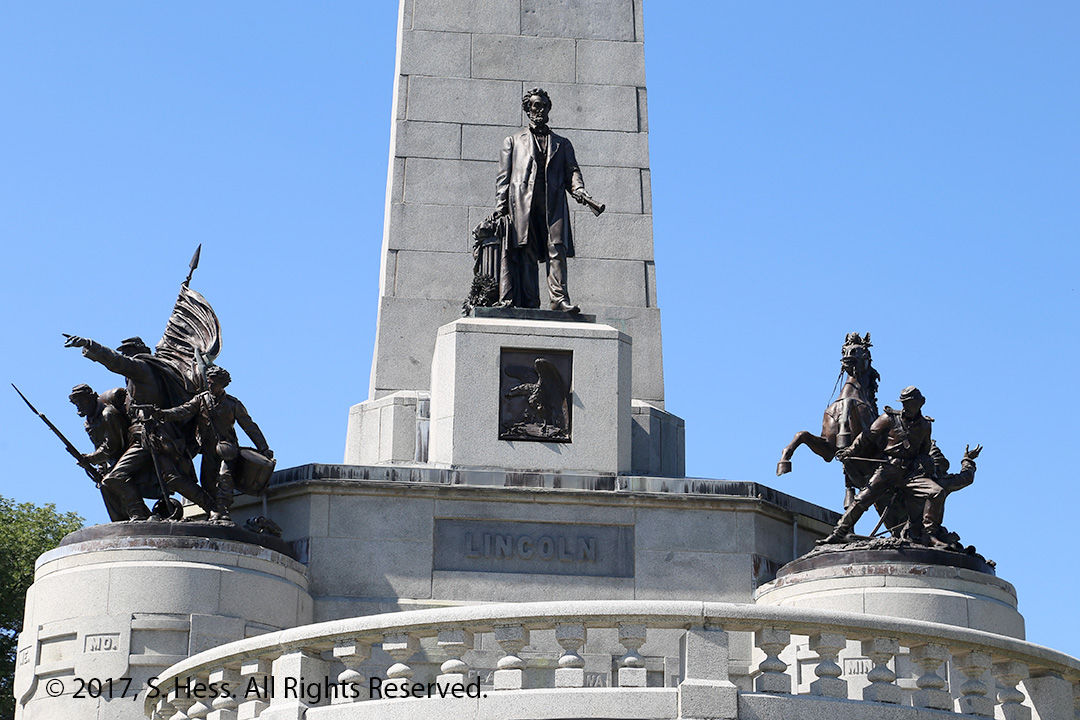
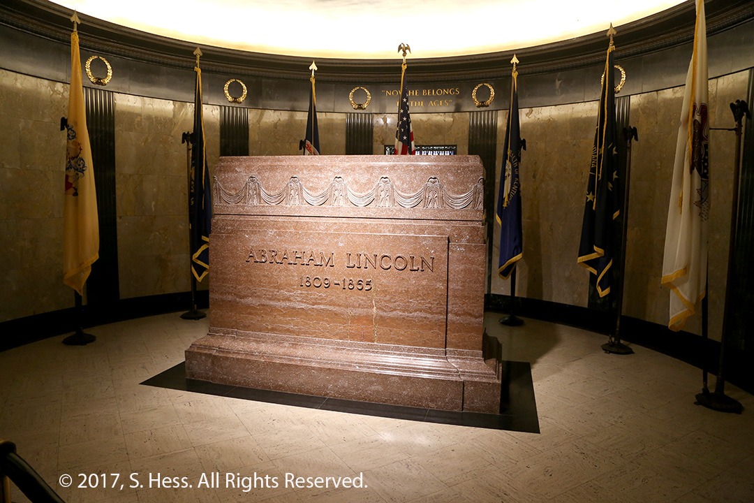
Unfortunately, the good time in Joliet cut into our time visiting Abraham Lincoln landmarks in Springfield. The first place we visited was Lincoln’s Tomb in Oak Ridge Cemetery (the 2nd most visited cemetery in the U.S. – the first is Arlington). Susie stayed on a bench outside, while I went inside the tomb, see pictures below.
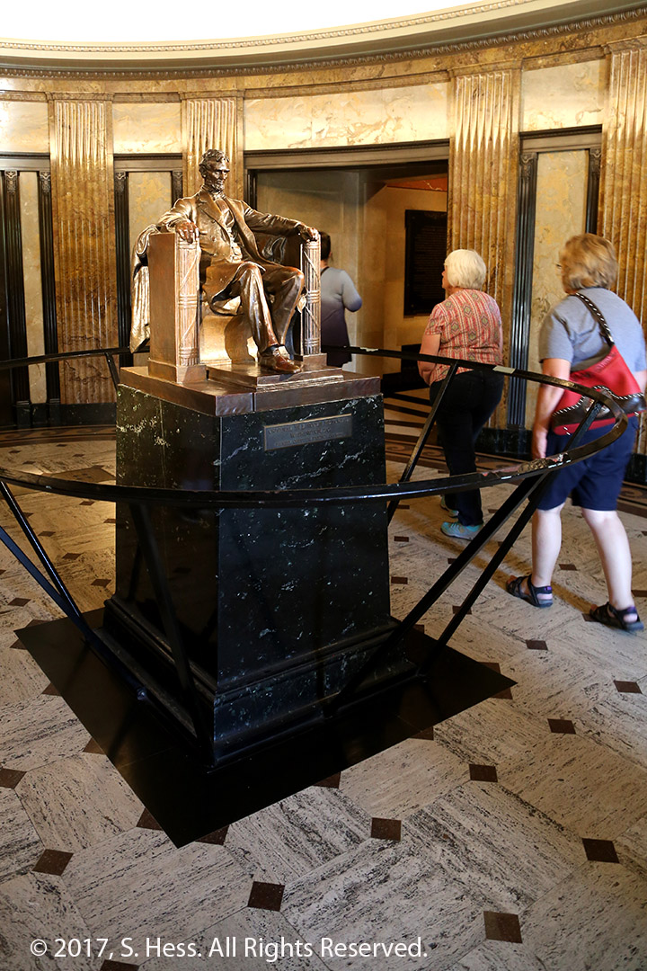
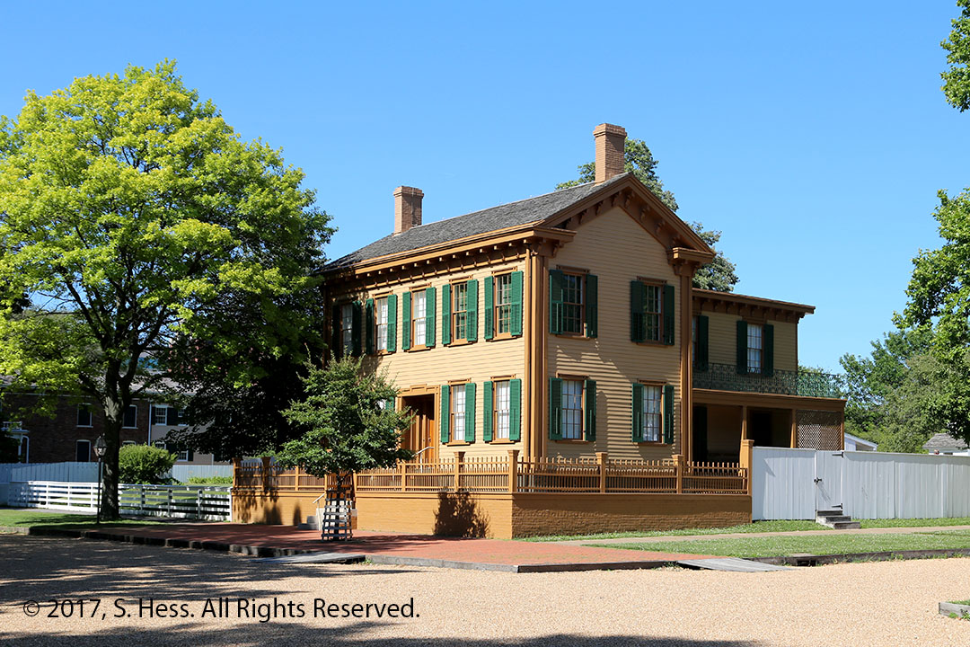
We then drove to Lincoln Home National Historic Site. There was a wait to get a tour inside the home so I had contend myself with pictures of the exterior. This is an interesting site, with many of the original neighboring homes open to the public.
After leaving Lincoln’s home we headed to Hannibal, MO, our destination for the night. Tomorrow we will have more time to visit Mark Twain’s home town.
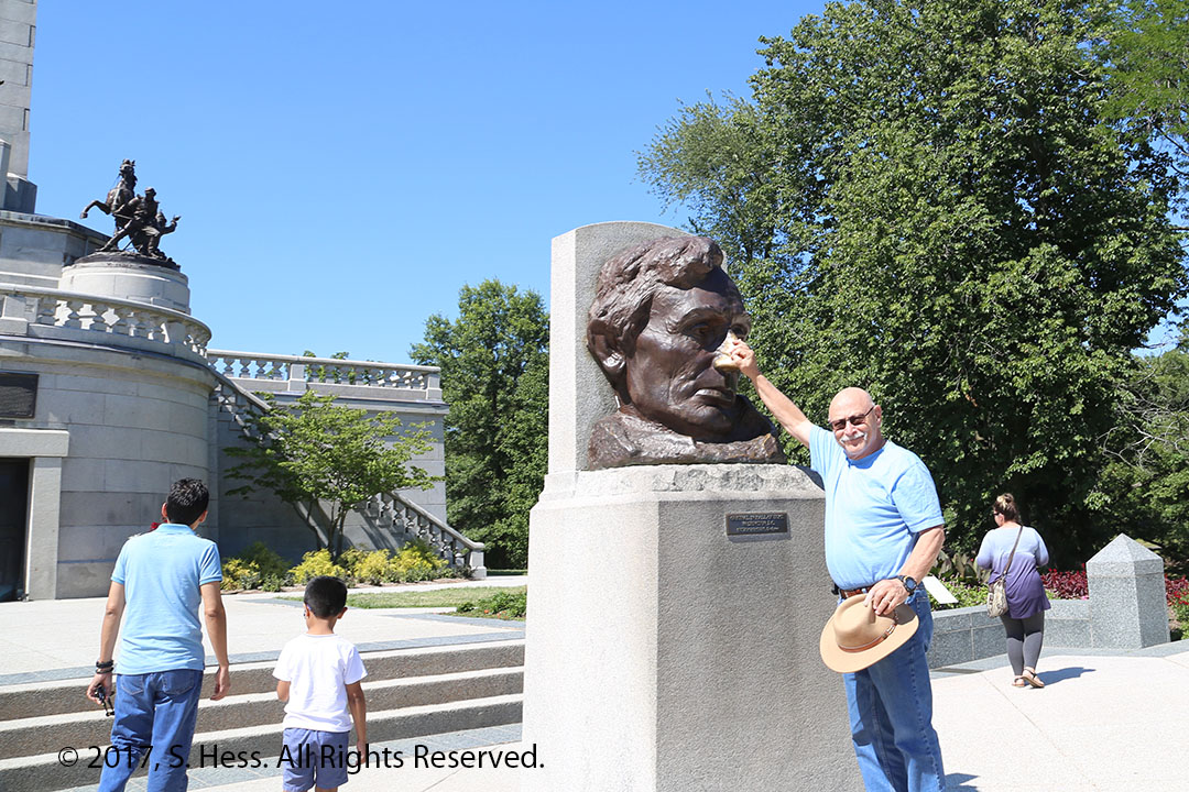
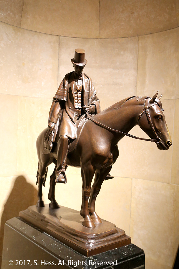
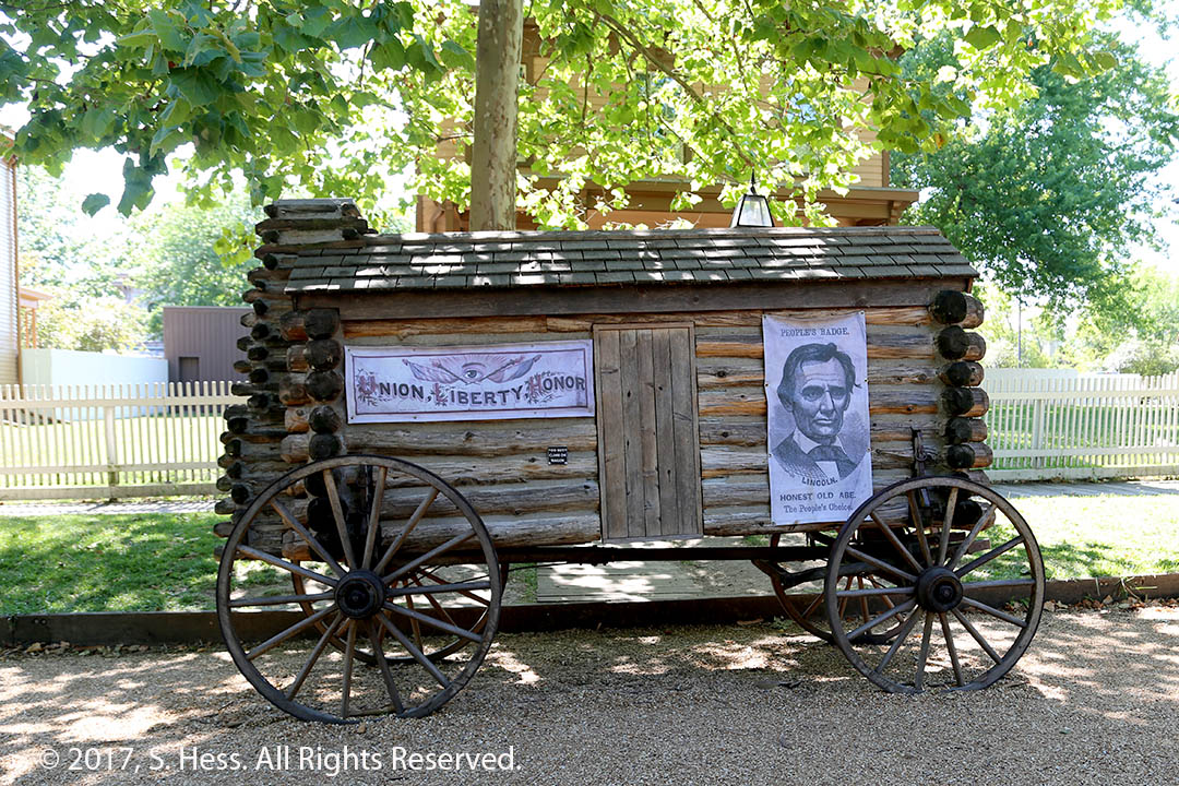
Lincoln’s TombDetail of Lincoln Tomb upper section. This section was closed to the public because of the damage caused by the passage of several million visitors.There is a superstition that say if you rub Lincoln’s nose you will have good luck. The nose is brightly polished bronze while the rest of the bust has darkened with time. Of course, I was looking for some good luck.A reproduction of the statue in the Lincoln Memorial greets you at the entrance of the tomb.Lincoln’s Grave. The coffin is encased in concrete several feet below the floor. After Lincoln was buried, southern sympathizers plotted to steal Lincoln’s coffin. The plot was foiled and the coffin was entombed in concrete to make it impossible to steal. Mary Todd Lincoln and three of their four sons are also buried in an adjacent area.This is a representation of Lincoln as a circuit riding frontier lawyer.Lincoln during the Civil warLincoln’s Springfield Home.A Lincoln Campaign wagon on the street near his home.
We left The Charm Countryview Inn before breakfast because we didn’t want to get into Chicago during the rush hour. This move probably made a significant drop in our daily calorie count from the previous two mornings.
Google Maps recommended using US 30 into western Indiana before getting on I-90 as the fastest way to Chicago. My Jeep GPS had us going a different way that put us on the I-90 in central Ohio. I let the GPS guide us, a decision I later regretted. The Ohio portion of I-90 was moving fairly well with only a few construction sites. Once in Indiana we encountered numerous construction sites with a single traffic lane. The construction delays cost us at least an hour on what should have been a six hour drive. As we neared Chicago, I-90 split from I-80 and headed north, traffic eased up. Nearing our destination the traffic got quite heavy and we were glad to get to the Hyatt Regency Chicago, the Convention’s Headquarters hotel.
This the third time we drove into Chicago and I hope the last. I doubt that we will be coming here for another convention, and if we do, we will fly in.
June 23rd
The first part of the morning was spent in our room with Susie preparing for a meeting at McCormick Place Convention Center and me working on some issues related to this blog. We also changed our itinerary by departing Chicago a day earlier than planned so that we would have two days to visit Hannibal, MO.
At 10:30 we got on the bus and headed to the convention center to register and for Susie’s first two meetings. I headed back to the hotel to complete a variety of tasks. Susie returned to the hotel in mid-afternoon.
Tonight we attended a reception hosted by Jim Neal, ALA President Elect. The reception was for new committee chairs and new interns.
June 25th
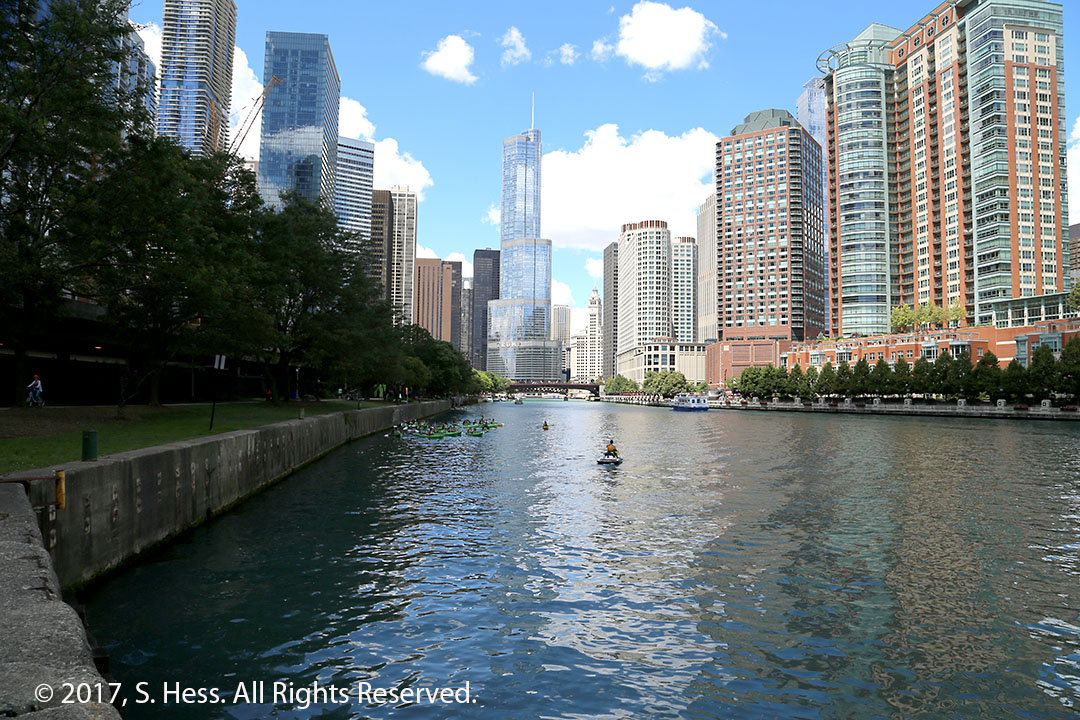
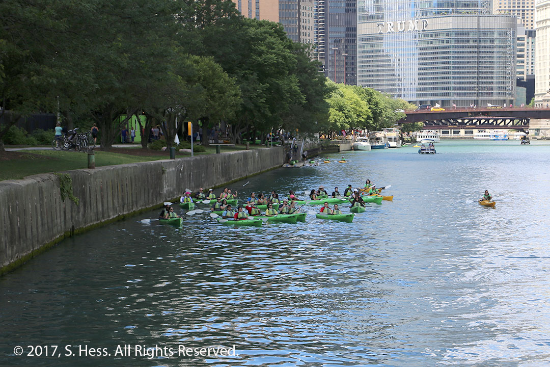
There was nothing on the schedule for this morning so Susie and I took a walk around the area. This part of Chicago has three layers, the river, the street and an intermediate level which contains streets, parking garages and train tracks. We stayed at the top level. After returning to the hotel, I decided to take my camera and go down to the river level. Susie didn’t accompany me because she would have difficulty going up and down three flights of stairs… it wasn’t so easy on my knees either. I only had a limited amount of time so I walked back and forth from the North Michigan Avenue bridge to just past the Lake Shore Drive Bridge. I walked to the furthest point and took the pictures, below, on the return trip.
We headed to McCormick Place just before one pm. Susie and I offered to help at the Award Presentations. After the awards were handed out and a presentation by Ron Chernow about his biography of Ulysses S. Grant, which will be out soon, we briefly attended a reception for the award winners and headed back to the hotel.
Today is our last full day in Chicago. Susie is hosting a presentation sponsored by the Rural, Native and Tribal Libraries Committee, which she chairs. After a luncheon, we will head to Joliet, a 48 mile run.
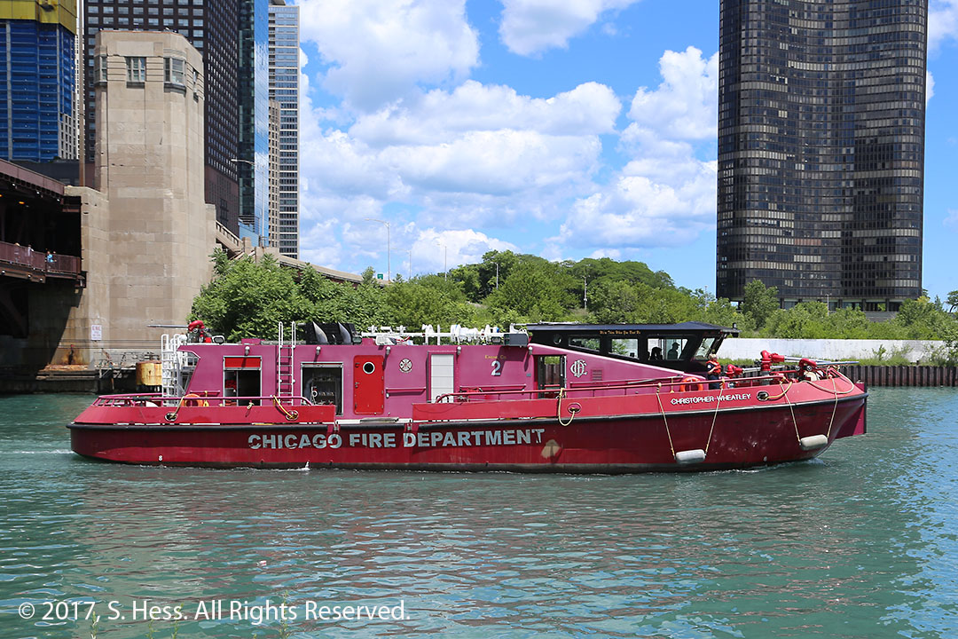
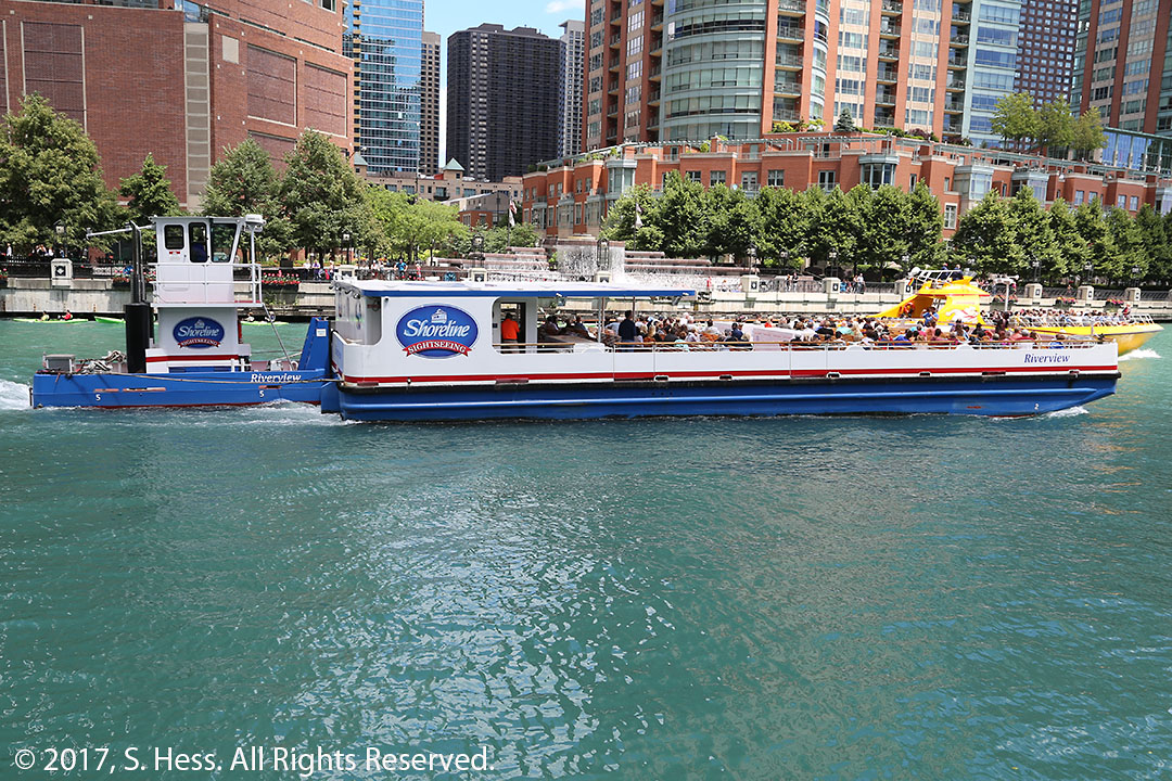
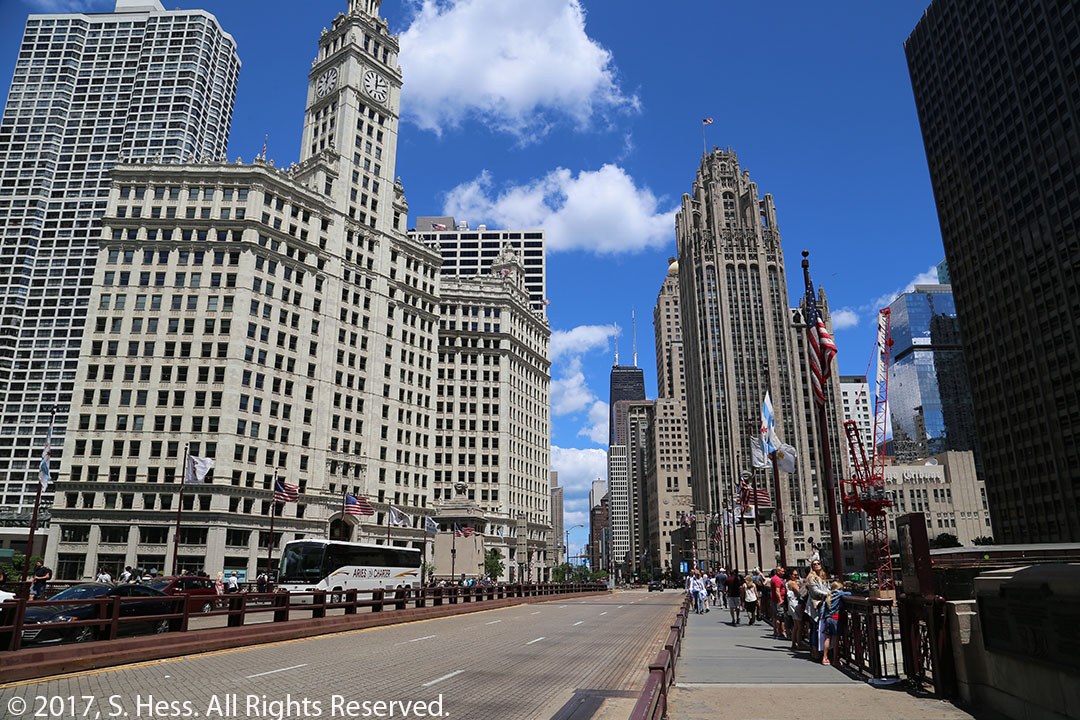
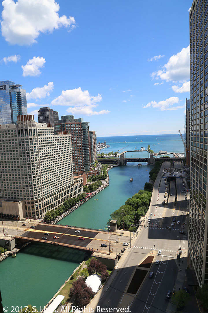
Navy Pier viewed from just east of the Lake Shore Drive Bridge.Chicago Fire Department fire boat returning to its station.Chicago River viewed from below the Lake Shore Drive Bridge.Kayakers preparing to go upriver.The oddest, at least to me, tour boat on the river is this barge pushed by a small tug.The Hyatt Regency Chicago West Tower as seen from the River.Wrigley Building, left, The Chicago Tribune Building viewed from North Michigan Avenue and East Wacker Drive.View east from the 26th floor hall window. The Columbus Avenue Bridge in the foreground and the Lake Shore Drive Bridge is in the background.View north from our hotel window. The tall building with the two antennas is the Hancock Building.
After yesterday’s rain we woke up to a beautiful morning. The view looking out our window this morning was picture perfect… so I took one.
Oh What a Beautiful Morning
I picked up our friends, Mary and Emanuel, and brought them to The Charm Countryview Inn for Breakfast. Breakfast at this B&B is unlike any other we have ever experienced (except here last year). It begins with the guests introducing themselves and telling how many times they stayed at the B&B… most have been here multiple times. This is followed by a sermon by the owner, Paul, who is a minister. While I’m not a Christian I really like the way he gets his message out… he really holds the guests’ attention. Once these formalities are concluded a three course breakfast is served. The food is great and plentiful… don’t come here if you are on a diet. The breakfast started around 8:15 and we didn’t leave the table until after 10.
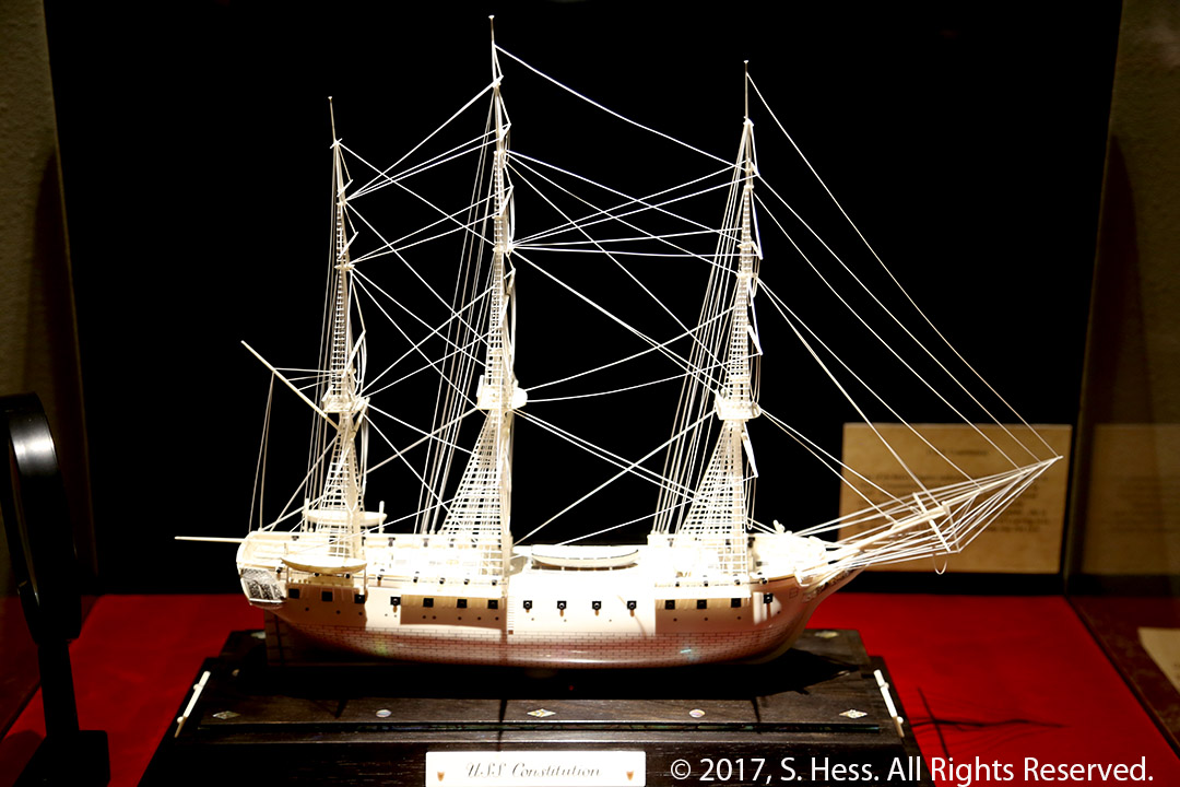
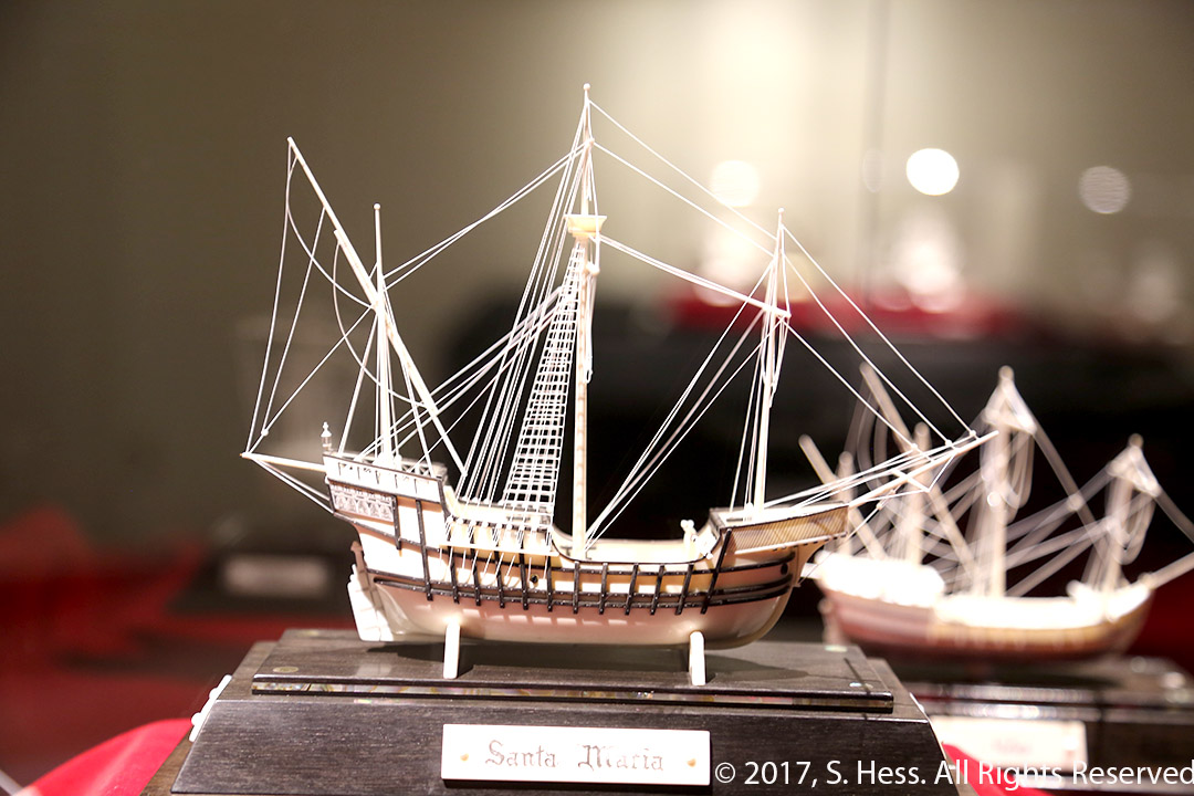
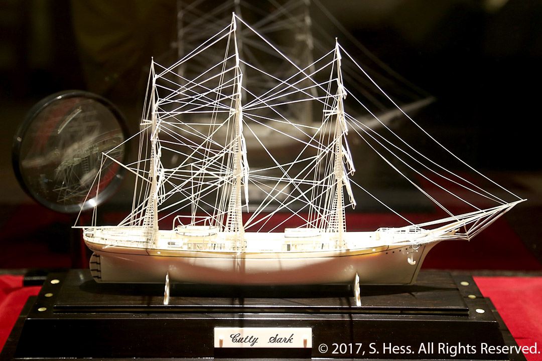
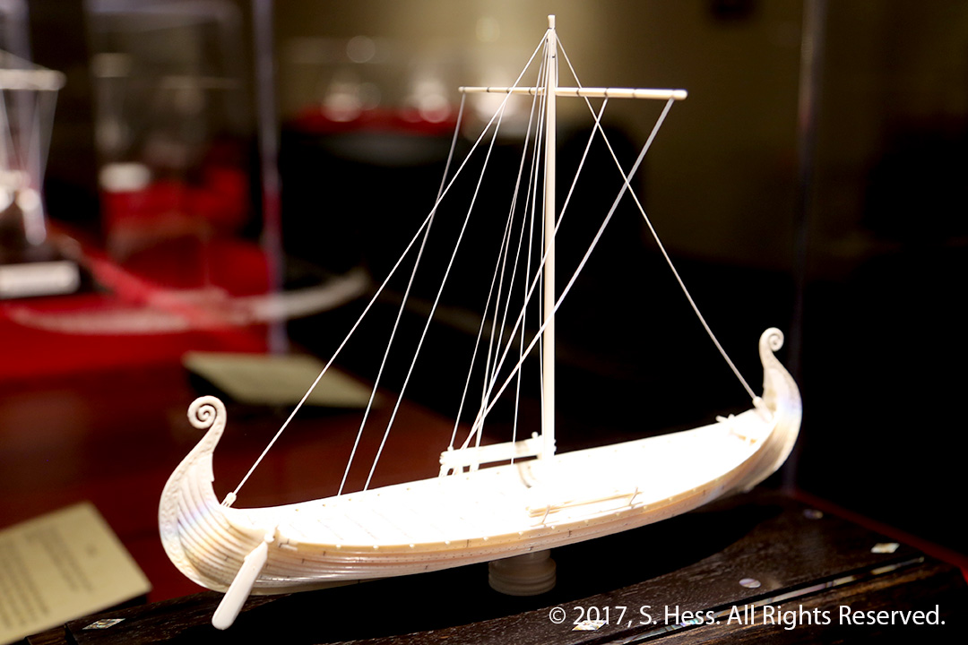
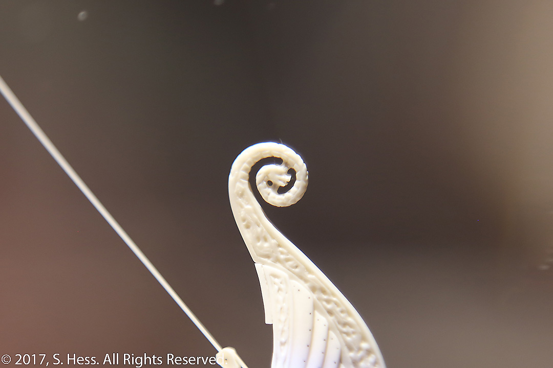
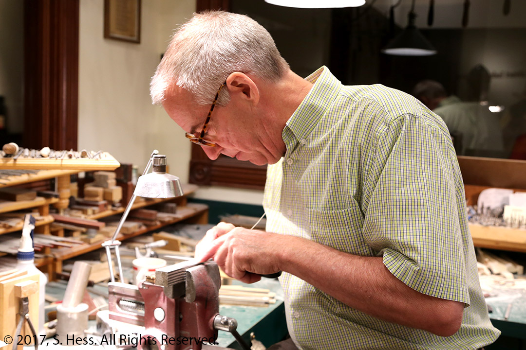
After Breakfast we headed to Sugarcreek and David Warther Carvings. This is a museum/workshop owned by David and contains several rooms of ship models carved from elephant ivory (all imported into the US before the ban). These carvings are not done by carving a solid piece of ivory. He cuts the individual components and pins them together with tiny ivory pins. The rigging is made from ivory so thin that they can flex quite a bit before they snap. You are escorted through the rooms by a guide who can answer your questions. At the end of the tour, David was available to answer questions. It was a fascinating museum that was well worth the trip.
USS ConstitutionSanta MariaKing Tutankhamen’s Royal ShipWhaling Ship Cutty SarkViking Queen’s Vessel. The guide tells you that there is a serpent in this vessel and challenges you to find it. it is extremely small and highly detailed (see below).Viking Vessel Bow Detail-photographed through a magnifying glass.David Warther Shaping Rigging
Like almost all our other trips, the first day is the longest… a little over 500 miles. Our goal is to get out of the Metropolitan area before rush hour traffic. When we got up at 5:30, Susie heard a traffic report that would instantly alter our travel our plans. An incident west of the George Washington Bridge caused delays in excess of one hour. Instead of going on I-80, our normal route west, we headed to the southern route (gray line on the map, above).
We left home around 6:45 without having breakfast… no coffee… I didn’t think I would survive. We encountered minimal traffic delays getting out of the city. The trip was uneventful except for about an hour of rain as we traveled through a cold front in western Pennsylvania. The temperature dropped from 88 degrees to 66 degrees in about 30 minutes.
We are now in our B&B, the Charm Countryview Inn. We stayed here last year and it is a great place if you want get away from it all. The only problem for me is that there is no WiFi (I’m using my iPhone as a hot spot), and no TV… but great breakfasts. I will try to upload a picture of the view from our room window tomorrow (it’s raining right now).
Note: In the note sent yesterday, I mentioned that this blog won’t send notes every time we post something. I should have also mentioned that you can have an RSS feed that works with most browsers and some e-mail clients. Activate an RSS feed at the bottom of the menu (left side of the blog page)
We are off again. As in most of the past few years, our jumping off place is the site of the American Library Association Annual Meeting. This year’s meeting is in Chicago. Our route to Chicago will take us through Ohio Amish country (specifically, Holmes County) to visit our Amish friends.
The main focus of this blog is a journey along the Mississippi River from Hannibal, MO to New Orleans. Most of our travel will be off the Interstate System. We will stay on local roads that run close to the river.
The rest of the trip is relatively static. Once we leave New Orleans we will head to Sarasota, FL. Last winter we sold our trailer and purchased a park model in the RV Resort that has been our winter home for the past several years. Our park model is similar to a “single wide” mobile home and provides more than double the covered living space than we he had in the trailer. We plan to stay in Sarasota for at least a month.