2023 Caribbean Cruise

Eight friends on our last night of the cruise

February 10, 2023 – Osprey to Miami Cruise Port

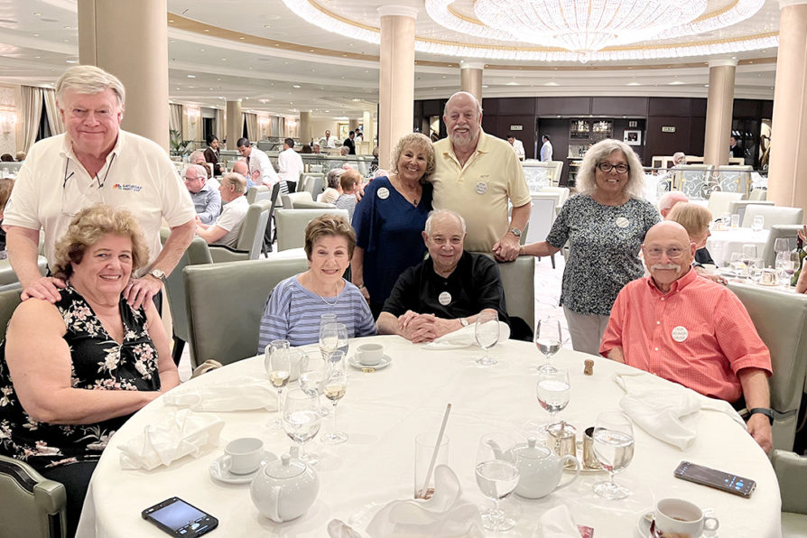
We were scheduled for a 1:30 pm check-in for boarding our cruise ship, Riviera. It is a roughly 3 ½ drive for us. We were accompanied by Warren and Luellen, our friends of 40 years. They had been our guests in Osprey for several days before our departure. We left around 7am so that we could meet my cousin, Don, for brunch on our way to the Miami Cruise Port. After a pleasant meal, we headed to the port, arriving well ahead of the scheduled check-in time. Our other friends from New York checked-in at the same time. After a few security checks and a long line, we were checked-in and boarded the Riviera.

Our rooms were not available until 3pm so we went up to the Terrace Café for buffet lunch. This my first test of my goal of not overeating on the cruise. I had a salad and a dessert and felt that I met my goal. The four couples making up our group were in adjacent cabins, so we all went to Deck 8 to await the arrival of our luggage and settle in.

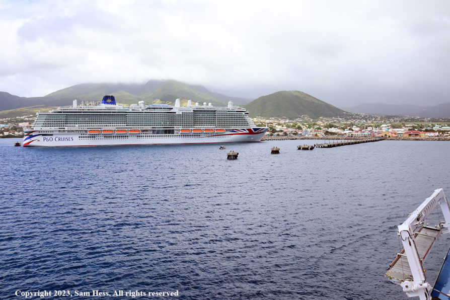
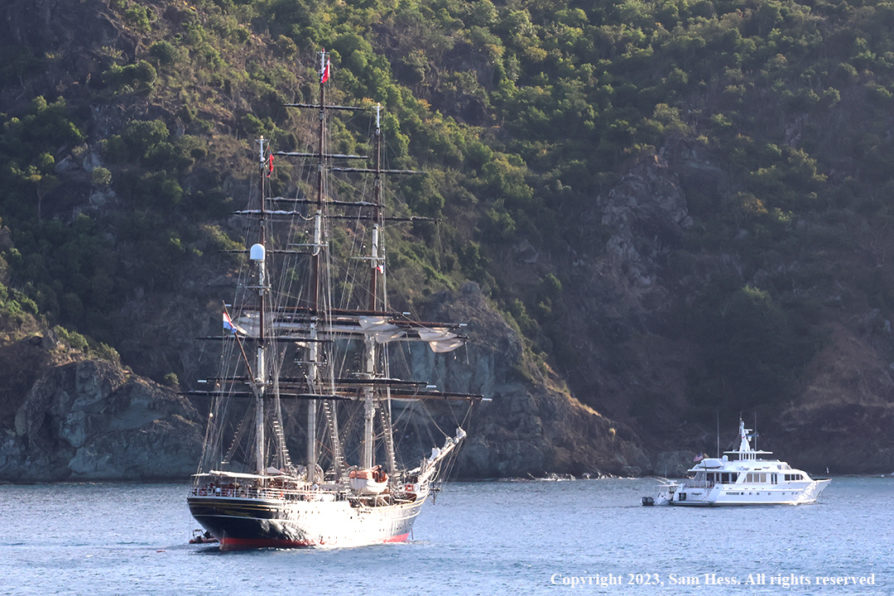
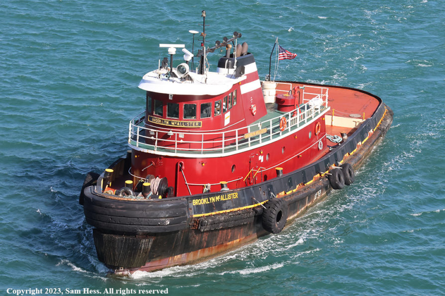
The Riviera is a small cruise ship (785 ft in length) with a maximum capacity of 1250 passengers and a staff of 800. It departs from Terminal J, which is located among the container ship docks. The ship was oriented west, toward the land. At 6pm, the ship started its departure from Miami. Many of us were out on our balconies watching the ship back up on a narrow channel, with the assistance of a tug. When we reached a wider part of the channel, the ship, using its thrusters and the tug at the stern, made a 180 degree turn and headed east towards the Atlantic.

Small container ship, assisted by a tug making 180 degree turn.
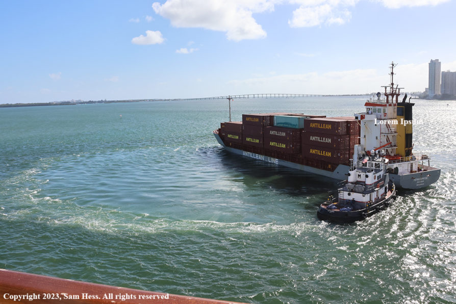
The much larger Riviera made the same, tug assisted, turn in order to get into the channel.
Miami, viewed from our Deck 8 Balcony

It was now 7pm, time for dinner and another test of my goal of not overeating. Our group sat at one of the two tables for eight in the main dining room. The menu came and my resolve failed me… I overate. Overeating, a glass of wine, and a long day got to me, and I decided to go to bed. Susie and the others went to the theater for a show.

February 11-12, 2023 – At Sea
All I can think of is the lyrics from a song I heard a long time ago, “A sailor went to sea to see the world and what did he see, he saw the sea.” That pretty much represents these day. Our first stop is Basseterre, St. Kitts, over 1,000 miles from Miami. We dock there on February 13th.

I got up early and could barely see the coast of Cuba to the south of us. I decided that I would exercise by walking on the top deck. We had strong winds and the deck that I was planning to walk on was closed on both days. I wound up doing core strengthening exercise on the floor of our cabin.

One of the few times we saw other vessels while at sea

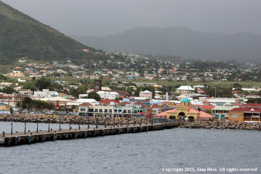
February 13, 2023 – Basseterre, St. Kitts

St. Kitts and Nevis Map

I woke up this morning to grey skies and a light mist which eventually turned to a period of rain. While I was eating breakfast, the captain announced that due to strong wind and currents, we would reach the pilot pick-up point at 11:30. Scheduled arrival time in St. Kitts was 11am. The ship was welcomed to the port by rain squalls, a normal part of the Caribbean experience.

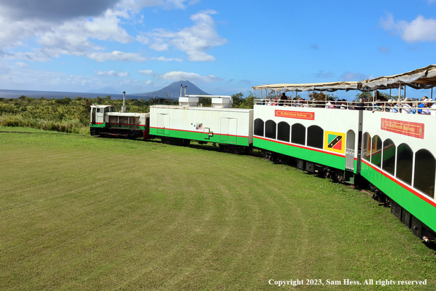
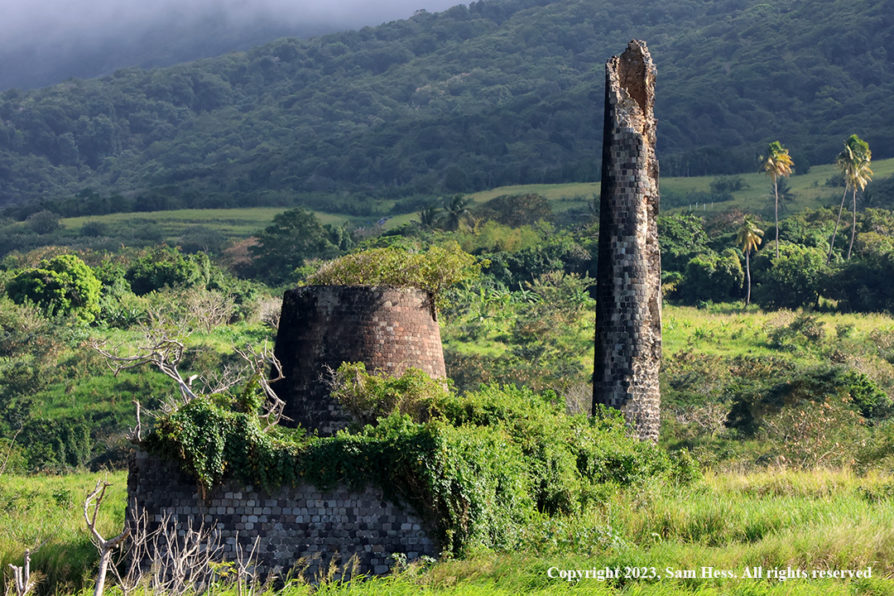
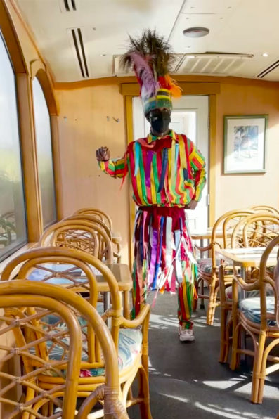
Our shore excursion was a scenic train ride around the Island. We boarded a bus that took us to the train station, a 30-minute ride. The train ran on a narrow-gauge track built in the early 20th century to carry sugar to the port.

The sugar industry was ended in 2000 because it could not compete with other producing sources. As a result, tourism became the economic engine of St. Kitts. The train was turned into a tourist attraction. Passenger cars are double-deckers, with upper deck being open and the lower deck having windows and air conditioning. After riding for about 45 minutes on the upper deck, I got a little bored because the scenery didn’t change much and headed down to the enclosed portion of the car.

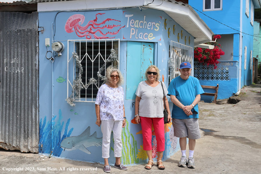
At the end of the train ride, we boarded the buses back to the ship. The busses dropped us off in an area filled with shops. Susie, as she does on most of our trips, went in search of a refrigerator door magnet. The ship departed St. Kitts at 6:30pm.

Approaching the Dock in Basseterre
The Heart of Basseterre
Narrow Guage Train
Rain Showers in the Hills
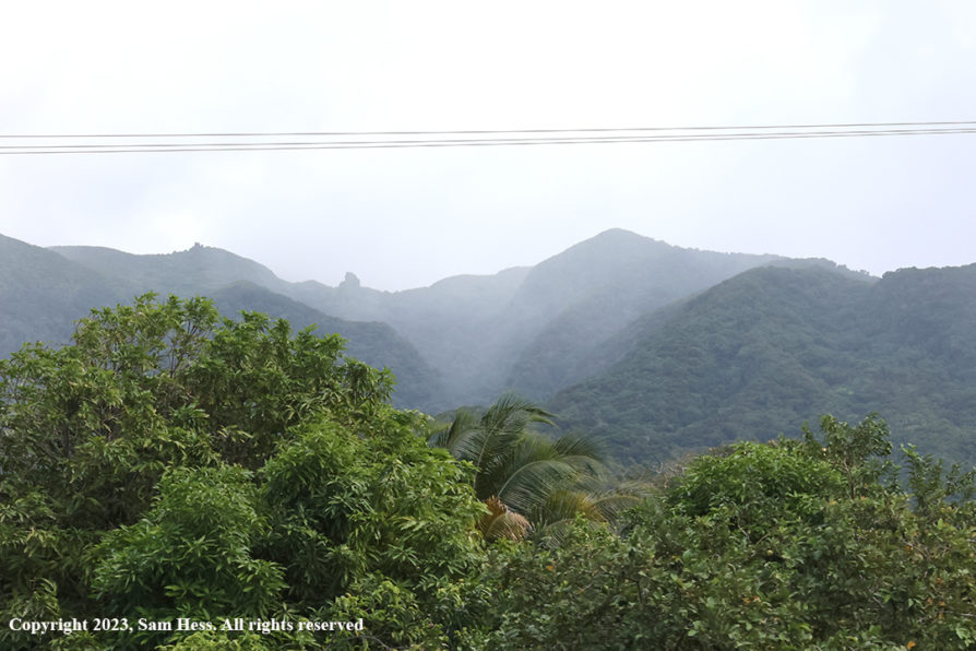
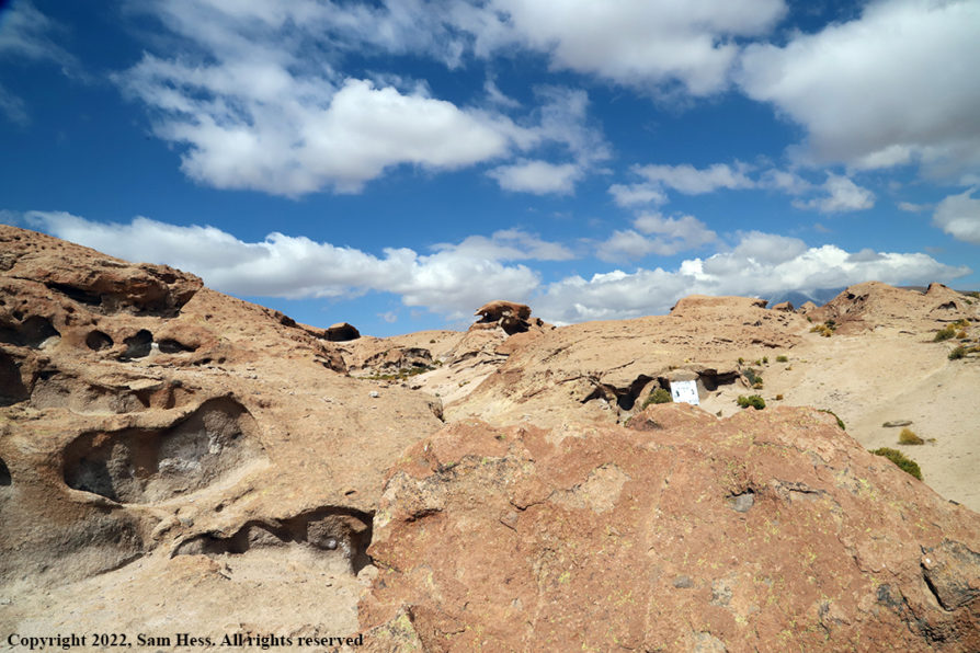
We were lucky to miss them
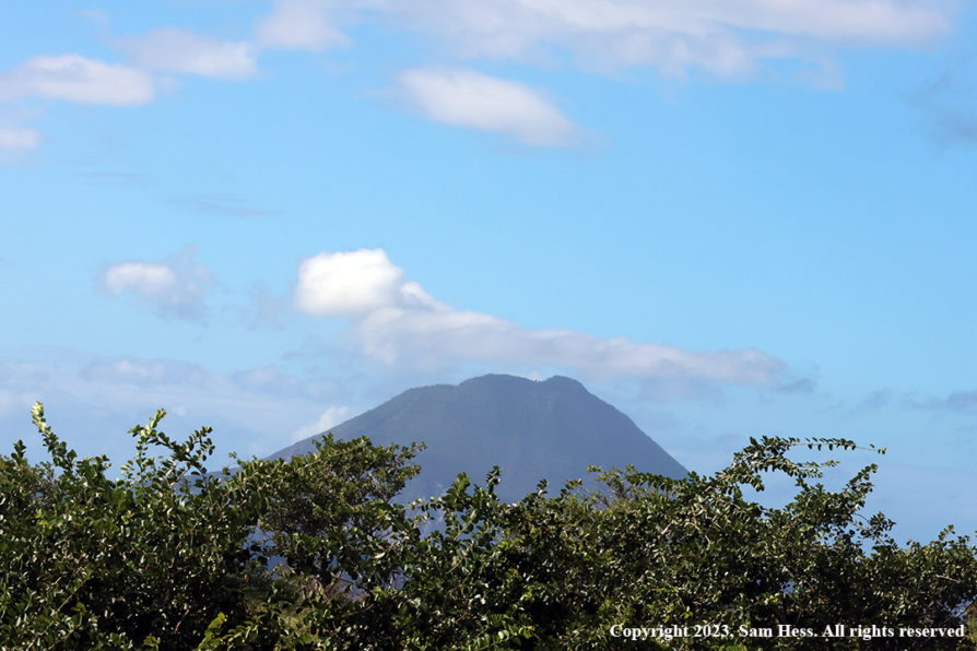
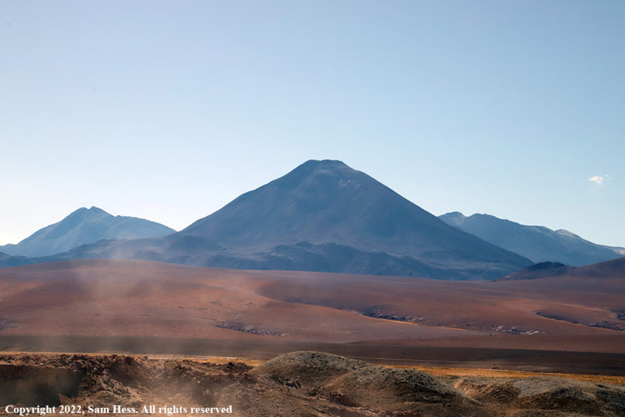
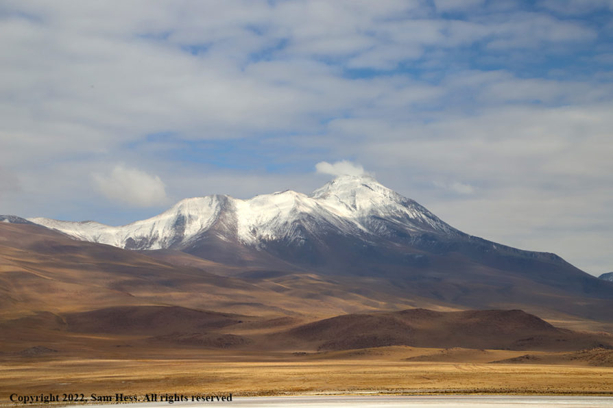
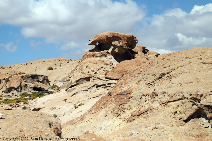
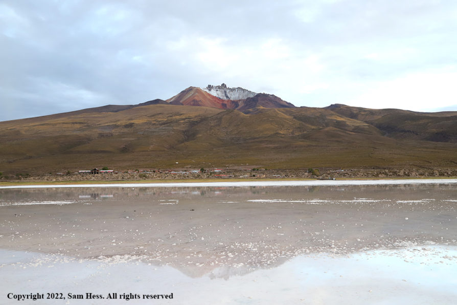
Mount Liamuiga
One of several sugar mill ruins seen from the train
Typical town passed by train
A lesson for the kids😁- Look both ways before crossing the street
Masquerade Dancer traveled from car to car entertaining us to the drumming of another dancer

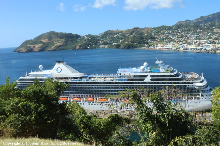
February 14,2023 – Kingstown, St. Vincent

Map of St. Vincent and the Grenadines

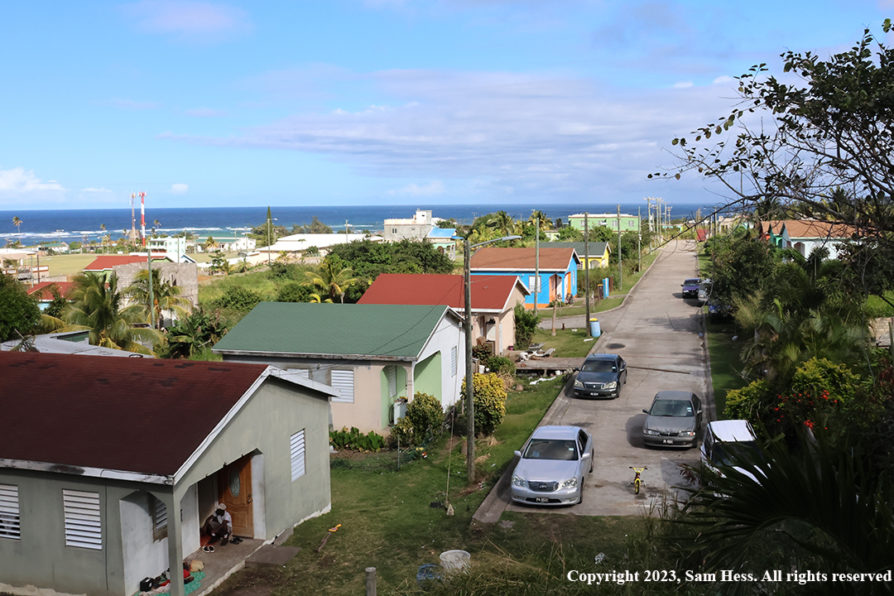
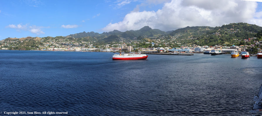
We arrived in Kingstown, the capital of St. Vincent and the Grenadines on time. The port area of Kingstown is, like other tourist destinations, filled with shops selling souvenirs and other items targeted to tourist trade.

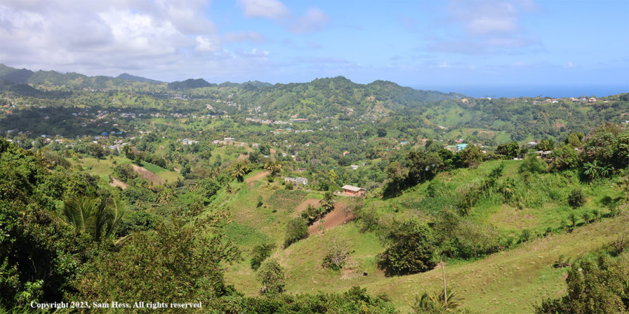
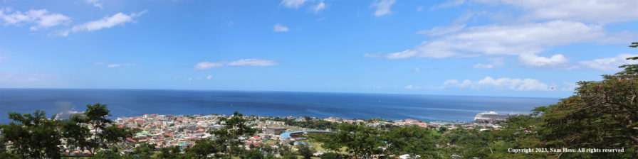
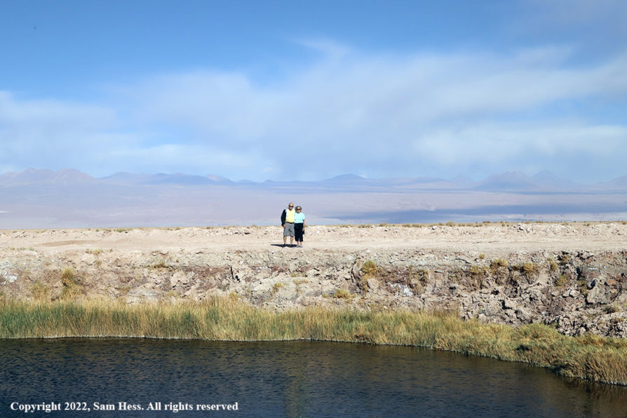
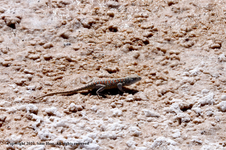
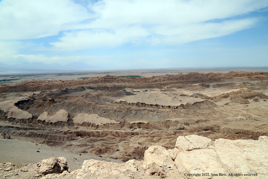
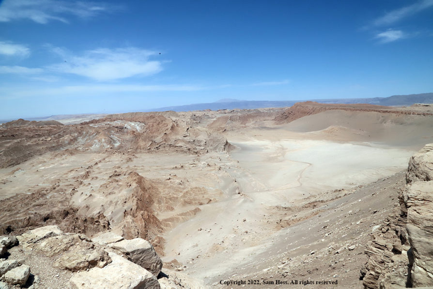
Our excursion was “A Panoramic Tour of St. Vincent.” The tour started at 12:15pm and lasted about two hours. This island certainly provides panoramic views of houses clinging to the hills. Crops are growing on steep hillsides. We drove through several villages, some had mansions on the hills and private homes and apartment buildings in the lower portions. Halfway through the tour, we stopped on a lookout that had a grand view of the Mesopotamia Valley. It is thought to be the remains of an extinct volcano and is considered the heart of the agricultural business in St. Vincent.

Mesopotamia Valley Panorama
Crops growing on steep hills
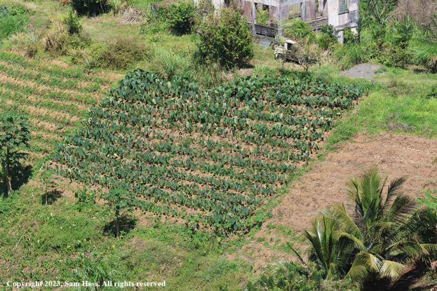
This crop is in the center of the panorama, above.

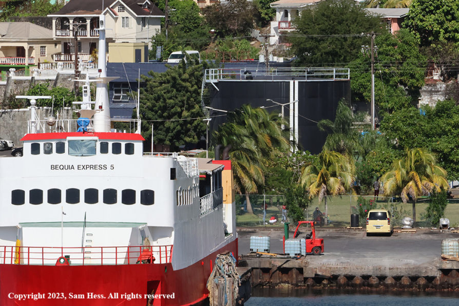
Tourism is the main economic engine for the island. It followed the decline of the sugar and banana industry because of competition from Central America. St. Vincent has long produced a very strong rum which was based on the molasses derived from the sugar crop. Ironically, the molasses is now imported from elsewhere. A large black tank stands in the port area to remind locals of the past. That tank contains the imported molasses.

Molasses Tank Near the Inter-Island Ferry Terminal

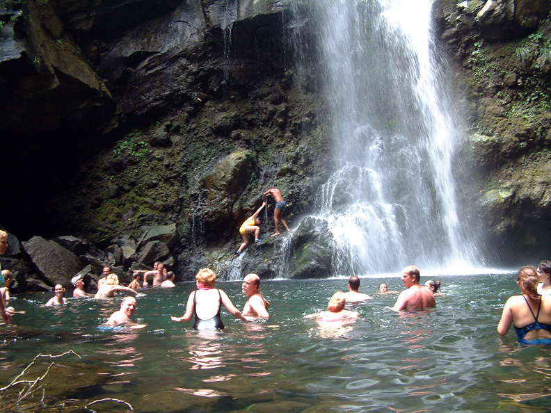
The tour did not cover the northern part of the island which contains the La Soufriere volcano. The volcano erupted on April 9, 2021, sending a plume of ash six miles into the sky spreading all over the island and into neighboring islands. Because the volcano had shown increasing activity for several month, the government issued an evacuation order for the northern part of the St. Vincent. No one was hurt and property damages were limited. Some areas had several feet of ash on the ground. Clean-up was slowed by heavy tropical storms and rain events. Susie and I visited a waterfall and natural pool at the base of the volcano in 2003 while on a Windjammer cruise. I can’t imagine what that beautiful area looks like today.

The waterfall and pool at the base of La Soufriere volcano in 2003
Kingstown Harbor Panorama
Mailbox on the dock in Kingstown with Queen Elizabeth II Marking… a reminder of British occupation
Rough surf on the Atlantic Side of St. Vincent
Riviera Docked in St. Vincent

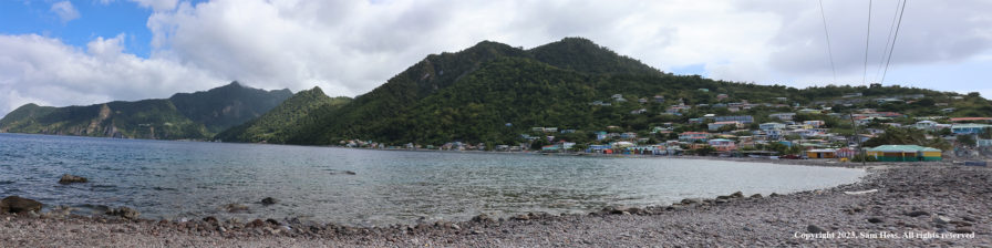
February 15, 2023 – Roseau, Dominica

Map of Dominica

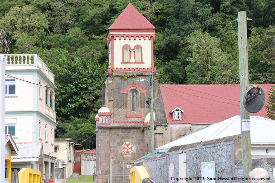
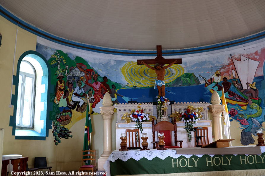
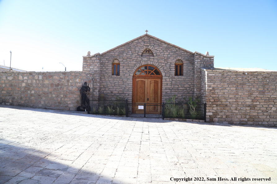
We arrived in port of Roseau around 7am. Roseau is located on the leeward (Caribbean) side of the island and is Dominica’s capital and major urban center. Over the last 2,000 years, Dominica was populated by Amerindians from the northern coast of South America. The island was sighted by Columbus on a Sunday in 1493 and was named Dominica, the Italian word for Sunday. In the 17th century the French built a small settlement and named it Roseau.

Our tour was scheduled for a departure at 9:45. The normal leisurely breakfast was out of the question. The tour focused on the southwest coast of the island.

As soon as you walk out onto the dock, you get an initial feel of the ruggedness of the Island. Before could get to the “nature” part of the tour, we had to navigate the narrow streets of Roseau. After leaving Roseau, we drove through several contiguous villages before getting to a less populated environment.

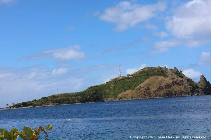
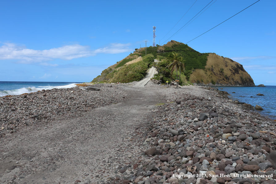
The road did not get any wider as we left the Roseau area. It hugged the side of the mountains as it climbed up and ultimately to a coastal section of the road. Our first stop was a lookout that gave us a view of the southwestern tip of the island, the Soufriere Bay Marine Reserve and Scott’s Head. We stopped at the end of the road and walked out on the narrow neck leading to Scott’s Head. The neck separates the Atlantic Ocean (rough surf) from the Caribbean Sea (calm seas). Soufriere Bay is an active sunken caldera. Heading back north, we stopped at Bubble Beach. The water at edges of the beach is heated by the volcanic activity and gas bubbles can be seen.

We continued north back to Roseau and drove through the Botanical Gardens, eventually stopping at a lookout where we viewed the city below.

I would have to say that Dominica was our favorite island. The beauty of the island speaks for itself. Our guide was excellent and didn’t hesitate to discuss the political environment on the island.

This is the sight that greeted us on arrival in Roseau harbor
Roseau Panorama viewed for a lookout above the city
Soufriere Bay Marine Reserve, viewed from the neck of land leading Scott’s Head
Scott’s Head
The neck of land leading to Scott’s Head with the rough Atlantic surf (left) and the calm Caribbean
Church of St. Mark near Bubble Beach
Mural Inside St. Mark Church depicting the farming and fishing aspects of the Dominica
Three teachers at Teachers’ Place

February 16, 2023 – St. Barts

Map of St. Barts

St. Barts is considered to be one of the most beautiful islands in the Caribbean. I could not give my opinion since we never left the ship.

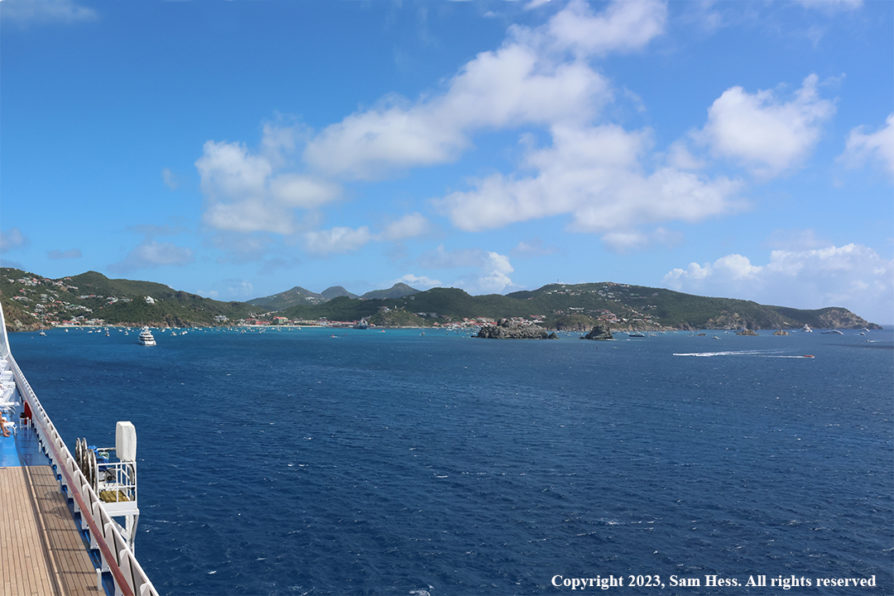
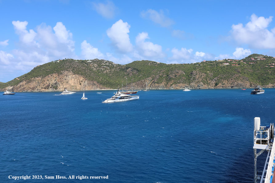
Gustavia, the main town of this French Island and its major port. For a ship the size of the Riviera, there are no dock facilities and access to the shore is provided by tenders (the ship’s life boats). Looking around the harbor, I would have to say that, based on the number of large yachts anchored in harbor, it is a favorite of the very rich.

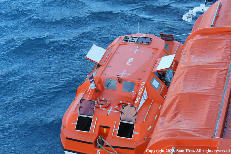
When we arrived in the harbor, the wind was blowing strongly, and high swells made the loading and unloading the tenders dangerous. The original schedule was to start tendering at 8am. Looking from our balcony I could see the difficulty the tenders were having approaching the ship to tie up at the boarding area. One tender made four approaches before successfully tying up to the ship. The captain announced that because of the rough seas and strong winds the tendering was postponed to 9am. As of last night, Susie and I were to go ashore, while our friends were going to stay on board. We didn’t have any excursions, so we also chose to stay on board. At 10am the captain allowed the tendering to proceed. The captain frequently repositioned the ship so that its bulk would provide some shelter for tendering operations.

Gustavia Harbor Panorama – Starboard side view
Gustavia Harbor – Port Side View
Passengers tender for trip to town
Three masted Schooner

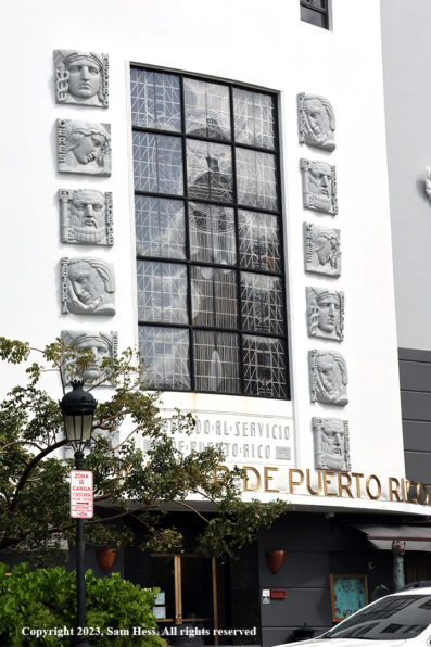
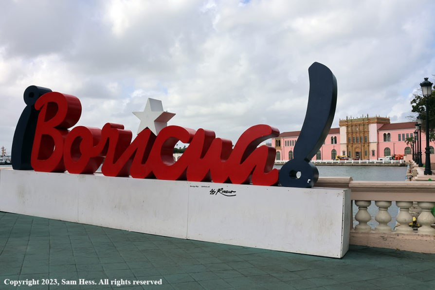
February 17, 2023 – San Juan, Puerto Rico

Map of Puerto Rico

Map of Old San Juan

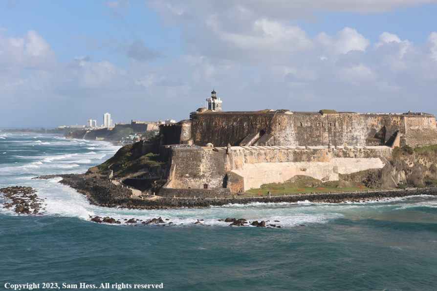
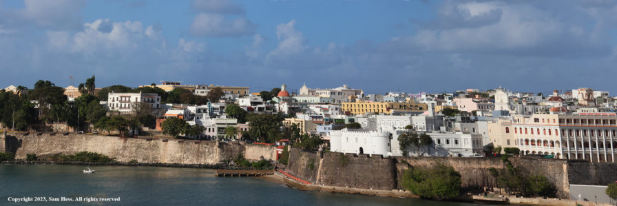
We arrived at the entrance to San Juan Harbor early in the morning. I was up hoping to get a good picture of El Morro Castle guarding the entrance to the harbor. By the time I got on the balcony, I missed the shot and had to wait until we were leaving the harbor. The lighting was better in the afternoon.

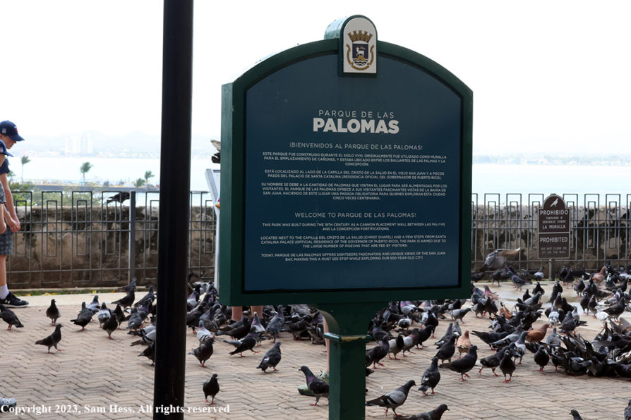
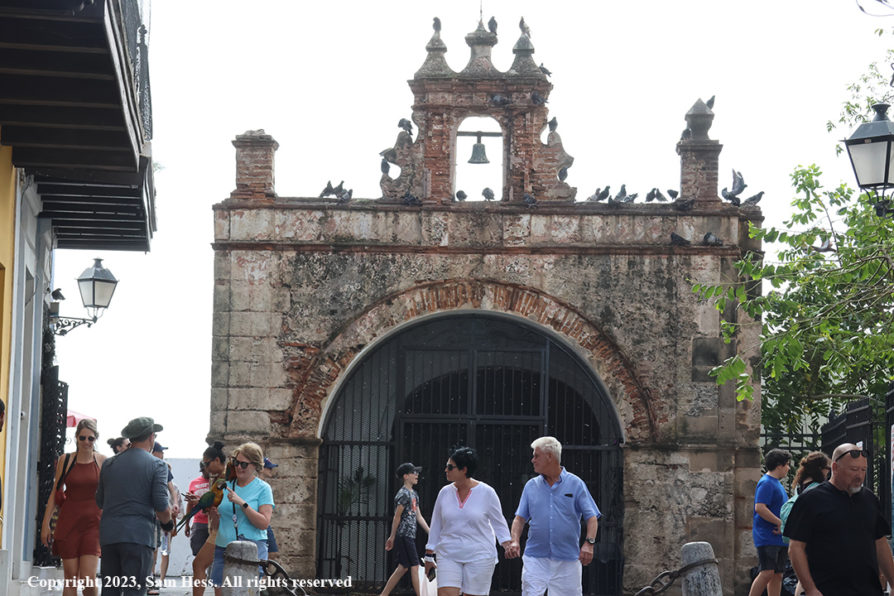
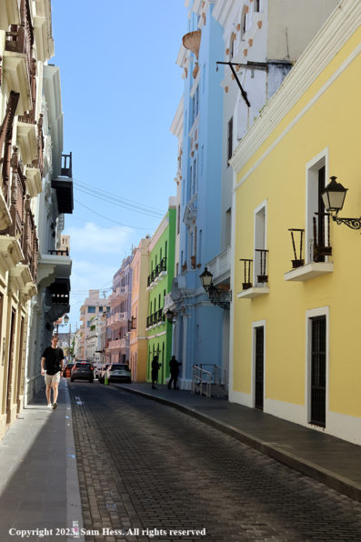
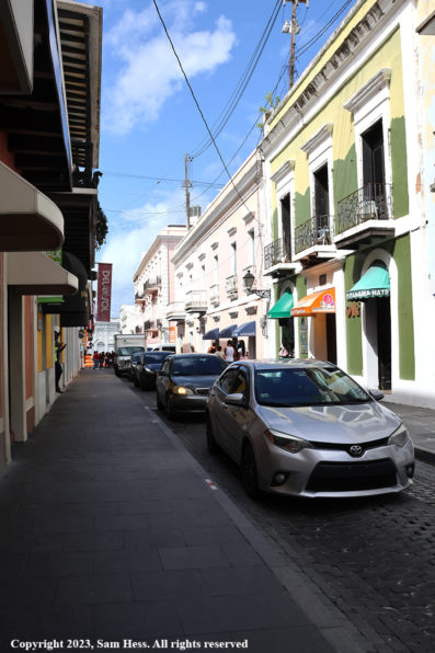
After breakfast, Susie and I decided to walk through Old San Juan to El Morro. According to Google Maps it was a thirty-minute walk. That didn’t take into account the streets that were closed to traffic due to construction and security considerations. As we walked, Susie spotted a shop selling locally made crafts. They had beautiful locally handmade magnets. She also saw an art piece that was produced by a local artist. I knew that it would be hanging in our house the minute she started talking to the salesman. It will be framed in the shop and sent to us… easier than carrying it. After completing the transaction, we walked a little bit further before heading back to the ship for lunch.

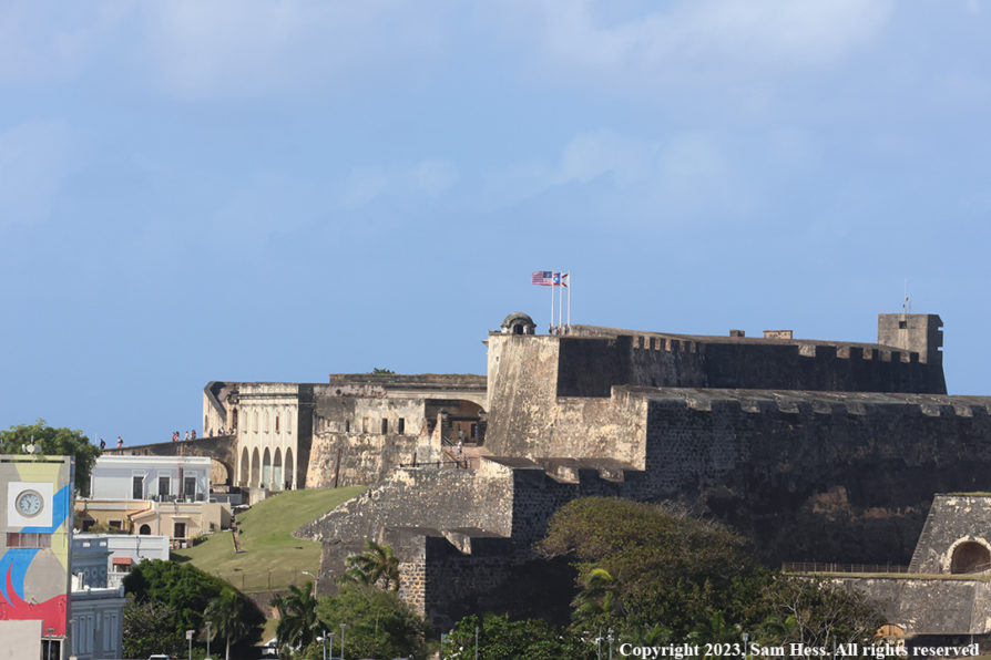
Our departure from San Juan was earlier that our other departures because of the distance to tomorrow’s destination, Puerto Plata, Dominican Republic. While Susie and our friends were sitting around the pool deck, I went to the top deck to get some pictures of Old San Juan and its fortifications.

The Tug Brooklyn McAllister assisted the Riviera to enter and exit San Juan Harbor
El Morro
Castillo San Cristobal
Old San Juan Panorama
Pigeon Park
Capilla del Santo Cristo de la Salud, a small chapel adjacent to Pigeon Park

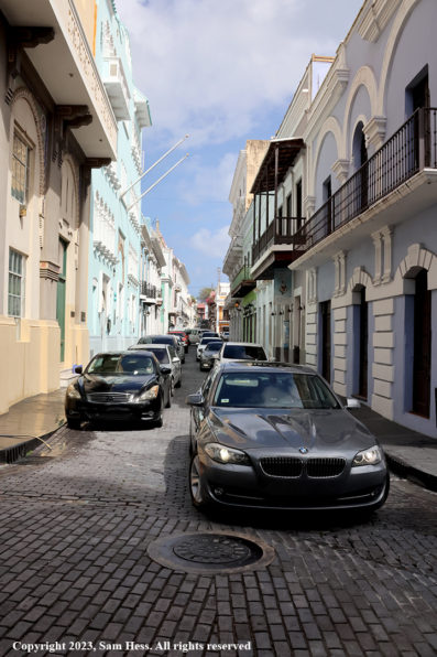
Old San Juan Street Scenes

Sculpture in an Old San Juan Park

February 18, 2023 – Puerto Plata, Dominican Republic

Map of Dominican Republic

Map of Puerto Plata

We were up early this morning for breakfast. Our departure time for the excursion was 9am. After breakfast, we were in our cabin when the captain made the announcement that we will not be docking in Puerto Plata and will continue on to Miami. Strong winds are forecast for Puerto Plata for the scheduled time of departure. Because the channel in the port is very narrow there are maximum wind limits for entering or leaving the port. The forecast winds are above those limits.

“I saw the sea”

Bottom line… two days at sea with an on-time arrival in Miami. In order to avoid some of the morning rush hour, we asked for the last departure from the Riviera at 8:45am. We got our luggage and loaded the car fairly quickly and headed home.

Chile’s Atacama Desert & Bolivian Saltpans

The Atacama Desert has been on my bucket list for a long time. We have traveled to Chile numerous times and on my seventh trip finally made it. The following is a summary of our visit the desert and to the Bolivian saltpans.

November 30 to December 2, 2022 – Miami to Santiago
Early this afternoon we left our home in Osprey and drove to Miami International Airport. It was an uneventful trip, except for the Motorcade of law enforcement vehicles (cars, trucks and motorcycles). I have seen motorcades before, but this one was the largest we have ever seen. We drove at least two miles until we got to the entry point of the motorcade… they were still coming onto northbound Interstate 75. We were lucky, as we were heading south.

We arrived at Miami International Airport several hours before flight time. Having experienced the crowds at this airport, we wanted to have a cushion of time. a couple waiting for their flight to Spain was sitting across the aisle from us. We wound up having a long chat with them. They were spending the winter an hour’s drive from us. We exchanged contact information and promised to get together at our home after we got back… We spent a nice evening with them after we got back,

Our flight was scheduled to depart at 9:15pm and was just a few minutes late. We arrived in Santiago on schedule and after going through immigration and agricultural checkpoints we were met by our driver for the ride to our hotel. We have been in Santiago several times, so we didn’t do the tourist stuff. We spent the next day and half with my cousins and their extended family.

December 1st-Dinner at Cousin Avi’s Home
December 2nd-Lunch with Cousins

December 3, 2022 – Santiago to Calama and San Pedro de Atacama, Chile
An early morning. A driver was picking us up and take us to the airport for the two hour flight to Calama in northern Chile. In Calama, we were greeted by a driver who took us to the Altiplanico Atacama Hotel in San Pedro de Atacama, our base for the stay in the Atacama Desert. The trip from Calama to San Pedro de Atacama was sixty miles on a paved road, one of the few we would see during our days in Chile and Bolivia. The road gave us our first taste of the elevations we would encounter during our stay. Calama is located at 7,400 feet. The road climbed at a modest rate to a 11,400 foot pass, and then dropped to 8,000 feet at San Pedro. Arriving at the hotel we had some time to get settled before we were picked up for our first tour. The tour took us Laguna Cejar, Laguna Tebinquinche and Ojos del Salar (Eyes of the Saltpan).

Laguna Cejar is a lake that has a high level of salt which, like the Dead Sea in Israel, enables one to float effortlessly. It is the only one of the three bodies of water that is available for swimming. Unfortunately, we didn’t have our bathing suits with us and moved on to Laguna Tebinquinche, which was another salt lake that was home to Flamingos. We learned that there are three species of flamingos in the Atacama Desert, Bolivia and Peru. These are the Chilean, James and Andean Flamingos. The Microbes that live in the waters of Laguna Tebinquinche are similar to the original life forms that populated the Earth. There is a sign by the lake that calls the area El Origen (the origin).

Cejar Lagoon Panorama
Andean Flamingos
Laguna Tebinquinch
One of the eyes of Ojos del Salar
Susie and Sam at Ojos del Salar
Fabiani Lizard
(It posed for this shot)

December 4, 2022-Toconao, Salt Flats and Chaxa Lagoon
A full day on the road (mostly unpaved). We were advised to wear layers because our trip will take to elevations in excess of 14,000 feet.

Our first stop was the oasis village of Toconao. The site of the village has been occupied for about 12,000 years. Since it was Sunday, the village was quiet, and we only saw a few people on the streets. The main attraction for us was the San Lucas Church (which was locked?) and its Bell tower, which dates back to 1744. The church itself was rebuilt in the late 1800s. The village is known for its woolen handicrafts… I guess they don’t work on Sunday.

Toconao’s San Luca Church


The four-foot-high Bell tower door is made from a local cactus that has a solid core. The only people to enter the tower are the nuns who serve the church.

Our next stop was the Salar de Atacama, the largest salt pan in Chile and the third largest in the world. Within the salt pan is Laguna Chaxa which is divided into several bodies of water and is home the three species of flamingos native to the Altiplano. We also traveled to see Laguna Miscanti and Laguna Miñiques located at 14,700 feet. There was a walking trail around the lagoons, but we only walked on a small section of the trails. It was here that we saw our first Vicuñas, one of the three camelid species native to this area. Vicuñas are wild animals while the Llamas and Alpacas are domesticated.

Susie at Salar Miscanti
Sam at Salar Miscanti
Flamingos
(Note mirror image)
Andean Avocet

On our way back to San Pedro, we drove through Toconao. This time there were plenty of people on the streets. A soccer game had just finished and it seemed as though all of them were in or on the way to the local restaurants. Our guide had planned to have lunch in one of the restaurants, but it was full. We wound up having a late lunch in San Pedro.

This was a long day and tomorrow we the pick up was scheduled between 4:30 and 5:00 am. We decided to skip dinner and sleep.

December 5, 2022 – El Tatio Geyser Field
A pre-dawn pick up at the hotel for the hour and a half trip to the El Tatio Geyser Field. We were told that the best time to visit El Tatio was at sunrise because of the light shining through the steam presents the best view. Unfortunately, we were late in arriving and didn’t get any of pictures of that view.

The Geyser Field is located at an elevation of 14,000 feet. We were told to wear several layers when we going to this elevation… we were wearing three layers. It was quite cold and windy and I wished that I had taken a heavier mid-layer. The weather and the elevation combination took its toll on Susie and she went to the relative warmth of the tour van. I have to admit that I was tempted to join Susie.

When I think of geysers, the picture Old Faithful comes to mind. The geysers in El Tatio stay rise to about 30 inches. Old Faithful erupts to an average height of about 140 feet. Our guide stated that the atmospheric conditions can depress these geysers to even lower heights. The heat that powers the geysers and fumaroles comes from the magma pool below the surrounding volcanos.

The guide talked about the controversy surrounding the tapping into the area surrounding El Tatio and other geysers for geothermal energy uses. She was a strong opponent of this use, suggesting that it would have a detrimental effect on the geysers. Geothermal energy proponents discount this impact. In our travels in the Atacama Desert, we saw a number of geothermal energy plants.

Cone Geyser at the Beginning an Eruption
Colors are from minerals and bacteria.
Erupting Geyser
Fumarole
Geyser Pool
Former Geyser Pool-Swimming not Recommended.
View East From El Tatio Geyser Field
Cerro El Volcan (18,240 feet) in background

On the way back to San Pedro we stopped at a couple of lagoons to view several bird species. The most plentiful were the flamingoes. The lagoons also had vicuña grazing around the shore.

The tour advertised that breakfast was included. It turned out to be a brunch. We stopped at the ruins of a sulfur mine whose floor provided a level place for the driver to cook scrambled eggs. The table had plates full of rolls, avocado, and various meats and cheeses. The walls of the ruins served as shelter from the strong winds. We returned to our hotel around 11:30 am.

Bolivia

Our trip map
(photographed by Susie off the hood of our tour vehicle)
Most of the trip involved the unpaved “roads” (yellow lines)

December 6, 2022 – Bolivia Day 1
The trip to Bolivia is scheduled for three days and two nights. As you can see from the map above, most of the trip is on desert tracks.

A local driver picked us up for the hour-long drive on a paved highway to the Hito Cajon border crossing between Chile and Bolivia (elevation 14,698ft). We had to go through the Chilean immigration post to exit Chile located in a modern structure that we drove into for processing about a mile from the border. After clearing Chilean Immigration our driver proceeded to actual border where he turned us over to the Bolivian guide and her driver. The Bolivian border post is a small building. There were some issues with Bolivian Immigration that were resolved by our guide.

After leaving the border we traveled on dirt roads and desert tracks. Our first two stops were Laguna Blanca (White Lake) and Laguna Verde (Green Lake).

Laguna Blanca Panorama
Laguna Verde Panorama with Lincancabur Volcano in the background

We continued our travels via desert tracks. There were a few more salars on our route. One of the spots we visited was Arbol de Piedra, a formation created by desert winds and airborne sand. There were other similar examples of the work of the combination of wind and sand erosion.

High desert and mountains
Arbol de Piedra
Close-up of erosion on a large Bolder
Boulders ejected by volcanic explosions littered the desert floor

One of the few mammals we saw among the rocks in the desert was the Viscacha, a rodent that looks like a cross between a rabbit and a squirrel. The one pictured below seemed not to be to concerned with our presence. I got quite close to it get the picture below.

Southern Viscacha

Our final destination for the day was the Los Flamenecos Eco Hotel, located on the shore of the Laguna Hedionda. The hotel is remote and only powered by solar panels. Apparently the capacity is limited as power was only available from 6 to 10pm. There is no heat at night or hot water for the morning shower.

The saline lake had a large population of flamingos that I was going to photograph after we settled into our room. Our window overlooked the lake and unfortunately, that was the only view I was going to get. It started pouring soon after we got into the room and didn’t stop until the overnight hours. It was the rainy season, but the heavy rains usually come later in the season. I tried to get pictures prior to breakfast but couldn’t get out as the main entrance seemed to be locked. On the plus side, dinner and breakfast were very good.

December 7, 2022 – Day 2

Today we are going to traverse the Uyuni Salt Pan, the largest salt pan on earth. We woke up this morning to discover that our heavy overnight rain dropped a cover of snow on the mountains.

Snow Covered Volcano

We had a bit of a drive to get to the Uyuni Salt Pan from our overnight stop. The route we took over the desert held some spectacular views.

Eroded Lava Fields

We drove through several communities this morning. Enroute we could see fields planted with Quinoa. The fields have been recently planted and only tiny green leaves are showing. They will eventually reach 3 to 7 feet high.

Quinoa Field early in the growing season

After some travel we reached the salt pan. Once on the salt pan there are no tracks. How the driver and guide navigated to get to specific destination is amazing to me. When you get further on the pan all you can see is nothing but white salt and mountains (some of which are mirages floating in the air).

We stopped for lunch on the salt pan. As in the previous day, it was a white tablecloth banquet. Our guide, Aida, who is part Quecuha, entertained us with a traditional dance.

Lunch On the Salt
Note the horizon shows nothing but salt… no land features.
Aida Dancing

There are several islands on the flat and we stopped at Incahuasi Island. The Island is the top of a volcano that existed millions of years ago below an inland sea. Coral fossils are readily found on the island. It is also covered by large cacti that we also noticed in the Atacama Desert.

Incahuasi Panorama
Incahuasi Fossil Corals

Our final stop for the day is the Hotel Tambo Coquesa Lodge. The property contains a main lodge and some cabins. Our cabins is made out of blocks of salt. The exterior is covered on stucco to waterproof the salt walls. Even some of the furniture is made out of the same salt blocks. The plan for the evening was to watch the sunset out on the salt pan with Champaigne and snacks. As in the previous evening, it started to rain lightly. The clouds hid the sunset, but we had our drinks on the salt anyway.

Communidad de Coquesa at foot of Tunupa volcano
Our hotel living room

December 8, 2022 – Back to San Pedro de Atacama

Sunrise viewed from our Coquesa hotel

After breakfast we started our return to Chile. After roughly three hours of driving on the salt pan, we reached the city of Uyuni. We had snacks while our driver fueled up the car for the driver Hito Cajon border crossing.

On our way we passed a number of salt harvesting and processing locations on the pan. After leaving the Uyuni Salt flat we stopped in the silver mining town of San Cristobal. A mining company wanted to build an open pit mine but the town occupied the site. The company offered jobs to any person in the town, built new homes and relocated the church.

San Cristobal Church

We stopped for lunch at a hostel and watched Llamas and Alpacas grazing below. Alpacas are distinguished from Llamas by their smaller size and facial hair.

Llamas and Alpacas

On the way to the border crossing, we crossed a pass above 15,000 feet. The remnants of the snow were all around us.

The crossing from Bolivia to Chile was uneventful. We transferred from our Bolivian guide and driver to a Chilean driver who took us back to our hotel in San Pedro.

December 9, 2022 – San Pedro de AtacamaValle de Luna
This morning we began at a normal hour. We checked out of the hotel and were met by our guide for a tour of the Valle de Luna (Moon Valley). The valley gets its name because some of its terrain resembles the craters of the moon. The valley terrain was, and continues to be, shaped by the wind.

Our guide was a very knowledgeable and interesting person. He guides only periodically and lucky for us this was one those days. It was a pleasure to spend half a day with him.

Valle de Luna Panorama
Susie and Sam at Valle de Luna
Susie and our Guide
Tres Marias (Three Marys)
The wind keeps shaping this formation until it completely disappears.
Susie learning about the crusty surface of the valley.
Salty crust of the valley surface
View from the “Amphitheater.”
Another view from the Amphitheater

Our journey to the Atacama Desert and Bolivia is now over. Our guide was also our driver to Calama airport for the trip back to Santiago. Susie and our guide exchanged contact information. When we got off the plane in Miami on December 10th, Susie received a text advising us that the Lascar Volcano erupted ten hours after we left the Valle de Luna. The eruption had a plume that rose 3.1 miles high and spread volcanic ash all over the area we had just left.

And now on to our next adventure, a Caribbean cruise with our New York (some now living in Florida) traveling friends.